Griend
Griend is moving. Around 1800 it covered 0.25 square kilometers; today it covers about 0.1. It used to lie further west, and it used to be larger, and it used to have a monastery and a walled town, and in 1287 the St. Lucia's flood swept most of that away. The island that remains is a low pale crescent of sand and shell in the middle of the Wadden Sea — not a place you visit, but a place that, every spring, becomes the loudest acre in Western Europe.
A Town Beneath the Water
In the Middle Ages Griend was inhabited. There was a walled settlement and a monastery. Then the sea found an angle of attack: storms eroded the coast, and in December 1287 the great St. Lucia's flood — one of the deadliest in European history — overran the island. The town was abandoned. Through the long centuries that followed, a few stubborn farmers stayed, building their houses on terpen, the artificial dwelling-mounds that Frisians had been raising against the sea since the Iron Age. By 1800 even they had left. The eggs of gulls and terns, gathered for the kitchens of Terschelling, were what Griend was useful for then.
Seven Meters a Year
The island never stopped moving. Currents and storms shaved sand from one side and laid it down on the other; by the start of the 1800s Griend was migrating southeast at about seven meters every year. After the Afsluitdijk closed off the Zuiderzee in 1933, the tidal flow through the Wadden changed and the erosion accelerated. By the late twentieth century, biologists wondered whether the island would survive at all. In 1990 Natuurmonumenten built a low sand dyke along the northern edge — not a wall, just a contour line of dune designed to slow what could not be stopped. Since then, gradual growth has replaced retreat. The island is still drifting east, but more slowly, and it is no longer disappearing.
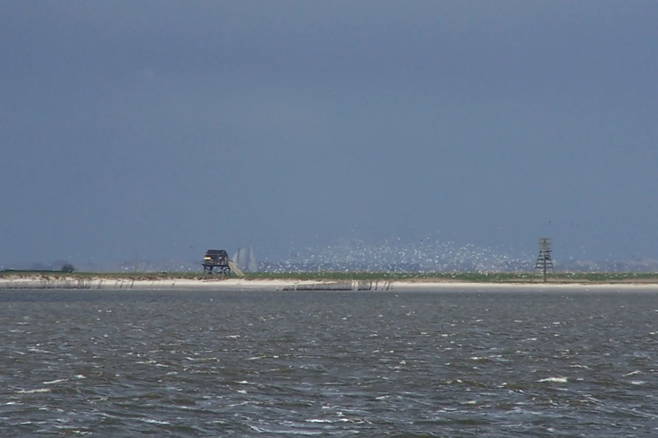
Ten Thousand Pairs
What Griend has, that nowhere else in Western Europe quite has, is its terns. Around ten thousand pairs of Sandwich terns nest here every summer — the largest colony on the continent's western coast. Stand on the deck of a Wadden ferry passing a few kilometers south and you can see them: a haze of white wings turning into a single weather pattern over the sandbar. Among them, common terns and Arctic terns drop into the shallows for fish; common eider and shelduck waddle in the dune grass; oystercatchers stalk the wrack line; redshank pipe at dawn. A short-eared owl, sometimes, hunts the dune. The island is closed to the public. A single wooden cabin, used in summer by birdwatchers and biologists for Natuurmonumenten, is the only human presence.
What the Sand Carries
Griend is the kind of place that complicates the idea of conservation. There is no permanent shape to protect, no original outline to restore. The island that was lost in 1287 lies somewhere out there beneath the water, a few kilometers west of where its descendant is today. The dykes built in the 1990s are not pretending to put Griend back; they are buying time, year by storm-season by year, so that the terns have somewhere to come back to in April. During the sand-dyke construction a colony of wood mice somehow arrived and decided to stay. Now they belong here too. Almost nothing about Griend is fixed. The wind keeps editing the coast. The terns keep returning.
Seen from Above
From the air on a clear day the Wadden looks like a great brown lung breathing tide in and tide out, channels and flats appearing and disappearing on the half-day rhythm. Twelve kilometers south of Terschelling, a small pale patch persists in the middle of all that motion. That is Griend. Around it, if the season is right, you can see the cloud of birds — not a flock you can count, more like a weather system over a sandbar — and you understand what the island is for. Not for people. Not for permanence. For terns, and for the patient idea that even something this fragile can be kept.
From the Air
Coordinates 53.25°N, 5.25°E. Griend sits in the central Wadden Sea, roughly 12 km south of Terschelling and 15 km north of the Frisian coast at Harlingen. Recommended viewing altitude 2,000–4,000 ft AGL for the colony detail, 6,000–10,000 ft to see the island in the Wadden's full geometry. Visual landmarks: Terschelling's long thin landmass to the north; Vlieland to the northwest; Harlingen's harbor to the southeast. Nearest airports: Leeuwarden Air Base (EHLW) ~40 km southeast, Drachten (EHDR) ~55 km east. Landing on Griend is not permitted — Natuurmonumenten manages the island as a strict bird sanctuary. Weather: best clarity in April–July when terns are nesting; spring fog over the Wadden can drop visibility quickly.
Nearby Stories
- De Verwachting, Hollum 0.6 km away
- Dronrijp Reprisals 2.1 km away
- HNLMS Johan Maurits van Nassau (1932) 8.1 km away
- Vlieter Incident 8.6 km away
- Lemmer 9.3 km away
- French submarine Amazone (Q161) 29 km away
- Ballum 39 km away
- West Sole Gas Field 228 km away