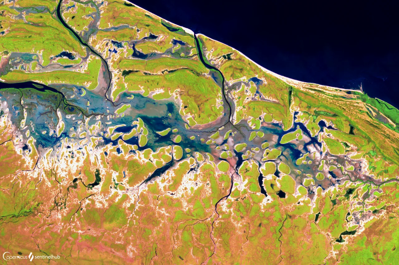

Gulf of Carpentaria
On certain mornings in late September, just after dawn near the tiny Queensland town of Burketown, a wall of cloud appears on the horizon and keeps coming. It is a single tube of vapour, smooth as a rolled blanket, tumbling forward over itself, and it can stretch a thousand kilometres from end to end. This is the Morning Glory, one of the rarest reliable weather phenomena on the planet, and it belongs to the Gulf of Carpentaria, a shallow inland sea scooped out of the top of Australia and cradled between Arnhem Land and Cape York.
The Scale of the Water
The Gulf is enormous and strangely flat. At its mouth it spans 590 kilometres, widening to 675 further south, and it runs more than 700 kilometres from north to south, covering roughly 300,000 square kilometres of sea. Yet it is barely a puddle by ocean standards: most of it is only 55 to 70 metres deep. The land that frames it is low and unbroken, with no mountain range to catch the rain. Because of that, the lush tropical growth of the coast fades into the dry scrub of central Australia not as a sharp line but as a slow, almost imperceptible drying-out of the country. Twice a day the tide moves across this huge shallow basin, rising and falling by two to three metres and breathing water deep into the rivers and mangroves of the surrounding Gulf Country.
The Cloud That Surfers Chase
The Morning Glory forms when sea breezes blowing off the Gulf and the Coral Sea collide over Cape York. As night air cools and collapses, it sends a solitary wave rolling across the Gulf, made visible as that astonishing cylinder of cloud, one to two kilometres high and travelling at up to forty kilometres an hour. The Gulf is the only place on Earth where it can be predicted with any confidence, and each spring a small band of glider pilots gathers at Burketown to ride the invisible wave at its leading edge, lifting silently along the front. As one pilot put it, fewer people have surfed the Morning Glory than have climbed Mount Everest.
Old Names, Old Waters
Long before any of this had a European name, the Gulf and its country were home to peoples whose languages still map the land. Yulluna, also written Yalarnga, belongs to the Cloncurry region; Kayardild is the tongue of Bentinck Island and the Wellesley group. The European chapter opened in 1606 when the Dutchman Willem Janszoon became the first to chart this coast, the first recorded European to land in Australia at all. His countryman Jan Carstenszoon followed in 1623 and named the gulf for Pieter de Carpentier, then governor-general of the Dutch East Indies. Abel Tasman traced the coast in 1644; Matthew Flinders charted it in 1802 and 1803. The first Europeans to reach it overland, Burke and Wills, struggled to the mouth of the Bynoe River in 1861, then died on the journey home.
A Working Sea
For all its emptiness, the Gulf is one of Australia's great working waters. Its real treasure swims unseen: the prawns. The Northern Prawn Fishery, one of the country's most valuable, depends on the Gulf, which supplies on average around 65 percent of its banana prawn catch and the overwhelming majority of its tiger prawns. Beneath the surface lies a geological surprise, a submerged province of coral reefs covering at least 300 square kilometres in the southern Gulf, undetected until sonar surveys revealed it in the mid-2000s, a fossil reef grown in an ice-age world of cooler seas and lower water. Above the seabed, zinc and lead from inland mines ship out through ports like Karumba and Bing Bong, and cattle stations stretch across the Gulf Country behind them. It is a place of overwhelming horizontal space, where the drama comes not from height but from sheer extent, of water, of sky, and of that improbable rolling cloud.
From the Air
The Gulf of Carpentaria is centred near 13.75°S, 139.00°E, an immense shallow sea bounded by Cape York Peninsula to the east and Arnhem Land to the west, with Groote Eylandt its largest island. From cruising altitude in clear dry-season weather (April to November) the whole basin reads as a broad, calm bowl of water set into the top of the continent. For the Morning Glory, the best vantage is low over the Burketown area shortly after dawn in September and October. Nearby coastal airports include Karumba and Burketown on the Queensland side and Gove (ICAO: YPGV) far to the northwest near Cape Arnhem. Expect tropical cyclones between November and April; the Gulf averages around three each year.
Nearby Stories
- Umbakumba 184 km away
- Wik-Ngathan language 210 km away
- Wurrwurrwuy stone arrangements 218 km away
- Archer River 229 km away
- Aboriginal Shire of Pormpuraaw 239 km away
- Vanderlin Island 245 km away
- Buku-Larrnggay Mulka Centre 273 km away
- Sir Edward Pellew Group of Islands 300 km away