.jpg)
Gunbarrel Highway
The man with the bulldozer was named Len Beadell, and he had a habit of carving his name and the date into the trunks of desert trees as he went. He was pushing a road through some of the emptiest country on Earth, and he meant for it to run dead straight, straight as a gunbarrel, which is how it got its name. The desert had other ideas. The Gunbarrel Highway dog-legs and wanders and corrugates the spine of every vehicle that attempts it, and it remains, more than sixty years on, one of the most famous and punishing tracks in Australia.
A Road for the Bomb
The Gunbarrel was not built for tourists or settlers. It was built for the atom. In the 1950s Britain and Australia were testing nuclear weapons at Emu Field and Maralinga and launching rockets from the Woomera range in South Australia, and that program needed roads where none existed. Beadell's Gunbarrel Road Construction Party drove a route west across the continent to reach the site of a planned weather station, vital for forecasting the high-altitude winds that would carry fallout, and to lay instrument lines along the path of the rockets. A third purpose was quieter: to let surveyors finally map the blank interior. The Cold War, in effect, bulldozed the centre of Australia open.
The Last Great Explorer
Len Beadell has been called the last of Australia's great explorers, and the title fits a man who surveyed and built more than 6,000 kilometres of outback roads largely by hand and instinct. He worked with a tiny crew, a theodolite and a grader, naming features after his family and his machines as he crossed country no wheeled vehicle had touched. His construction party reached Carnegie Station, the western end of the original route, on 15 November 1958, completing the first east-west road across the centre of the continent. Beadell was awarded the British Empire Medal for the work. He died in 1995, and a memorial now stands atop the rocky rise that bears his name, Mount Beadell.
The Hardest Miles
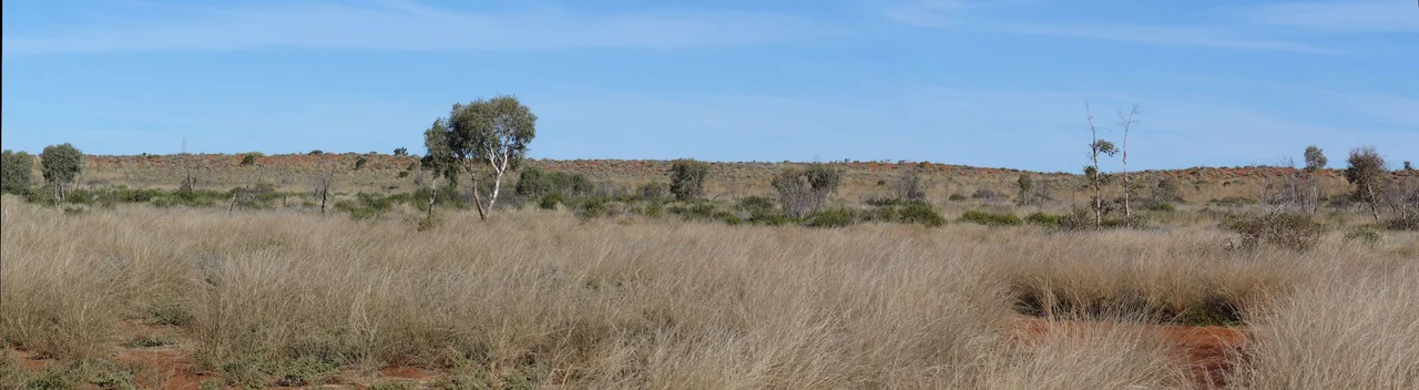
To drive the Gunbarrel today is to take on a serious expedition, not a scenic drive. The roughest, remotest stretch runs east of Carnegie Station, where the track is unmaintained and the corrugations, stones and washaways punish everything. The longest gap between fuel stops, Carnegie to Warburton, is 489 kilometres of self-reliance, and there is no calling for help. Travellers cross the Mungilli Claypan, skirt the Gibson Desert Nature Reserve and camp wherever the day runs out, often at old construction bores where a hand pump still draws water to the surface. Sections of the original Gunbarrel are now abandoned entirely, swallowed back into the spinifex Beadell once cut through.
Crossing Country That Belongs to Others
The desert the Gunbarrel crosses is not empty, whatever the maps once implied. The road threads through Aboriginal lands, and travellers need permits to pass the Central Australia and Petermann areas, because these are living communities and homelands, not scenery. Places like Warburton and Warakurna are off-limits to passing tourists, a reminder that the right to cross this Country is granted, not assumed. The route ends in the shadow of Uluru and Kata Tjuta, the great monoliths that have anchored the spiritual world of Aboriginal Australia for tens of thousands of years. After more than a thousand kilometres of dust, that ending puts Beadell's brief Cold War road into a far older perspective.
From the Air
The Gunbarrel Highway runs east-west across the Western Australian interior; the western Carnegie Station end sits near 25.80°S, 122.97°E. From the air the track appears as a faint, near-arrow-straight reddish line scored across vast spinifex sandplain and the dunes of the Gibson Desert Nature Reserve, with claypans and salt features punctuating the route. It is one of the few human-made lines visible across this country and a useful navigation reference. The rocky outcrops of Mount Beadell and Mount Everard rise modestly along the eastern WA stretch. Nearest aerodromes along the corridor are Wiluna Airport (YWLU) near the western start, Warburton Airport (YWBR) mid-route, and Ayers Rock / Connellan Airport (YAYE) near the Uluru-Kata Tjuta eastern end. There are no services in between. Visibility is typically excellent, though heat haze and dust build on summer afternoons. Recommended viewing altitude 7,500-10,500 ft AGL to follow the line of the track against the desert.
Nearby Stories
- Lake Carnegie 41 km away
- Little Sandy Desert 55 km away
- Matuwa Kurrara Kurrara National Park 67 km away
- Mulga Queen Community 174 km away
- Glikson Crater 213 km away
- Neale Junction 349 km away
- Ilkurlka Community, Western Australia 500 km away
- Kata Tjuta 740 km away