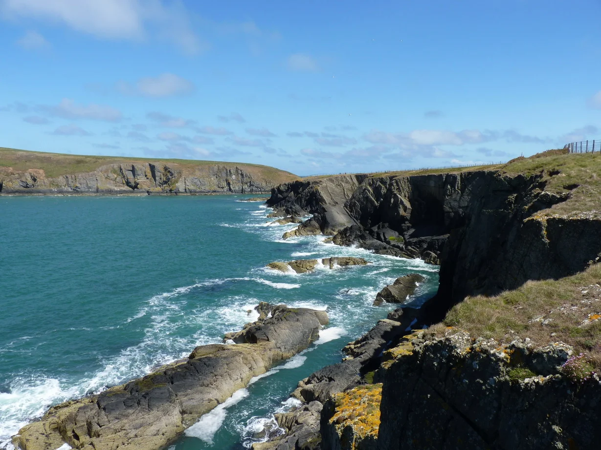

Gwbert
In 1889, the local newspaper announced that the small cliff-top hamlet of Gwbert was about to become Cardigan's New Brighton. Plans were drawn for villa residences. A landing jetty was contemplated. The Gwbert Watering Hole was renamed the Gwbert Hotel. A solicitor named Morgan-Richardson incorporated a company to develop the place. The Great Western Railway had just reached Cardigan; promotional brochures gushed about lofty cliffs facing the Atlantic and country life with all its glorious advantages. Then in May 1906 the Gwbert Hotel burned to the ground. Then the First World War happened. Then the Second. And Gwbert was still, somehow, sixty residential properties and two hotels and a caravan park. The New Brighton never arrived. What arrived instead, eventually, was something better.
The Failed Resort
The proposal to turn Gwbert into a major seaside resort to challenge Brighton and Scarborough was made in 1886, immediately after the Whitland and Cardigan Railway opened to nearby Cardigan. The reasoning was straightforward: tourists could now reach Cardigan by train; if Gwbert had hotels, they would come the last few miles to the sea. By 1889 the Cardigan and Tivyside Advertiser was calling it Cardigan's New Brighton. Kelly's Directory of South Wales (1895) described Gwbert as a small place rising into favour as a watering place. Charles Edwardes in The Rivers of Great Britain (1897) called it distinctly primitive and pleasing. The Bishop of Bangor was quoted on postcards calling it one of the most charming spots he ever visited. It should have worked. The cliffs were dramatic, the views across the estuary to Cemaes Head were spectacular, and the wildlife — though no one talked about it then — was extraordinary. But the development never quite happened. Cardigan was too small to drive enough traffic. The hotel fire of 1906 was a blow. The Great War redirected investment elsewhere. Today Gwbert has sixty residential properties on three small streets, two hotels, and an Iron Age fort with a golf course built across it.
The Watering Hole
Before all the promotional optimism, Gwbert was a small inn known in the 1880s as the Gwbert Watering Hole — a stopping place for travellers on the coast road north from Cardigan. The name Gwbert itself is thought to derive from a Celtic dedication, possibly to a wandering saint called Cubert, who according to tradition landed on this coast and sheltered in a cave. Five saints — Cubert, Pedrog, Briog, Carannog, and Meugana — are honoured in church dedications near the mouth of the Teifi, and remarkably in churches that cluster together again in mid-Cornwall and in Brittany. The pattern suggests a real network of Celtic missionary work in the 5th and 6th centuries, with the same saints sailing the same routes between Wales, Cornwall and Brittany, settling and naming places as they went. Towyn Farm on the dunes north of Gwbert was recorded in 1326 as a medieval gentry house belonging to Gwilym ap Einon, constable of Cardigan Castle. The name Pant-y-Gilbert appears on maps from 1697; by 1748 both that and Gwbert were in use; an 1838 map writes it Goobert.
Europe's Dolphin Coast
What Gwbert quietly owns, more than any Victorian developer guessed, is the wildlife. Cardigan Bay has a resident population of over 100 bottlenose dolphins — some estimates put the number above 200 — and they are most often seen off the southern Ceredigion coast between Gwbert and Aberaeron. This is the largest resident bottlenose dolphin population in Europe; the only other UK colony is in the Moray Firth in Scotland. Atlantic grey seals haul out in the caves below the cliffs at Gwbert's Cardigan Island Farm Park, basking on rocks they have used for generations. Choughs nest in cliff holes. Gannets, razorbills, guillemots, Manx shearwaters, fulmars all work the cliff face. In recent years basking sharks, sunfish, and even orcas, minke whales and humpbacks have been recorded from these waters. In September 1979 a 24-foot whale washed up dead at the foot of the cliffs by Clunyrynys Farm — a scientific officer found a rare 15-spined sea stickleback feeding on the carcass.
Iron Age Above the Sea
On the cliff edge near the Cliff Hotel are the earthworks of a coastal promontory fort — Iron Age defences using the natural geography, with a substantial earthen bank 2.5 metres high and 40 metres long cutting off the narrow neck of land that gives access to the headland. The defenders simply built across the access. Today the Cliff Hotel's nine-hole golf course makes use of the same promontory, with a Grade 2 listed lime kiln among the lime pits inside the old ramparts. In the 1970s an eroding cliff section at Coronation Drive yielded a sand-covered medieval rubbish pit — three metres across and one and a half deep — containing 75 pieces of pottery from the 13th century. That pottery now has its own type-name: Gwbert Ware, a variant of Dyfed Gravel-Tempered Ware. Medieval leather shoes came up too. The pit produced animal bones, an ox scapula, and the imprints of cattle hooves preserved in the old soil under the sand.
Looking Across
Today Gwbert is reached by the B4548 from Cardigan, 2.8 miles away. There is no shop, no church, no school in the village itself; the nearest of those are at Ferwig, a mile inland. The Cliff Hotel and Gwbert Hotel still operate; the Patch Caravan Park accommodates summer visitors from March to October. The Ceredigion Coast Path passes through, the Wales Coast Path passes through, and on a clear day the view across the Teifi estuary to Poppit Sands and the cliffs of Cemaes Head is the kind of thing that brought the Victorians here in the first place. They wanted New Brighton. They got a quiet hamlet on one of Europe's richest dolphin coasts. The accidental result is probably better than the planned one would have been.
From the Air
Gwbert sits at 52.11 degrees north, 4.68 degrees west, at the most southerly coastal point of Ceredigion, on the east shore of the Teifi estuary mouth. From the air the village shows as a small cluster of buildings on a cliff-top promontory, with Cardigan Golf Club's links extending north across the dunes of Towyn Burrows. Cardigan Island lies 200 metres offshore directly to the west; Poppit Sands beach is visible across the estuary mouth to the south-west. Best viewed at 1,000-1,500 feet AGL on a coastal pass. Nearest airfield is Haverfordwest (EGFE), about 23 nm south. Aberporth military airfield lies 5 nm to the east-northeast. Cardigan Bay weather is changeable; sea fog from the bay can roll inland up the estuary quickly.
Nearby Stories
- HMS H47 4.6 km away
- National Botanic Garden of Wales 5 km away
- Narberth 6.3 km away
- Aberystwyth Lifeboat Station 9.3 km away
- Skomer 13 km away
- Diamond (1823 ship) 21 km away
- Talley Abbey 22 km away
- HMS Tyler 32 km away