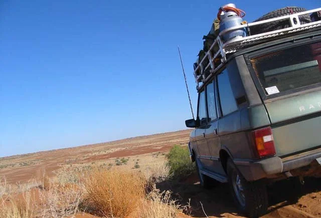

Haddon Corner
There is nothing to see at Haddon Corner but a pillar, a fence line, and an enormous quantity of empty country. And yet people drive for days to stand beside it. The reason is geometry. This is the precise spot, on the lands of the Karuwali people, where the long straight border between Queensland and South Australia stops running west and bends south: the north-eastern corner of the South Australian rectangle. To reach it is to reach a place that exists chiefly as an act of mathematics made real on the ground, a survey mark at the meeting of the 26th parallel of latitude and the 141st meridian, set there in 1880 and standing ever since.
Drawing a Line Across a Desert
The surveying of this border was one of the great feats of colonial Australia, and an ordeal. The western section of the Queensland-South Australia boundary was run in 1879 and 1880 by a party under Augustus Poeppel, a Hamburg-born surveyor who reached the camp at Innamincka in February 1880 with the surveyor Lawrence Wells. The Queensland surveyor Alexander Hutchison Salmond took star observations to fix the latitude, the position determined not by any landmark but by the heavens. Haddon Corner was marked first, in 1880, with a willow post twelve feet long sunk over an iron bar and flanked by trenches cut into the angle of the border. From here Poeppel's party turned and chained westward along the 26th parallel, mile by exhausting mile, toward the corner that now carries his own name.
A Border Born of Argument
The line itself was the product of decades of colonial wrangling. Surveyor-General Augustus Charles Gregory had argued as early as 1860 that the boundary ought to follow the 138th meridian rather than the 141st, reasoning that it would run through barren country and bring a useful anchorage on the Gulf of Carpentaria within Queensland. London disagreed, then the colonies pushed back, and after a flurry of despatches and Letters Patent in the early 1860s the matter was settled: Queensland would extend to the 141st meridian. Two decades later, surveyors like Poeppel and Salmond had to translate that paper decision into posts hammered into the desert floor, fixing in the real world a line that politicians had drawn from a distance.
Close Enough Forever
Modern satellites have quietly revealed what the surveyors could not have known. Haddon Corner does not sit exactly at 26 degrees south and 141 degrees east; given the conditions, the wonder is that it comes as close as it does. But the law has put the question to rest. The Queensland Boundaries Declaratory Act of 1982 confirmed that each boundary fixed by marking it on the ground before 1900 is, and always has been, the border, wherever the posts happen to lie. Geography, in a sense, defers to history. To complicate matters further, the slow drift of tectonic plates means the precise latitude and longitude of any fixed point on Earth shifts almost imperceptibly over time. The corner is wherever the surveyors said it was.
The Pull of an Empty Place
Haddon Corner took its name from Haddon Downs, a station taken up along the border in 1880, now absorbed into the great holding of Cordillo Downs. The original timber post is long gone, replaced by a concrete pillar, and the survey mark is protected by law against tampering. None of this would seem to make a tourist attraction, yet it has become one: a heritage-listed site, added to the Queensland Heritage Register in 2012, and a fixture on the outback's circuit of border corners alongside Cameron Corner to the south and Poeppel Corner some 300 kilometres to the west. Travellers come to stand with one foot in each state, to sign a visitors' book at the edge of nowhere, and to feel the strange satisfaction of arriving at an exact point on the map.
From the Air
Haddon Corner sits at the Queensland-South Australia border at approximately 26.00 degrees S, 141.00 degrees E, in the outback Channel Country of South-West Queensland within the pastoral lands of Tanbar. From the air the defining feature is the dead-straight border fence line, which runs west along the 26th parallel and turns south at the corner; the marker itself is a small concrete pillar easily missed without the fence to guide the eye. The terrain is arid floodplain and gibber, with Cooper Creek's channels not far off. Nearest useful strips are Windorah (YWDH) and Birdsville (YBDV); Innamincka in South Australia lies to the south-west. This is extremely remote country with no nearby controlled airspace and effectively no ground lighting at night, so plan fuel and navigation with wide margins. Visibility is usually excellent, though heat haze and dust can intrude in summer.
Nearby Stories
- Tanbar Station 26 km away
- Lake Yamma Yamma 32 km away
- Morney Plains Station 40 km away
- Canterbury, Queensland 40 km away
- Durrie Station 45 km away
- Cordillo Downs 58 km away
- Burke and Wills Plant Camp 95 km away
- Durham Downs Station 101 km away