
Burke and Wills Plant Camp
On the evening of 3 April 1861, on a nameless creek about a hundred kilometres north of where Birdsville now stands, William John Wills took his final astronomical observations. Then he buried his instruments. To 'plant' something, in the language of the day, was to cache it in a shallow hole for later recovery, and the camp where Wills planted his sextant and his scientific gear is remembered for that act: Return Camp 46, the Plant Camp. It marks the moment the Burke and Wills expedition stopped trying to measure the land and started simply trying to outrun it. By then the men were starving, the return crossing had become a desperate race south, and the instruments that had defined the journey were no longer worth their weight.
The Race South
Months earlier, Robert O'Hara Burke and William Wills had pushed all the way to the Gulf of Carpentaria, completing the first overland crossing of the continent from the settled south, a journey of around 2,800 kilometres. The return was where the expedition unravelled. Burke ordered everything abandoned except food and what the men could carry on their backs, and Wills, the surveyor and scientist of the party, had to leave behind the very tools that recorded their position. The goal was the depot camp at Cooper Creek, far to the south near the present Nappa Merrie homestead, where supplies and waiting men were supposed to be. They were racing toward rescue with nothing left to spare, lightening their loads one buried cache at a time.
What the Ground Remembers
The camp left two kinds of evidence, scattered along the unnamed ephemeral creek on what is now Durrie Station. The first is a litter of European artefacts: percussion caps, nipples and bullets matching the weapons the expedition carried, buckles, sewing needles, and small brass fittings such as a clasp, latch and hinge that may once have closed an instrument case. Each item has been checked against the expedition's detailed List of Stores and found consistent with goods officially supplied. The second kind of evidence stands two and more kilometres east along the creek: two scarred trees. The origin of the scars is unknown, but they may be blazes cut by the expedition, deliberate markers meant to guide later explorers, or any rescuers, to the buried cache.
A Rescue Nine Hours Late
The race south ended in one of the cruelest near-misses in exploration history. By late April the men reached the Cooper Creek depot, only to find that the party waiting for them had given up and departed earlier that same day. Burke and Wills did not survive. Both died at the end of June 1861, within days of each other, on the banks of Cooper Creek. Only John King lived, and he lived because the Yandruwandha people of the Cooper sheltered and fed him for some two and a half months until a search party reached him in September. The expedition that set out to conquer the interior was, in the end, kept alive by the very people whose knowledge of this country its leaders had never thought to seek.
The Cost of Digging
The Plant Camp matters precisely because it is undisturbed ground that can still answer questions, and that makes the damage done to it especially painful. Heritage-listed in 2008, the site shows clear evidence of looting. Both scarred trees have been dug around extensively, the soil turned and tested by treasure-hunters searching for buried instruments. Every artefact pulled from the ground without record of where it lay strips away the context that could tell us how the explorers rationed their supplies, why they kept some objects and discarded others, and what those choices reveal about a journey that ended in death. The buried camp was meant to be recovered one day. It deserves to be recovered carefully, not pillaged.
From the Air
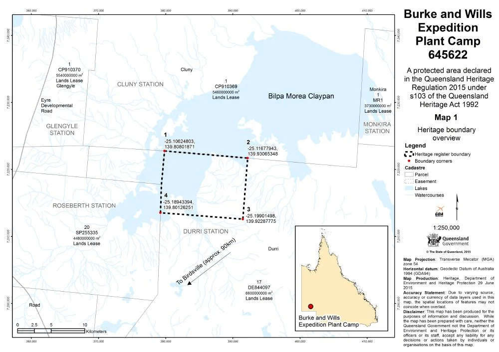
The Plant Camp lies at roughly 25.15 degrees south, 139.87 degrees east, on an unnamed ephemeral creek on Durrie Station, about two hours' drive north of Birdsville and near Betoota. There is no monument to spot from the air, only the faint line of the creek and its claypan terminus winding through gibber and channel country, best traced from 1,500 to 3,000 feet AGL in raking light. Nearest strips are Birdsville (YBDV) to the south and Bedourie (YBIE) to the northwest, with Boulia (YBOU) further north. Treat this as serious outback flying: minimal landmarks, long distances between fuel, and summer heat that flattens contrast and lifts haze across the floodplain.
Nearby Stories
- Lake Machattie Area 24 km away
- Yarluyandi 42 km away
- Big Red Bash 46 km away
- Betoota, Queensland 53 km away
- Lakes Muncoonie, Mumbleberry and Torquinie Important Bird Area 53 km away
- Adria Downs 80 km away
- Astrebla Downs National Park 89 km away
- Currawilla 108 km away