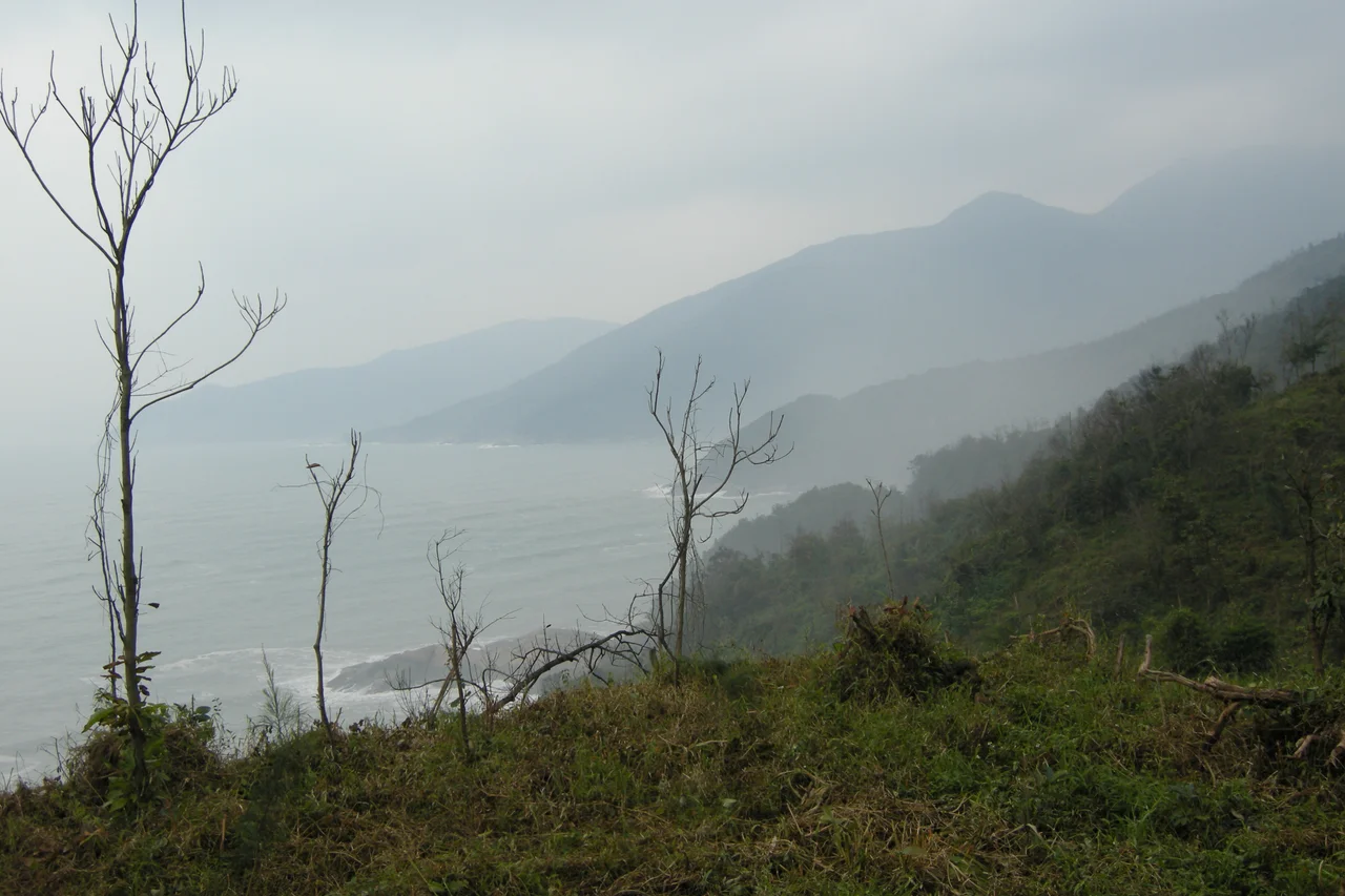

Hải Vân Pass
Stand at the summit of Hải Vân on a winter morning and you can watch two weathers at once. To the north, cold gray mist rolls in from the South China Sea, the kind that blurs the ridgeline and keeps the lowlands damp for months. To the south, Da Nang lies in warm sunlight, sheltered by the very spur of mountains you're standing on. The pass doesn't just divide Huế and Da Nang — it divides climates, and for most of Vietnamese history it divided kingdoms. A poem attributed to Nguyễn Phúc Chu, written sometime between 1675 and 1725, calls Hải Vân "the most dangerous mountain in Vietnam." Two thousand years of history suggest he wasn't exaggerating.
Where Kingdoms Met
The Hải Vân Pass crosses a spur of the Trường Sơn Range — the Annamite Range — where it pushes eastward into the South China Sea, forming the Hải Vân Peninsula and the adjoining Son Tra Island. For centuries, this geography made the pass the natural frontier between two distinct political worlds. In the 1st century AD, the Chinese general Ma Yuan advanced south through northern Vietnam, establishing the border of the Han empire with bronze marker columns, possibly at Hải Vân itself. He stationed Chinese military families to hold the frontier. When the Han empire collapsed at the end of the 2nd century, the kingdom of Lâm Ấp — the predecessor to Champa — emerged in its place, probably centered near what is now Huế to the north.
From 1306, the pass marked the formal boundary between the kingdoms of Đại Việt to the north and Champa to the south. That boundary held until 1471, when Đại Việt's military campaigns pushed Champa's territory further south. The pass that had been an international frontier became an internal road.
The 21-Kilometer Gauntlet
Approximately 21 kilometers long and climbing to roughly 496 meters above sea level, the National Route 1 crossing of Hải Vân was, for generations of drivers, an ordeal of switchbacks and coastal fog. The road is winding, the drops are steep, and the mists that give the pass its name — Hải Vân means "ocean cloud" — reduce visibility without warning. Loaded trucks and buses crept around blind bends above the South China Sea. Motorcyclists navigated conditions that required constant attention. The pass functioned as a strategic barrier for armies moving between northern and central Vietnam — any force approaching from either direction had to negotiate its length in single file, exposed to the high ground above. The geography that made it beautiful also made it deadly, and not only because of weather.
A Record of Catastrophe
The pass has witnessed two of Vietnam's most serious rail accidents. On June 24, 1953, approximately 100 or more people were killed when two locomotives and 18 cars of a passenger train plunged 50 feet through a viaduct that had been sabotaged by the Viet Minh. A powerful explosive charge detonated as the train arrived, collapsing a 25-foot span into the ravine. The pass had frequently been the site of attacks during that conflict; the dead on this train were largely civilians traveling on a route that had become a front line without announcement.
On March 12, 2005, an express passenger train traveling southbound from Hanoi to Ho Chi Minh City derailed north of the pass in Phú Lộc District, killing 11 people and injuring hundreds, many of them seriously. Between those two dates, on December 28, 1969, a United States Marine Corps CH-46 helicopter from Marine Medium Helicopter Squadron 364 crashed in the pass at night after experiencing radio problems. All 10 crew and passengers were killed. A portion of the tail pylon is now on display at the National Museum of the Marine Corps.
The Road That Remains
Since the Hải Vân Tunnel opened in 2005, most commercial traffic bypasses the pass entirely, cutting through the mountain rather than over it. The old National Route 1 crossing is now used primarily by tourists — particularly motorcyclists, for whom the switchbacking road above the South China Sea coast has become one of Vietnam's signature rides. The concrete bunkers from various military eras still dot the ridgeline, weathering slowly in the sea air. Looking down from the summit, you can see both the modern tunnel portal in the valley below and the rail line that hugs the coastline, threading through its own series of tunnels. The pass itself hasn't changed. The weather still shifts at its crest, the sea still disappears into cloud to the north, and the road still demands more attention than most roads require.
From the Air
Hải Vân Pass sits at approximately 16.1875°N, 108.1308°E at the summit, on the border of Đà Nẵng and Thừa Thiên–Huế Province. The pass is a prominent terrain feature visible from altitude — a forested mountain spur jutting sharply into the South China Sea with obvious coastal cliffs on the eastern side. Approach from the south at 4,000–6,000 feet for the best view of the switchback road and the coastline below. Da Nang International Airport (VVDN) is approximately 20 km to the south-southwest; Phú Bài International Airport (VVPB) near Huế is approximately 50 km to the north. Be aware of orographic cloud and reduced visibility, especially November through March on the northern approach.
Nearby Stories
- Chàm Islands 7.3 km away
- Cam Ne incident 7.4 km away
- Tomb of Tự Đức 19 km away
- Battle of the Mỹ Chánh Line 32 km away
- Operation Hong Kil Dong 32 km away
- Perfume River 50 km away
- Dong Ampham National Biodiversity Conservation Area 100 km away
- Hainan Island Incident 314 km away