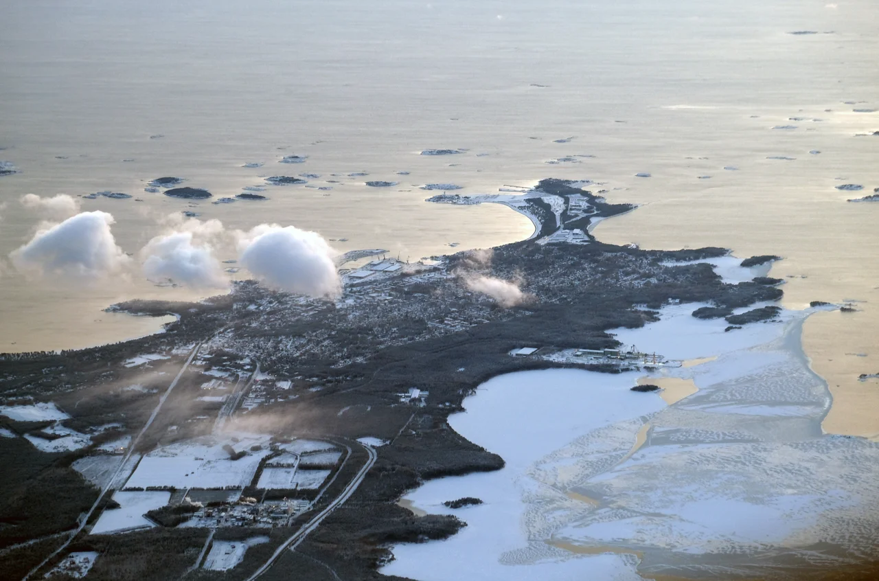

Hanko Peninsula
Cartographers had to draw the line somewhere, and they drew it here. Take a ruler from the tip of the Hanko Peninsula to the northwesternmost point of mainland Estonia, and everything east of that line is the Gulf of Finland while everything west of it is the Baltic Sea proper. There is no wall in the water, no change in the colour of the waves. But the convention is not arbitrary: this narrow sandy finger, the southernmost reach of mainland Finland, genuinely is where the open Baltic stops and a long enclosed arm of it begins. Every ship that wants to reach Saint Petersburg has to round this point, which is precisely why the peninsula has spent three centuries being fought over.
What the Ice Left Behind
The peninsula is not bedrock but debris. It is the far southwestern tip of the Salpausselkä, a terminal moraine roughly 500 kilometres long that marks where the retreating ice sheet stalled during the Younger Dryas cold snap, somewhere between about 12,250 and 10,400 years ago. Meltwater dumped sand and gravel along the ice margin for centuries, and when the ice finally went the ridge remained, damming the lake systems of southern Finland behind it. Here at the seaward end the result is a strip of sandy moraine holding pine and low shrub, thin-soiled and wind-shaped, fringed with long pale beaches that look transplanted from somewhere further south. Offshore the moraine dissolves into an archipelago of skerries — beautiful, and treacherous to anyone navigating it without local knowledge.
Gangut, 1714
On 7 August 1714 by the Gregorian calendar — 27 July in the Julian one the combatants used — the young Russian navy fought its first important battle just off this coast. The Russians called the place Gangut, a transliteration of the Swedish *Hangö udd*. Peter I's galley fleet found the Swedish sailing squadron becalmed and unable to manoeuvre, and after an attempt to drag galleys bodily across the peninsula on greased ox skins was abandoned, the Russians simply rowed past the stranded Swedes and fell on Schoutbynacht Nils Ehrenskiöld's small defending line drawn between two islands. The fighting lasted about three hours at close quarters, ship against ship, and it was brutal: 361 Swedish sailors and soldiers were killed and some 580 taken prisoner, Ehrenskiöld among them. Every Swedish vessel was captured or destroyed. Russia had its first naval victory, and with it the sea road into Finland.
Fortified Ground
Nobody who held the peninsula afterwards felt able to leave it alone. Russian batteries built as part of Peter the Great's Naval Fortress — the ring of coastal defences meant to shield the imperial capital — still stand in fragments among the pines and on the islands offshore. In April 1918, during the Finnish Civil War, the German Ostsee Division chose this shore for its landing, marching inland from a beach chosen for the same reason everyone else chose it: from here you can reach anywhere on the southern coast quickly, and from here you can watch everything that passes.
A Pistol at Finland's Back
In October 1939, Finnish staff officers told the journalist Geoffrey Cox that they would surrender almost anything rather than Hanko, which in Russian hands would be "a pistol pressed into Finland's back" and was "the real key to the Gulf of Finland." They surrendered it anyway. The Moscow Peace Treaty of March 1940 that ended the Winter War leased 115 square kilometres of the peninsula, the town, its waters and some four hundred islands to the Soviet Union for thirty years. The handover came at midnight on 22 March 1940. Finland had already emptied the area: roughly eight thousand people packed what they could carry and left homes their families had lived in for generations, with no idea whether thirty years meant forever. Behind them the Soviets built the Hanko Naval Base, and on the new border both sides dug in — fortifications, garrisons, and elaborate plans for a decisive blow that neither ever delivered.
December, and What Was Left in the Ground
When the Continuation War began in 1941 the expected battle for Hanko never quite materialised. Fighting along the leased border stayed limited; the Finns did not assault the base, and on 2 December 1941 the Soviets simply left, evacuating some 25,000 troops by sea. Finnish forces and the Swedish Volunteer Battalion moved onto the peninsula that December to find it exhaustively mined. The mines were the reason the eight thousand could not come straight home; clearing them took time and cost lives after the shooting had moved elsewhere. The Soviet Union later took Porkkala instead, and formally gave up its claim to Hanko in the Paris peace treaty of 1947. What remains now is quieter than any of that sounds — concrete emplacements going soft-edged in the sand, a museum devoted to the Hanko Front, and pine woods that give no hint of what they cover.
From the Air
The Hanko Peninsula runs southwest from mainland Finland to a point at roughly 59.83°N, 23.08°E, with the town of Hanko at its tip. Hanko Airfield (EFHN), Finland's southernmost, sits about 8 km east of the town centre; Helsinki-Vantaa (EFHK) is some 120 km northeast and Turku (EFTU) about 130 km northwest. Best viewed from 2,500–5,000 ft, where the moraine shows its true shape: a straight-edged sand ridge running out into the Baltic, dark pine on top, pale beaches along both flanks, breaking up into a scatter of skerries offshore. The Salpausselkä trend is legible from the air as a continuation of the same ridge running northeast inland. Sea fog forms readily over the cold water in spring and early summer; autumn generally offers the cleanest air over the Gulf of Finland.
Nearby Stories
- Jussarö 3.1 km away
- German submarine U-745 10 km away
- Teijo National Park 12 km away
- Junkarsborg 13 km away
- Battle of Lemo 32 km away
- Archipelago National Park 35 km away
- Peter the Great's Naval Fortress 50 km away
- Sinking of the MS Estonia 52 km away