Peter the Great's Naval Fortress
The disaster at Tsushima in 1905 left Russia without a Baltic Fleet. Forty warships had sailed halfway around the world to relieve Port Arthur and met the Japanese Navy in the Korea Strait. Two days later most of them were on the bottom. Saint Petersburg, the imperial capital on the Gulf of Finland, suddenly had no defense at sea. The cheapest answer was concrete and steel: a chain of coastal artillery so dense that no enemy fleet could pass. Tsar Nicholas II approved the plans on 5 July 1912. The fortifications would stretch from Estonia to Finland, anchored on a 36-kilometer narrows. They never finished it.
Closing the Gulf
Look at a map of the Gulf of Finland and the strategic problem becomes obvious. The water narrows like a funnel toward Saint Petersburg, and at one point the gap between Tallinn on the Estonian side and Porkkala on the Finnish side closes to just 36 kilometers. Russian engineers proposed to fill that gap with crossfire. Heavy coastal guns on each shore could throw shells about 25 kilometers — enough to overlap their fire and trap any enemy fleet trying to slip through. The whole defensive system was layered. The innermost ring protected Saint Petersburg directly with the old Kronstadt fortress and outposts at Krasnaya Gorka and Ino. A second line stretched from Kotka to Narva. A third — the main one — ran between Tallinn and Porkkala. A fourth reached out almost to the Hanko Peninsula. Around Helsinki and Tallinn, thousands of kilometers of railway, tunnels, and artillery positions encircled the cities.
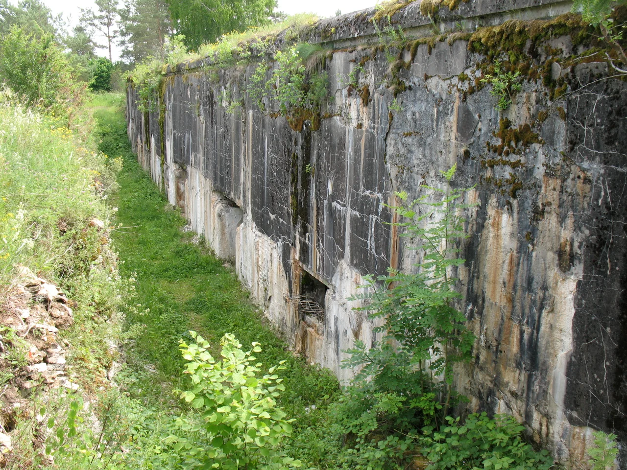
Guns on Islands
The heaviest weapons in the planned scheme were 356 mm coastal guns, designed in 1913 — colossal pieces capable of hurling armor-piercing shells over thirty kilometers. They were never finished. By the time the Russian Revolution swept everything aside in 1917, the foundations were poured but the barrels were still in the workshops. What did get installed was impressive enough. On the small Estonian island of Naissaar — a low, forested rock about ten kilometers from Tallinn — Russian gunners mounted four 305 mm guns, four 234 mm, four 203 mm, and lighter pieces alongside. Mäkiluoto, the corresponding Finnish island, received its own cluster. Aegna got two of the big 305s. The fortifications at Suurupi, Viimsi, and Kakumäe extended the line. Each battery was concrete and steel, dug deep into the rock, with magazines and rangefinders and barracks for hundreds of men.
Empire Out of Time
World War I slowed everything. Materials and manpower drained away to the front. By 1917 the fortress was perhaps half-built — substantial enough to have changed naval calculations in the Baltic, but never the impenetrable wall the Tsar had imagined. Then both Finland and Estonia declared independence in the aftermath of the October Revolution, and the entire purpose of the project evaporated. The very nations whose coasts the fortress was supposed to defend now wanted nothing to do with Russian artillery on their islands. The German Navy made one major landing on the Finnish coast in April 1918, fighting alongside the Finnish Whites against the Reds, and conquering Helsinki. The empire that had ordered the fortress no longer existed.
Guns Turned Around
Through the 1930s, Finnish and Estonian coastal defenses planned to use these same fortresses against their old masters — to keep the Soviet Baltic Fleet bottled up. A joint defensive scheme was worked out, with minefields and submarines coordinating across the gulf. The plans never had a chance to operate. In 1939 Stalin demanded — and got — naval bases throughout the Baltic States, and within a year both nations were absorbed into the Soviet Union. The Porkkala fortress with its 305 mm guns was leased back to the Soviets under the Moscow Armistice of 1944, then returned to Finland in 1956 with the guns demolished as part of the handover. Today rusting concrete batteries on Naissaar and the other gulf islands are a tourist curiosity, evidence of a vast imperial calculation that history simply rendered moot.
From the Air
Peter the Great's Naval Fortress was a system, not a single point. The reference coordinate (59.46°N, 24.39°E) places you over Naissaar Island, the largest Estonian battery, about 10 km north of Tallinn (EETN). From cruising altitude on transits across the Gulf of Finland between EETN and EFHK (Helsinki Vantaa, 90 km north) you fly directly over the historic line. Mäkiluoto Island sits about 30 km southwest of Helsinki. ULLI (St. Petersburg Pulkovo) lies 320 km east. In good visibility the gulf islands appear as dark forested rocks against pale Baltic water. The historic fire-control geometry — 36 km wall to wall — is visible only when you understand what you are looking at.
Nearby Stories
- Padise Abbey 17 km away
- Raseborg Castle 29 km away
- Haapsalu Castle 39 km away
- Military Museum of Finland 42 km away
- Battle of Weissenstein 52 km away
- National Museum of Finland 53 km away
- Battle of Hanko (1941) 64 km away
- Battle of Wesenberg (1268) 80 km away