Haut-Lomami District
If you could put every map of this part of central Africa on a single table and stack them by year, the lines would jump. Katanga is a single province in 1920, then six provinces, then one again, then three, then four, then twenty-six. Through all of it, the country northeast of Lubumbashi - the open bushveld rolling toward the Lomami River - kept being rearranged, renamed, split and stitched. Haut-Lomami District is the name of one of those reshufflings. It lasted long enough to leave a paper trail, outlasted an independence war, and eventually became the name of the province it had always secretly been.
Six Provinces and a Governor's Logic
The Belgian Congo started with four provinces and a lot of local autonomy. In 1933 the colonial authorities reorganised everything into six provinces, each named after its capital, and pulled power back toward Brussels. Katanga became Elisabethville Province, after its southeastern capital. The number of districts in the entire colony was reduced to fifteen. Within Elisabethville Province, administrators drew Lualaba District in the west, and Tanganika and Haut-Katanga districts in the east. For two decades that structure held. Then, in the mid-1950s, the map was redrawn again. Lualaba shrank. Its northern reaches became a new district: Haut-Lomami. Its eastern edge was handed to Luapula-Moero.
A District on the Plateau
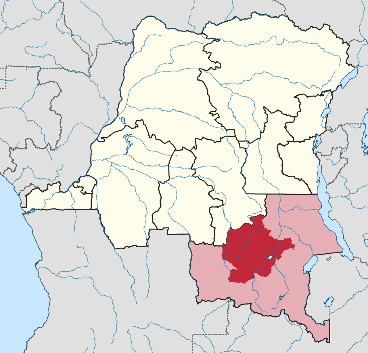
By the late 1950s Haut-Lomami District stretched across 163,300 square kilometres of the Katangan plateau - about a third of the whole province. A 1955-57 administrative map shows it bounded by Lulua and Kabinda districts to the north, Tanganika to the northeast, Luapula-Moero to the southeast, Lualaba to the south, and Portuguese-held Angola to the west. This was miombo country: dry upland woodland broken by dambos, crossed by the headwaters of the Lomami and Lualaba rivers, populated by Luba and Songye communities who had lived with these waters long before a Belgian clerk ever sketched a boundary line. The district was an administrative convenience laid over a landscape that had its own older geography.
Independence, Secession, Stitching Back Together
On 30 June 1960 the Congo became independent. Eleven days later, on 11 July, Katanga seceded as a breakaway state under Moise Tshombe, backed by mining interests that wanted the region's copper outside national control. Fighting dragged on for two and a half years. In November 1961 national forces reconquered the northern portion and renamed it Nord-Katanga. On 21 January 1963 the rest of Katanga was brought back under Kinshasa's control and divided into the provinces of Lualaba and Katanga Oriental. Then, on 28 December 1966, the three pieces were stitched back together into a single Katanga again. Haut-Lomami District, through all of this, kept a kind of shadow existence on the maps - the name waiting for its moment.
The Promotion, 2015
That moment came almost a half-century later. In 2015, as part of a constitutional reform that finally implemented the 2006 decentralisation plan, the DRC broke its eleven huge provinces into twenty-six smaller ones. Haut-Lomami District became Haut-Lomami Province - one administrative layer promoted, after sixty years of being a district, to sovereignty over its own affairs. The town of Kamina, a railway junction and former colonial garrison at the district's heart, was elevated to provincial capital. For most residents the practical change was modest. For the map, though, it was the first time in a century that the name on the land matched the name used by the people living on it. In a part of Africa where borders have usually been handed down from far away, that kind of correction is not a small thing.
From the Air
Centered near 10.30 degrees south, 25.89 degrees east, over the high plateau of south-central DRC. Best viewed from 12,000-25,000 feet AGL; the district's 163,300 sq km of miombo woodland, dambo wetlands and the Lomami headwaters are most striking in dry-season morning light (June-September). Kamina (FZSA) is the current provincial capital airport and the main aviation reference point. Lubumbashi International (FZQA) lies roughly 400 km southeast.
Nearby Stories
- Kalukundi mine 11 km away
- Ciments du Katanga 16 km away
- Shinkolobwe 60 km away
- Bunkeya 67 km away
- Upemba National Park 114 km away
- Sakeji School 133 km away
- Kalene Hill 158 km away
- Lomami Province 442 km away