.jpg)
Hellenic Trench
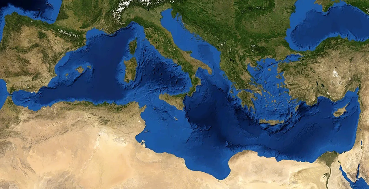
Beneath the blue surface of the Ionian Sea, about 180 kilometers southwest of the Peloponnese, the Mediterranean floor drops away into darkness. The Calypso Deep, nested within the Matapan-Vavilov Deep, is the deepest point in the entire Mediterranean Sea. The Hellenic Trench is the system that contains it: a 1,200-kilometer arc of oceanic trough that curves from the Gulf of Corinth south past Crete and east toward Rhodes, tracing the collision zone where the African plate has been sliding under the Eurasian plate for some 30 million years. From the air, the sea gives no hint of what lies below. From the seafloor, it is one of the most geologically active places on Earth.
Where Two Plates Meet
The Hellenic Trench marks the outer edge of one of the most complex tectonic systems in the world. Africa is moving north, pressing against Eurasia. Where the two plates meet, the African slab dives under the Aegean Plate — a process called subduction — pushing up the arc of highlands and islands that form the Hellenic Arc, including Crete and the southern Aegean island chains.
But the classical explanation — trench equals subduction line — turns out to be only part of the story. Subsequent research revealed something unexpected: the Aegean Plate has been stretching southward at a rate far greater than Africa's northward push could account for. The mechanism is slab rollback, in which the subducting slab bends back on itself as it sinks, pulling the overlying plate outward behind it. The entire Aegean Sea, in a sense, is the product of this stretching. The trench moves south as the slab rolls under, consuming more of the African plate as it goes. Even the debate about whether the Hellenic Trench is still actively subducting — or is a remnant of a zone that has moved elsewhere — remains unresolved.
The Calypso Deep
The deepest basin in the western leg of the trench is the Matapan Deep, also called the Matapan-Vavilov Deep, located south of the Peloponnese's Mani peninsula — the middle of the three 'fingers' that reach down from the Greek mainland. Within it lies the Calypso Deep, the lowest point in the Mediterranean, at roughly 5,267 meters below sea level.
The name carries its own mythology. Calypso, in Homer's Odyssey, was the nymph who kept Odysseus on her island for seven years. The Ionian Sea was the sea he sailed. The trench named after his captor sits in those same waters, in the same darkness where the ancients imagined gods living beneath the waves. Whether the name was given with that echo in mind or not, it fits.
The Hellenic Trench is also home to the kind of life that thrives in deep, untrafficked water. Sperm whales hunt in these depths. Cetaceans of several species use the trench as habitat, and some of them are endangered — threatened particularly by ship traffic in the Eastern Mediterranean. ACCOBAMS, the regional cetacean conservation body whose membership includes every Mediterranean-bordering state, has designated the trench and its surrounding arc as an International Marine Mammal Area and a Marine Protected Area.
A Curved Scar, 1,200 Kilometers Long
The geometry of the Hellenic Trench is not a simple line. It forms an arc roughly 1,200 kilometers in length along its outer edge — or about 1,000 kilometers if measured along the subduction line itself. On a map it resembles the track of something enormous that swept through the region and bent everything in its path.
The western leg of the trench runs from near Zakynthos and the Strofades islands south and east to a vertex south of Crete. The eastern leg fans into three parallel trenches — the Ptolemy, the Pliny, and the outermost Strabo — trending northeast toward Rhodes. The two legs do not form a smooth curve; they meet at an angle, which reflects the different plate motions operating on each side. Dip-slip faults dominate the west; strike-slip movements complicate the east.
The 365 CE Crete earthquake — one of the largest in Mediterranean history, which triggered a tsunami that struck coastlines as far as Alexandria and the Levant — originated in the Hellenic subduction zone. The scar in the seafloor remembers it.
Thirty Million Years of Geology
The Hellenic Trench did not appear suddenly. Its origin traces back to the Oligocene, about 30 million years ago, when successive waves of African plate subduction under Eurasia began building the mountain ranges of Greece. Each wave of subduction created a forearc — a raised rim at the edge of the overriding plate — and each rim was eventually welded onto the continent in front of it. The Alps, the Dinaric Alps, the Hellenides: all of them are products of this long-running collision.
The current configuration — the Hellenic Arc curving around from Corfu to Rhodes, with the trench sitting in its foredeep — is geologically young, the result of back-arc extension that began sometime after the Oligocene compression ended. Greece's strips of distinct geology, running northwest to southeast across the mainland, are the preserved record of those older episodes of subduction. The trench itself, still the subject of active research and ongoing debate about what exactly is happening along its length, is just the latest chapter in a story that began before the Mediterranean Sea took its current shape.
From the Air
The Hellenic Trench lies in open water roughly centered around 37.80°N, 20.00°E in the Ionian Sea, with the Calypso Deep located approximately 36.5°N, 21.5°E south of the Mani peninsula. Flying from LGZA (Zakynthos 'Dionysios Solomos' Airport) south or southwest at cruise altitude, the Ionian Sea stretches out featurelessly below — the trench is entirely submarine and not visible from the air, but the scale of the water and the sense of depth beneath it are striking in clear conditions. LGKL (Kalamata Airport) to the northeast provides an alternate departure point for the eastern sections of the trench near Crete. The best visual orientation is the Mani peninsula of the Peloponnese to the east, pointing like an arrow toward the deepest part of the Mediterranean below.
Nearby Stories
- Lixouri 7.2 km away
- 2018 Ionian Sea Earthquake 18 km away
- County Palatine of Cephalonia and Zakynthos 27 km away
- SM UC-38 46 km away
- Strofades 109 km away
- Battle of Heraclea 326 km away
- The Arrival of the Black Death: When Ships Brought the Apocalypse 333 km away
- Valletta 470 km away