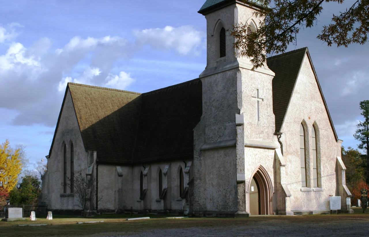

High Hills of Santee
Malaria built these hills, in a sense. Every summer the Lowcountry around Charleston turned into a death trap of mosquitoes and fever, and wealthy planters fled inland to anywhere with breeze and elevation. The High Hills of Santee, a narrow upland ridge running twenty-five miles along the east side of the Wateree River, became their refuge. The South Carolina historian David Duncan Wallace called them part of the state's 'red hill region' and said they 'attain an almost mountainous appearance.' They are not mountains, only sandy ridges sometimes five miles wide, but in the flat coastal plain they were high enough to matter. Three National Historic Landmarks now stand among them, the surviving fabric of an antebellum world that ran on cotton and on the forced labor of enslaved Africans.
The Gamecock and His County
Thomas Sumter came to South Carolina from Virginia, married a local widow in 1767, and became a successful planter. The Revolution made him famous - a guerrilla commander so harassing to the British that they nicknamed him the Carolina Gamecock. Sumter District, later Sumter County, took his name. After the war he represented South Carolina in the U.S. House and the Senate. His home, called Home House, no longer stands, but he is buried at the site. The grandson who carried his name owned Moor Hill nearby. Sumter is one anchor of the region. The other is a woman most people have never heard of.
Angelica's Brief White House
Angelica Singleton was born in the High Hills, daughter of one of the great planter families. She married Abraham Van Buren, eldest son of President Martin Van Buren - and because Martin Van Buren was a widower when he took office, his daughter-in-law Angelica served as acting First Lady. She was twenty when she walked into the White House to host receptions, modeling her style on the European courts she had toured during her honeymoon. The portrait Henry Inman painted of her in 1842 still hangs at the White House. The High Hills shaped her childhood with the rhythms of cotton planting, summer relief, and the constant presence of enslaved people whose labor made all of it possible. Among those her family enslaved, no individual names have come down to us through the records this story relies on. Their absence is part of the story too.
Stateburg, Where the Poinsettia Sleeps
The village of Stateburg sits at the heart of the High Hills, listed on the National Register as a historic district that includes two of the region's three National Historic Landmarks. Borough House Plantation, an unusual rammed-earth structure built in the 1820s, was the birthplace of Confederate general Richard H. Anderson. Across the way stands the Church of the Holy Cross, also rammed-earth, where Joel Roberts Poinsett is buried. Poinsett - statesman, botanist, ambassador, and the man who introduced the bright red Mexican Christmas flower to American gardens - died at Borough House in 1851. The poinsettia bears his name. Stateburg also gave the world Mary Boykin Chesnut, born here in 1823, whose Diary from Dixie became one of the most important first-hand accounts of the Confederate home front. Furman University takes its name from Richard Furman, pioneering Baptist minister and first pastor of the High Hills of Santee Baptist Church.
Kings Highway and the Railroad Stonehenge
The major road through the hills since the eighteenth century has been Kings Highway, today South Carolina 261, originally a Catawba trail running from Charleston to Camden. An antebellum branch of the South Carolina Railroad threaded the hills too, joining the Wilmington and Manchester at Wateree Junction. In April 1865, General Edward E. Potter's Union troops found nine locomotives and roughly 200 rail cars hidden there from Sherman's army. They burned and blew them in place. Local memory called the resulting wreckage 'the railroad stonehenge.' During the Second World War the scrap was salvaged for the war effort. By 1997 the last rails and ties were lifted. What remains today are Pinewood Depot, the southern gateway to the hills; the Lenoir Store at Horatio; Magnolia Hall at Hagood; and the long quiet of place-names that once meant junctions and stations - Wedgefield, Claremont, Foxville, Manchester. The High Hills, despite their proximity to Sumter and Columbia, are still mostly rural and isolated, as they were in antebellum times.
From the Air
The High Hills of Santee run roughly north-south at 33.98N, 80.55W, paralleling the Wateree River on the east side. The ridge extends about 25 miles, rising up to about 70 meters above the surrounding plain. Nearest airports: Sumter Airport (KSMS) 12 nm east, Shaw AFB (KSSC) 10 nm east, Columbia Metropolitan (KCAE) 25 nm west. From cruise altitude the hills appear as a soft north-south band of higher elevation and denser tree cover between the Wateree and Sumter. Best viewing 3,000 to 6,000 ft AGL on a clear morning.
Nearby Stories
- Lexington, South Carolina 4.1 km away
- Battle of Camden 12 km away
- Hartsville, South Carolina 12 km away
- Battle of Mobley's Meeting House 20 km away
- Orangeburg Massacre 33 km away
- Graniteville Train Crash: The Night Invisible Death Came to a Mill Town 59 km away
- Francis Marion National Forest 79 km away