,_Wales15.jpg)
Holyhead Mountain
It is not really a mountain. At 722 feet, Holyhead Mountain - Mynydd Twr in Welsh, meaning 'mountain of the heap' - is shorter than most office towers and would be a foothill in the Alps. But on a low, flat island in the Irish Sea, it is by a large margin the highest ground for many miles in every direction, and the people who lived around it have treated it as a mountain for the better part of five thousand years. Prehistoric standing stones cluster at its foot. A late Roman watchtower called Caer y Twr crowns its eastern side, set inside an Iron Age hillfort that predates the Romans by centuries. On a clear day, looking west from the summit, you can pick out the Wicklow Mountains in Ireland sixty miles away across the open sea.
Stone Age to Roman, Stacked on the Same Hill
Holyhead Mountain has been continuously useful to humans since the middle Stone Age. The slopes show traces of field systems, dry-stone wall bases, and twenty surviving hut circles from the Iron Age settlement on the southwestern terrace - the Holyhead Mountain Hut Circles, occupied through the Roman period and possibly later. There are standing stones nearby, including the dramatic Penrhos Feilw pair south of the mountain. Caer y Twr, the late Roman watchtower on the east side, sits inside a prehistoric hillfort whose dry-stone ramparts are still visible. The Romans did not build the fort - they reused it, dropping their own watchtower inside walls that were already old when the legions arrived. Stand on the summit and you are standing on something that has been a marker, a refuge, and a lookout for fifty centuries.
Seven Million Tons of Mountain
On the northeastern side of Holyhead Mountain, the slope shows visible scars from one of the largest construction projects in Victorian Britain. Seven million tons of quartzite came out of those quarries between 1848 and 1873 to build Holyhead Breakwater - the longest breakwater in the United Kingdom, at over 1.7 miles, sheltering the New Harbour for the Dublin ferry trade. The stone was carried to the harbour on a dedicated railway and laid course by course by divers working in submarine bells. A brickworks attached to the operation produced specialist facing bricks, also from material taken from the mountain, and stayed in production until 1973. The breakwater would not exist without the mountain. The mountain still bears the marks of the breakwater. One physically rearranged the other.
What Lives on the Cliffs
The summit is rocky quartzite, and the slopes are clad in heather that turns the whole hill purple in late summer. Most visitors do not come for the summit. They come for what nests on the cliffs below it. The mountain ends to the southwest in the sea cliffs above South Stack, where puffins arrive in spring to dig burrows in the turf, where stonechats chip from the gorse, where Eurasian oystercatchers patrol the rocks with their loud orange-and-black severity. The RSPB runs a reserve at South Stack focused specifically on the seabird colonies. Grey seals haul out below in summer, visible from the clifftop paths if you know where to look. The combination - moderate hill, dramatic cliffs, large bird colonies, and an unbroken view across to Ireland - draws walkers and birdwatchers in numbers that the prehistoric inhabitants would have found incomprehensible.
The View from the Trig Point
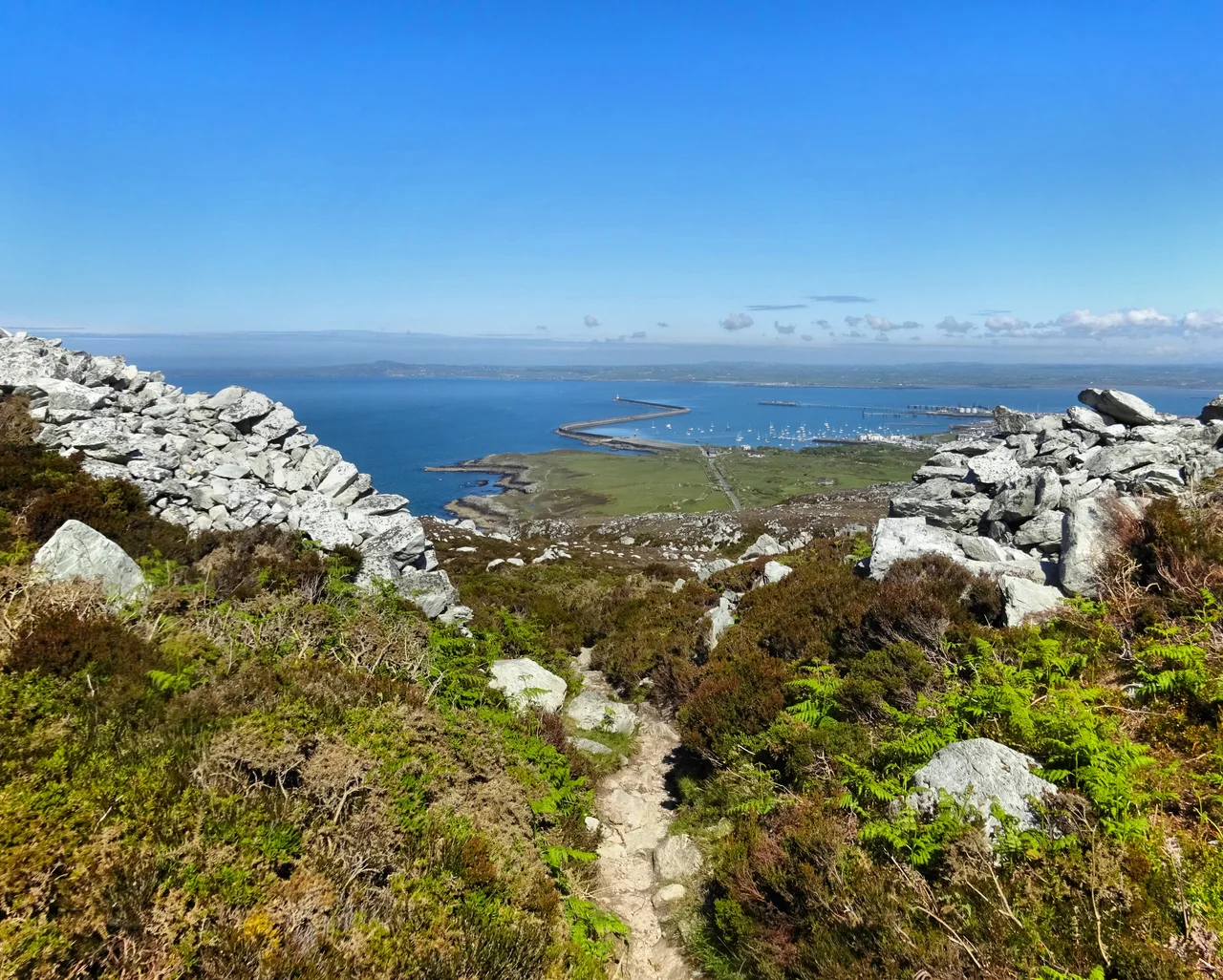
There is a triangulation pillar at the summit, white concrete, weathered by Atlantic weather. From it you can see the entire western half of Anglesey, the breakwater curving out into the Irish Sea, the ferries running their tidy lines toward Dublin, and on the best days the smudge of the Wicklow Mountains sixty miles to the west. South Stack Lighthouse is visible to the southwest. Mynydd Bodafon, the highest point on the main island of Anglesey at 584 feet, looks smaller than it should from this angle. There is something disorienting about standing on the highest point in a county and being able to see clean across to a different country. Holyhead Mountain is the place where you understand, viscerally, why this island has spent five thousand years being the spot where the British Isles reach toward each other.
From the Air
Holyhead Mountain (722ft / 220m) at 53.31N, 4.68W is the most prominent terrain feature on Holy Island and is unmistakable from the air - a steep quartzite outcrop covered in heather, rising sharply above otherwise low-lying ground. Look for the white trig point at the summit and the visible quarry scars on the northeastern slope where the breakwater stone came from. South Stack Lighthouse is at the southwestern foot. Mountain weather can develop rapidly with strong winds and low cloud sweeping in from the Irish Sea. Nearest airfields: RAF Valley (EGOV) 6nm southeast, Caernarfon (EGCK) 22nm southeast. Maintain safe terrain clearance.
Nearby Stories
- Snowdon Mountain Railway 8 km away
- German submarine U-1051 8.3 km away
- German submarine U-246 11 km away
- Trwyn Du Lighthouse 13 km away
- Irish Sea Bridge 20 km away
- HMS Manners (K568) 34 km away
- HMS Tyler 47 km away
- Birkdale Palace Hotel 79 km away