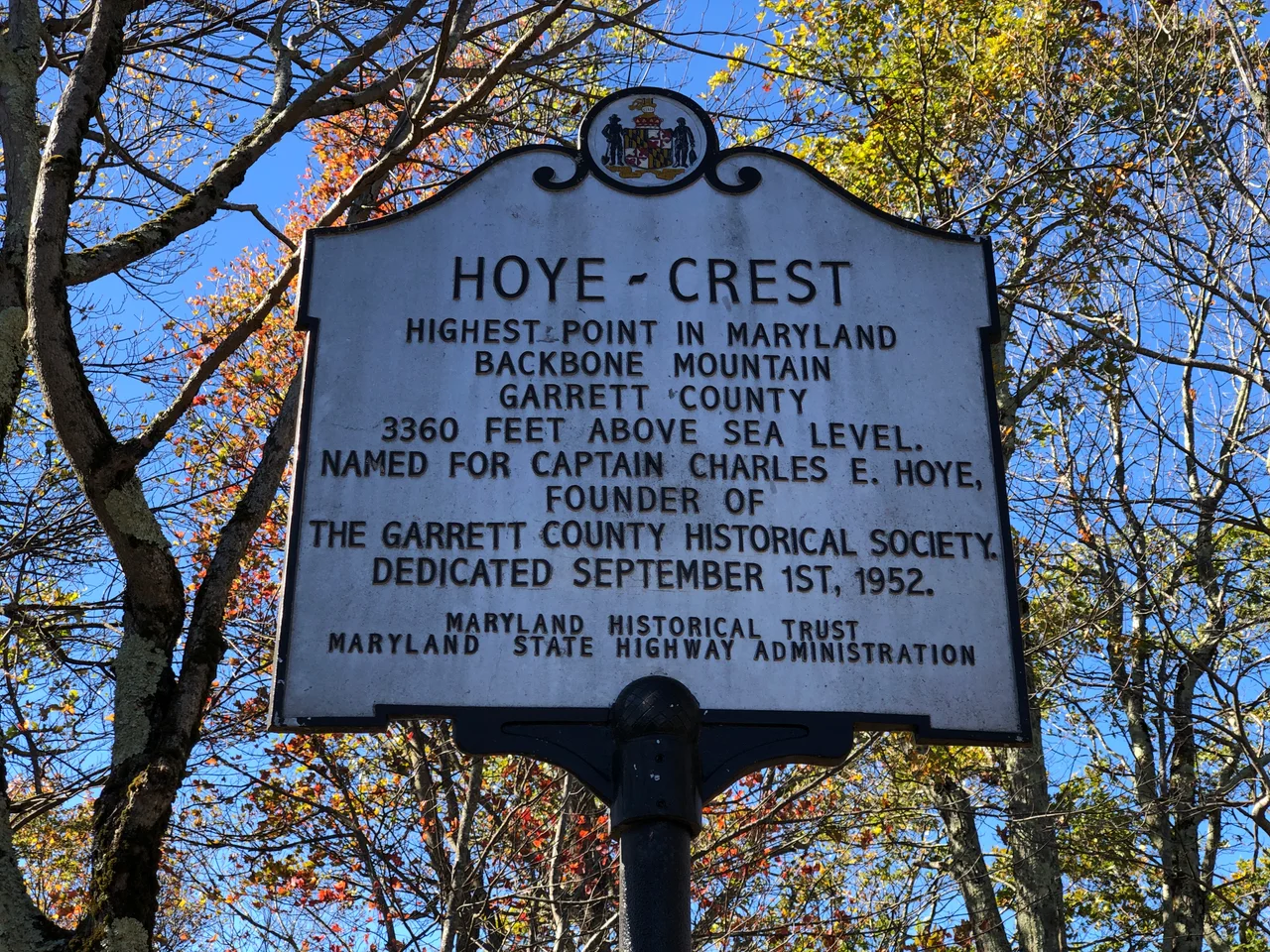

Hoye-Crest
To reach the highest point in Maryland, you start in West Virginia. The Maryland High Point Trail begins along U.S. Route 219 just south of Silver Lake, West Virginia, and climbs Backbone Mountain on an old logging road through Monongahela National Forest land. About a mile in, the trail crosses the state line. From there it heads north along the border to Hoye-Crest - a 3,360-foot summit on the Maryland side of the line that is the highest natural point in the state. The peak is unmarked by infrastructure. There is no parking lot. No vehicular access. Just a historical marker placed in September 1952 by the Maryland Historical Society, recognizing the spot that almost no Marylanders would ever otherwise notice.
The Captain and His Crest
Hoye-Crest takes its name from Captain Charles E. Hoye, who lived from 1876 to 1951 and founded the Garrett County Historical Society. Hoye spent his career documenting and preserving the history of western Maryland - the rugged Allegheny country that the rest of the state often forgot. The naming was posthumous, an acknowledgment of his work, with the dedication held in September 1952 in the small ceremony at the summit. The historical marker placed that day is still there. From the summit, the view opens east into the North Branch Potomac River valley - the same drainage whose source at the Fairfax Stone defines the western Maryland border. The marker is the only built structure on the peak.
The High Point Quest
Hoye-Crest is part of an unusual American hobby: highpointing. Enthusiasts attempt to summit the highest point in each of the 50 states. Some are major mountaineering challenges - Denali in Alaska, Mount Rainier in Washington. Others are easy drives - Iowa's Hawkeye Point, Florida's Britton Hill. Maryland's Hoye-Crest sits at the easier end, requiring a one-mile hike each way on a moderate trail. Most highpointers complete it in less than an hour of walking. For people working toward the full 50, it tends to be one of the simpler stops. For West Virginia and Maryland residents who happen to be driving U.S. 219, it makes for an unexpected mid-afternoon detour.
Private Land, Public Access
Hoye-Crest sits on private property owned by Western Pocahontas Properties. The owner allows public access for hiking. The arrangement is informal but reliable - the trail is maintained, the markers are in place, and visitors are welcome to make the climb. The trail itself crosses from federal Monongahela National Forest land on the West Virginia side onto private corporate-owned land on the Maryland side. The state line runs roughly along the ridge of Backbone Mountain here, which is why a Maryland high point is accessed from a West Virginia trailhead. The hike passes second-growth Appalachian hardwood forest - oak, maple, hickory - with the occasional remnant hemlock and the standard mix of laurels and rhododendrons under the canopy.
Backbone, the Range
Backbone Mountain itself stretches about 35 miles along the West Virginia-Maryland border, running roughly northeast-southwest. The ridge holds elevations consistently above 3,000 feet for much of its length, making it one of the longer high ridges in the central Appalachians. The 44-turbine Mountaineer Wind Energy Center sits on the southwestern end of the same mountain - the first wind farm in West Virginia when it opened in December 2002. Frontier woodsman Meshach Browning, the early hunter and explorer of the Potomac and Youghiogheny watersheds, lived on Backbone Mountain in the early nineteenth century and left memoirs that documented the wilderness as it was before the logging booms. The mountain runs through the country he hunted. Today the highest point on the Maryland side is named for the historian who preserved his memory.
From the Air
Located at 39.24 degrees north, 79.49 degrees west, on Backbone Mountain in Garrett County, Maryland, at the West Virginia state line. The 3,360-foot elevation is the highest natural point in Maryland. Best viewed from 5,000 to 6,500 feet AGL. The ridge runs northeast-southwest along the border. The wind turbines on the southwestern part of Backbone Mountain are visible as a clear landmark. Nearest airports are Garrett County (K2G4), Cumberland Regional (KCBE), and Elkins-Randolph County (KEKN).
Nearby Stories
- Joseph Hanks 2.8 km away
- West Virginia Wesleyan College 6.9 km away
- Governor Joseph Johnson House 8.8 km away
- Allegheny Mountains 11 km away
- Hardy County, West Virginia 21 km away
- Battle of Fort Necessity 30 km away
- United Airlines Flight 93 58 km away
- West Virginia Penitentiary 65 km away