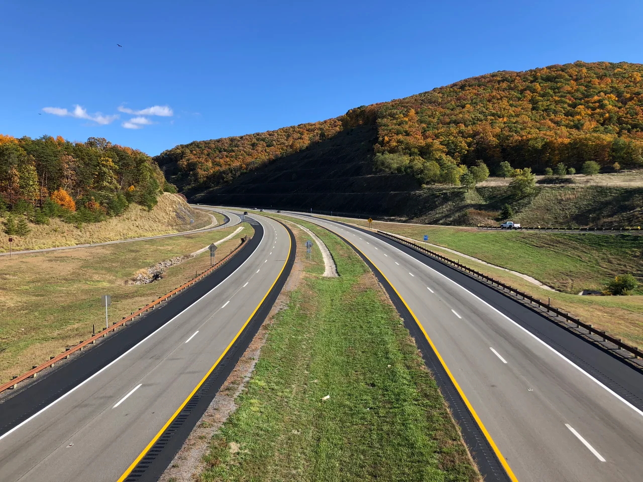
_from_the_overpass_for_McCauly_Road_in_Fort_Run,_Hardy_County,_West_Virginia.jpg)
Hardy County, West Virginia
The river did something strange here. Thousands of years ago, the South Branch Potomac met a long ridge of rock and instead of crossing it the way most rivers cross mountains - with a single notch worn through over time - the South Branch ran through it from end to end. The result is a seven-mile slot called simply The Trough, hundreds of feet deep, walls almost perpendicular, a single narrow channel of water at the bottom. That gorge is one of the geological signatures of Hardy County, West Virginia.
A Quiet 1786 County
Hardy County was carved out of Hampshire County in 1786 and named for Samuel Hardy, a Virginia delegate to the Continental Congress. The first European known to visit was John Van Meter in 1725, and the first permanent settlements went in during the 1730s, when the South Branch Valley was a frontier of long German and Scotch-Irish migrations down the Great Wagon Road. Hardy joined the other fifty counties that became West Virginia at statehood in 1863, splitting from Virginia in the political earthquake of the Civil War. Even then, Hardy was conflicted. The county voted against secession - but most of those Unionist votes came from what would soon become Grant County, detached after the war. The 2020 census counted 14,299 people across 584 square miles. Most of the land is still farmed.
A Valley, a River, and The Trough
The South Branch Potomac River runs the length of the county through what locals just call The Valley. Several miles wide and flanked by high, heavily timbered mountains, the Valley's fertile bottomland has carried Hardy's economy since the 1730s. Corn, wheat, apples, peaches, melons, cattle, and poultry have rotated through these fields for nearly three centuries, and a household garden is still a near-universal feature of rural life. The South Branch itself is a clear, wide, fish-filled stream that periodically rises over its low banks to flood the valley. Then it reaches The Trough. The gorge - seven miles long, hundreds of feet deep, vertical walls of rock - is now best known as the route of the Potomac Eagle scenic railroad. It was once how flatboat farmers got produce out of the valley toward markets downstream.
A Pre-Civil War Black Community
Hardy County has a rich African American history, including a notable population of free Black families who lived and farmed there before the Civil War. Henry Louis Gates devoted part of his PBS series African American Lives to this community in his Part 2 episode, tracing the long roots of free families whose freedom predated emancipation by generations. In a region where slavery was the dominant labor system, these households held property, married, raised children, and built community networks that historians are still mapping. The county's small towns - Moorefield, Wardensville - and unincorporated places like Lost River, Old Fields, and Baughman Settlement all carried these histories into the present, even as much of the documentation was scattered or lost.
Moorefield at the Center
The county seat sits at the very center of the South Branch Valley, on the east side of the junction where the South Fork meets the South Branch Potomac. In 1860 Moorefield was a quiet farming center of roughly 1,500 people, with no bridges over the South Branch. Travelers either forded three miles upstream or waited for a busy ferryboat. Stagecoach lines connected Moorefield to Petersburg, Romney, and New Creek - now Keyser. Today U.S. 48 (Corridor H), U.S. 220, and West Virginia Routes 28, 29, 55, 59, and 259 lace the county, and parts of the George Washington National Forest and the United States National Radio Quiet Zone fall inside the county lines. The Radio Quiet Zone, which protects the Green Bank Observatory's radio telescopes, restricts what kinds of broadcasts can operate from parts of Hardy County - a 20th-century constraint imposed on what is otherwise a county of 18th-century origins.
From the Air
Centered near 39.01 degrees north, 78.86 degrees west, between the Allegheny Front and the Shenandoah ridges. From 5,000 to 8,000 feet AGL the South Branch Potomac valley reads as a wide green channel running south-to-north between mountains, with The Trough visible as a sharp gorge cutting through Branch Mountain. Grant County Airport (W99) at Petersburg sits just to the southwest; Moorefield's Hardy County Airport (W99 area facilities) and Winchester Regional (KOKV) are nearby alternates. Portions of the county lie within the National Radio Quiet Zone.
Nearby Stories
- Hoye-Crest 5.1 km away
- Battle of the Trough 6.5 km away
- Allegheny Mountains 8.2 km away
- Willa Cather Birthplace 9.9 km away
- Belle Grove Plantation 12 km away
- Lincoln Homestead and Cemetery 15 km away
- Jones-Imboden Raid 31 km away