
Huadong Valley
Two mountain ranges bear down on either side, and between them runs a corridor so narrow and so long that it feels like the earth held its breath. The Huadong Valley—also called the East Rift Valley, the Hualien–Taitung Valley, or the Longitudinal Valley—stretches roughly 180 kilometres from Hualien City in the north to Taitung City in the south, sealed on the west by the Central Mountain Range and on the east by the Coastal Mountain Range. During the era of Japanese colonial administration, planners called it the Nakasendō Plain. The name has changed, but the landscape's essential character has not: this is a place shaped by forces larger than any one civilization, and the Amis, Bunun, Puyuma, and other indigenous peoples who have lived here for generations have known it longer than any map.
A Crack in the Crust of the Earth
The valley's existence is an accident of deep geology. Scientists believe it forms part of the northern terminus of the Philippine Mobile Belt—a restless zone of tectonic plate fragments, subduction pressure, and volcanic intrusions where the Eurasian and Philippine Sea plates meet in slow, grinding collision. The rift is still active. Earthquakes rattle the region regularly, a reminder that the scenery arrives courtesy of forces that have been rearranging this island for millions of years. What those forces left behind is an extraordinarily fertile corridor: the valley floor is built from the alluvial plains of three major river systems—the Hualien River, the Xiuguluan River, and the Beinan River—all of which drain westward through the valley and then pivot sharply east to reach the Pacific Ocean. The rivers carry sediment down from some of Taiwan's highest peaks, depositing the dark, rich soils that make this one of the most productive agricultural regions on the island.
Rice, Terraces, and the Rhythm of the Seasons
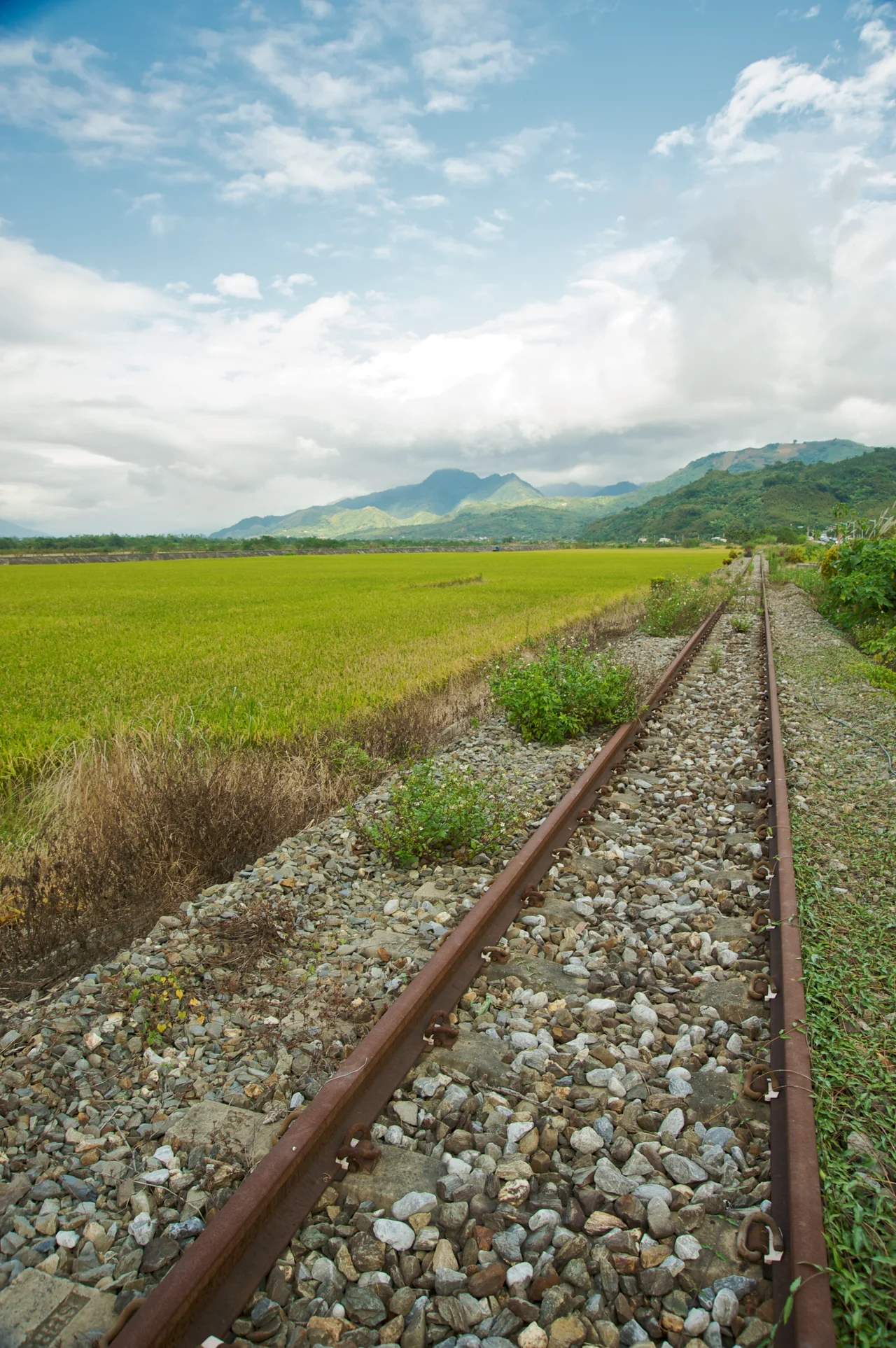
From the air, the valley floor looks like a patchwork quilt stitched in shades of green and gold. Rice paddies fill the lowlands in Shoufeng Township and Fuli Township, their neat rectangles reflecting sky during the growing season and turning a dusty amber at harvest time. Cyclists on Provincial Highway 23 in Fuli Township pass alongside fields that seem almost too perfectly ordered to be real—geometry imposed on a landscape that, just a few kilometres away, dissolves into raw mountain wilderness. The Huadong Highway, a section of Provincial Highway No. 9, runs the full length of the valley from north to south, threading through towns that have grown up around railway stations, riverside terrace farms, and hot springs. Decommissioned stretches of the old Hualien–Taitung railway line still appear along the highway corridor in Ruisui Township, the tracks rusting quietly beside the paddy fields, stubborn remnants of an earlier infrastructure era.
Indigenous Homelands at the Corridor's Heart
The Amis people are the largest indigenous group in Taiwan, and the East Rift Valley is one of their core homelands. Villages throughout the corridor maintain traditional practices—harvest ceremonies, weaving, music, and architecture—that connect contemporary communities to histories stretching back long before Chinese or Japanese settlement arrived. Other peoples also call this valley home: the Bunun, known for their extraordinary polyphonic choral tradition; the Kavalan, originally coastal people who moved inland; and smaller communities whose languages and ceremonies differ village by village. Travelling south through the valley, the presence of indigenous culture is not a tourist overlay but an everyday reality—in the murals on school walls, in the languages spoken at local markets, in the temple festivals that mark the agricultural calendar. Writing about the valley without acknowledging these communities would be like describing the Central Mountain Range and leaving out the mountains themselves.
Where the Ranges Converge
Stand anywhere on the valley floor and the mountains crowd the horizon in both directions. To the west, the Central Mountain Range rises abruptly, its highest peaks reaching toward 3,000 metres and beyond. To the east, the Coastal Mountain Range—lower and more rounded—forms a green wall between the valley and the Pacific. The visual effect is one of compression: the world narrows to this corridor, and the sky becomes a long blue stripe overhead. Hikers, cyclists, and photographers come specifically for this enclosed drama. Hot air balloons have become a local attraction around Luye and Chinan, drifting above the valley at dawn when morning mist still fills the lower fields and the mountains emerge slowly from the haze. The valley is at its most extraordinary in those transitional moments—between seasons, between light and dark, between the wild high country and the cultivated plain.
Through the Valley, Into the Island
The Huadong Valley is not simply a scenic corridor—it is the connective tissue of eastern Taiwan. The railway that replaced the Japanese-era tracks now carries passengers between Hualien and Taitung in a journey of several hours, the cars swaying gently through townships that have their own distinct personalities: Ruisui with its hot springs and the Tropic of Cancer marker; Yuli with its famous noodles and the trailhead for the Walami historic path; Fuli with its organic rice and bicycle routes. Each stop along the valley reveals a slightly different version of the same elemental landscape—two mountain walls, a ribbon of farmland, rivers pulling meltwater and rain toward the sea. The valley has absorbed wave after wave of settlement, administration, and change, and it persists beneath all of it, shaped by tectonics that no government has ever been able to name or rewrite.
From the Air
The Huadong Valley runs roughly north–south at approximately 23.44°N, 121.36°E. At cruising altitude on a clear day, the valley is unmistakable from above: a long green corridor compressed between two parallel ridge lines, with the grey-blue Pacific visible to the east where rivers break through the Coastal Range. Approach from Hualien Airport (RCYU), which sits at the northern end of the valley near Hualien City. Flying south along the valley axis at 3,000–5,000 feet reveals the full extent of the agricultural patchwork—rice paddies, river deltas, small townships connected by the Highway 9 ribbon. For southern Taitung coverage, Taitung Airport (RCFN) at the valley's southern terminus is the nearest alternative. The Central Mountain Range to the west tops 3,000 metres; plan altitude accordingly and watch for afternoon convective activity building over the ridge in summer months.
Nearby Stories
- Lulin Observatory 6.6 km away
- Sanxiantai 10 km away
- Ci En Pagoda 13 km away
- 2024 Hualien Earthquake 14 km away
- Baolai Spring Park 26 km away
- Twin Forts of Romblon 1182 km away
- Sinking of MV Sewol 1228 km away
- Sibuyan Island 1230 km away