.JPG)
Istanbul's Rural Outskirts
The name on the map says Istanbul, but the land tells a different story. Forty kilometers west of the minarets and the Bosphorus, Thrace takes over: rolling farmland, pine forests dipping toward the Black Sea, village bazaars on Thursday mornings, and an occasional Roman wall half-buried in someone's field. The three districts of Silivri, Çatalca, and Arnavutköy form the European hinterland of the world's most famous city — a place where the megapolis gradually loses its grip and something older, quieter, and considerably less crowded begins.
Three Districts, Three Characters
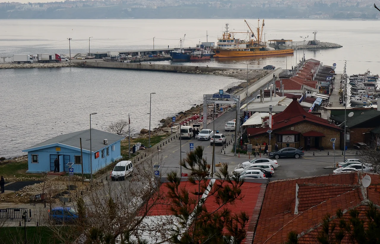
Silivri anchors the southern end of this region along the Sea of Marmara. Its roots go back to Roman and Byzantine times, when it was a modest coastal settlement. The Ottomans kept it modest too — a farming village known for its produce and its proximity to the capital rather than for any great strategic or architectural importance. That began to change in the 20th century, when Silivri's seafront made it attractive for summer retreats from Istanbul, and changed further in recent decades as industrial development and residential construction have arrived. Today the marina and the fish market coexist with factory zones.
Çatalca, in the middle of this stretch, has the most ancient and complex history. Byzantine-era remains dot the district, and the landscape here was the site of some of the First Balkan War's most significant fighting in 1912–1913. It remains largely agricultural and wooded, close enough to Istanbul to feel its gravitational pull without yet being consumed by it.
Arnavutköy, in the north, takes its name from Albanian settlers who arrived during the Ottoman period — *Arnavut* means Albanian in Turkish. For generations it was a fishing and farming community. Now it hosts Istanbul Airport, one of the largest airports in the world, and the transformation of this formerly quiet area is accelerating rapidly.
The Black Sea Shore
The northern edge of all three districts meets the Black Sea, and this coastline rewards those who make the trip. A string of small beach resorts runs westward from the Bosphorus shore, past Kilyos and Rumelifeneri, continuing through Arnavutköy and into Çatalca territory. These are not polished resort towns with boutique hotels; they are working beaches, some with no facilities at all, set against a coast of low cliffs and dark-green forest that rolls down almost to the water.
Swimming here requires attention. Strong currents run along this stretch of the Black Sea coast, and the water behaves differently than the calmer Marmara shore to the south. But on a clear morning in May, with the sea still cold and the beach empty, the Black Sea north of Istanbul is genuinely beautiful — a reminder that the city's geography extends far beyond what most visitors see.
Bird-watchers know this region too. Lake Terkos (Lake Durusu), tucked behind a narrow strip of land from the sea, draws migratory species and is noted as an Important Bird Area.
Forests, Cliffs, and the Air Above Ormanlı
The Çilingoz Nature Reserve, in the forested hills inland from the Black Sea coast, offers the best hiking and cycling in the region. Marked trails run through pine and oak forest, with occasional clearings that open views across Thrace toward the distant outline of Istanbul's towers. The reserve is large enough that a morning walk feels genuinely remote, not like a city park.
Above the beach north of Ormanlı, the cliffs catch thermal air currents reliable enough to support paragliding. Tandem flights — where a passenger is strapped to a certified instructor — are available from operators including Mod Extrem, making it accessible even without prior training. The launch point sits above a stretch of coast where, on a still day, the Black Sea spreads out flat and grey-green toward the horizon, and the forested ridges fall away steeply below.
For those who prefer lower altitudes and slower speeds, the district also hosts a golf club, a horse-riding farm, and the kind of weekly bazaars found in district centers across Turkish Thrace — practical markets with local produce, textiles, and the specific pleasures of provincial commerce.
The Airport and What It Changes
Istanbul Airport (LTFM) opened in 2018 in the Arnavutköy district, built on forested land north of the city. It is one of the largest airports in the world by terminal area, designed to handle up to 90 million passengers annually in its first phase. The scale of the project — and the development it has attracted — is reshaping Arnavutköy faster than any previous force in the district's history.
Hotels have multiplied around the airport, particularly in Arnavutköy's town center. Road infrastructure has expanded. Metro line M11 now connects the airport district to the city. What was, a generation ago, a coastal farming community and fishing village is becoming a dense node of the metropolitan economy. The process is not yet complete, and in the gaps between construction sites and hotel blocks, older traces of the district's Albanian-settler heritage and agricultural past remain visible — though for how long is an open question.
From the Arnavutköy coast, on a clear day, you can still see the Black Sea. The airport is somewhere behind you. Ahead, the water is the same color it was when the Albanian families first arrived.
Getting Out from Here
This corner of Istanbul Province is also a gateway. Bus and rail connections from the western districts carry travelers into Eastern Thrace, toward Tekirdağ on the Marmara coast (the provincial capital, known regionally for its köfte and for rakı production), then further west to Keşan and the Gallipoli peninsula, or north to the Greek border. Edirne, the former Ottoman capital at the Bulgarian frontier, is reachable in roughly two hours by road — a city worth the trip for its mosques and its layered history.
Those heading in the other direction, back toward Istanbul, can navigate by the D-100, D-200, or the O-4 (E-80 TEM) motorway. The M11 metro serves the Arnavutköy area. For the Black Sea coastal villages, a car or local bus is the practical option — the infrastructure that serves a megacity does not always reach its quieter edges.
From the Air
Istanbul's rural western districts lie at approximately 41.35°N, 28.31°E, spanning westward from the Bosphorus along both the Black Sea coast and the Sea of Marmara shore. The nearest major airport is LTFM (Istanbul Airport, ICAO: LTFM), located in the Arnavutköy district — it is visible from the air as an enormous terminal complex with multiple parallel runways set in what was recently forested land. At 3,000–5,000 feet heading west from the Bosphorus, the transition from the dense urban fabric of Istanbul to the agricultural and forested terrain of Thrace is clearly visible. Lake Durusu (Terkos) appears as a large freshwater body just inland from the Black Sea coast. The coastline itself shows the small beach resort settlements strung along the water.
Nearby Stories
- 2012 Istanbul Suicide Bombing 6.1 km away
- Selymbria 6.5 km away
- Kilyos 24 km away
- Battle of Constantinople (922) 42 km away
- SS Kurtuluş 53 km away
- Ganos 81 km away
- Edirne 100 km away
- Ottoman conquest of Adrianople 144 km away