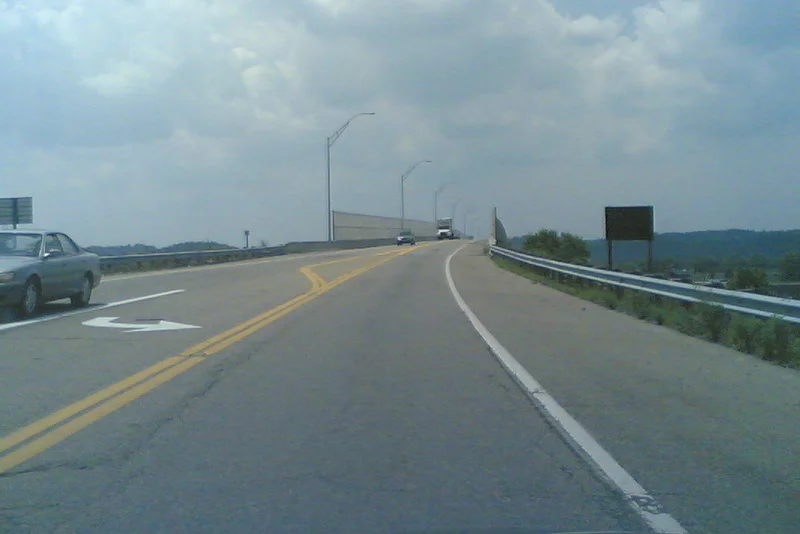

Jesse Stuart Memorial Bridge
Most river bridges go over the water. The Jesse Stuart Memorial Bridge goes over the lock and dam complex that controls the water. Completed in 1984, the viaduct sits directly atop the Greenup Lock and Dam, carrying traffic between Kentucky and Ohio across the structure that lifts barges up and down through the Ohio River's slack-water system. The bridge is named for Jesse Hilton Stuart, the Greenup County poet laureate who spent his life writing about these hills - a fitting memorial for a writer whose work was rooted in the specific geography this bridge connects to the rest of the country.
Bridge on a Dam
The engineering logic is straightforward and unusual. The Greenup Lock and Dam already crossed the Ohio River with a structure tall enough and stable enough to support a roadway. Building a separate bridge nearby would have meant duplicating much of the construction the dam already provided. Instead, the highway department put a viaduct directly on top of the existing complex. Drivers crossing the bridge are simultaneously crossing the lock - the chamber where barge tows are raised or lowered by adjusting the water level - and the dam itself. The arrangement is not common in the United States, though it appears at a handful of other Ohio River locks and dams downstream. It saves money and consolidates infrastructure.
The Routes It Carries
The bridge is part of an unusual road designation. Kentucky Route 10 - the AA Highway, one of the state's major east-west arterial routes - runs west of the bridge but is unsigned over the structure itself. The bridge carries traffic from the AA Highway and U.S. Route 23 intersection across to the Ohio side, where the route becomes Ohio State Route 253 and connects to U.S. Route 52. The naming arrangement is the kind of administrative complexity that interstate bridges often produce, where each state insists on its own route number and the result is a brief crossing with multiple official identities. For drivers, it is just a bridge. For maps, it is a small puzzle.
Jesse Stuart's Hills
Jesse Hilton Stuart (1906-1984) was born in Greenup County and spent most of his life on the W-Hollow farm where he was raised. He wrote more than 2,000 poems and 460 short stories - a productivity exceeded by almost no other American writer of the twentieth century - drawn from the people, the landscape, and the work of these eastern Kentucky hills. He served as Kentucky's poet laureate. His novel Taps for Private Tussie won the Thomas Jefferson Memorial Award. The bridge that bears his name was completed in 1984, the year he died. Stuart did not live quite long enough to drive across it. But the bridge connects the country he wrote about - Greenup County, the Eastern Coalfield, the Kentucky side - to the wider American world his books were also part of.
September 11 and What Closed
After the September 11 attacks in 2001, the bridge, the dam complex, and the surrounding facilities were briefly closed. Federal authorities classified the lock and dam as critical infrastructure - the kind of installation whose damage would have downstream effects on barge traffic carrying coal, grain, petroleum, and chemicals throughout the Ohio River system. The facilities reopened after security reviews, but the observation platforms on both sides of the dam, which had previously let visitors watch barges work through the locks, never did. The view of the river system at work, once a small piece of public engineering education, became another casualty of an era's changed assumptions about access and risk.
The Park and the Rest Area
On the Kentucky side, an Army Corps of Engineers park provides fishing access and picnic facilities. On the Ohio approach, a ramp leads to an Ohio Department of Transportation rest area. Both facilities serve the long-distance traffic that the bridge carries, particularly truckers using U.S. 23 and U.S. 52 to move freight through the Ohio River valley. The combination of bridge, dam, park, and rest area concentrates a lot of public infrastructure into a single geographic point - one of the more functionally rich crossings on the Ohio River, even if it lacks the visual drama of the longer suspension spans further downstream. From above, the bridge reads as a horizontal line laid on top of the dam structure, with the river extending out to either side.
From the Air
Located at 38.647 degrees north, 82.859 degrees west, crossing the Ohio River between Greenup County, Kentucky and Scioto County, Ohio. Recommended viewing altitude 2,500 to 4,500 feet AGL for clear views of the bridge, the dam, and the lock chamber. Nearest airports are Greater Portsmouth Regional (KPMH) about 5 nautical miles west, and Ashland Regional (KDWU) about 15 nautical miles east. The bridge is identifiable from the air by its location directly atop the dam structure - a distinct combination of straight line and water-stair shape.
Nearby Stories
- Gen. Albert Gallatin Jenkins House 1.4 km away
- Point Pleasant 12 km away
- Serpent Mound: The 1,400-Foot Snake Nobody Can Explain 22 km away
- Salt Reservations 26 km away
- Yatesville Lake 27 km away
- Hobet Coal Mine 36 km away
- The Kentucky Meat Shower: When Flesh Fell From a Clear Sky 44 km away
- Ripley and the Underground Railroad 50 km away