
John Dean Provincial Park
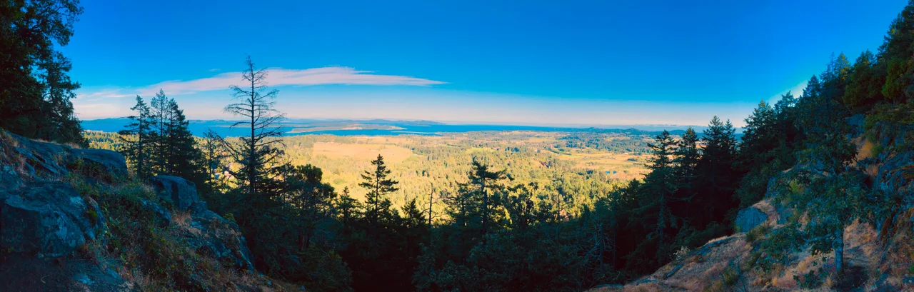
In W̱SÁNEĆ tradition, this is the mountain that saved everyone. When the great flood came, the people took to their canoe and anchored it here, to a tall arbutus at the summit, with a rope braided from western red cedar. The mountain is ȽÁU,WELṈEW̱ -- best approximated in English as Tlay-will-nook -- and it appears on most maps as Mount Newton. It is not a large mountain. The Saanich Peninsula is only about eight kilometres wide where it stands, and from marked viewpoints on its flanks you can see Saanich Inlet on one side and Cordova Channel on the other. High ground does not have to be high to be the only ground left.
The Bachelor Who Gave It Away
John Dean was, by every surviving account, an eccentric. He had served as mayor of Rossland, in the Kootenays, and he lived his entire life unmarried. In the early 1900s he built a cabin near what is now the centre of the park, on the slopes of a mountain that was already old in every sense that mattered. In 1921 he donated the land. The gift became a provincial park, later expanded to its present 174 hectares, and Dean lived until 1943 with the unusual satisfaction of having watched his own bequest take effect. The cabin came down in 1957, but its foundation and much of its building material are still on the ground, marked with a signpost -- an oddly moving thing to come across on a trail, a rectangle of stone in deep forest. Dean himself lies at Ross Bay Cemetery in Victoria.
One Percent of What There Was
What Dean protected turned out to be far rarer than he could have known. The park holds unlogged old-growth Douglas-fir and western red cedar in a coastal Douglas-fir ecosystem that has been almost entirely erased from southern Vancouver Island. The numbers are stark: 73 percent of the island's productive old-growth forest has been logged, 87 percent on the southern island, and 99 percent of the coastal Douglas-fir zone. Of the dry old-growth Douglas-fir habitat specifically, roughly one percent survives. The tallest tree here, a Douglas-fir just off the Valley Mist trail, measures 70.9 metres and is the tallest in the municipality of North Saanich; the runner-up, 69.9 metres, stands very close by. Higher on the slope the forest shifts character entirely, from cedar and fir into an open oak-arbutus-fir woodland where Garry oak -- itself an endangered habitat in British Columbia -- takes over. Pileated woodpeckers work the standing dead wood, and rare native wildflowers come up through it in spring.
A Forest That Crosses Jurisdictions
The park is a legal boundary drawn inside something larger. About a quarter of the old growth to the northwest lies not in the park at all but on the Cole Bay reserve of the Pauquachin First Nation -- meaning the continuity of this forest depends on two entirely different systems of tenure agreeing, in practice, to leave it standing. Saanich Inlet forms the western edge. On the east slope sits the affluent subdivision of Dean Park, and to the south the land shades into low-density housing and small-scale agriculture, some of it held within the Agricultural Land Reserve. It is a wild place hemmed by real estate on three sides, which is the ordinary condition of protected land near a capital city.
The Big Soccer Ball
At the summit stands a white sphere visible from nearly every elevated point in Victoria. Locals call it the big soccer ball, and a great many of them believe it is weather radar. It is not. The dome shelters a Doppler radar owned and operated by Nav Canada for air traffic control, sitting atop a foundation tower that rises 25 metres above the ground. It arrived through a program of national ambition: in the mid-1980s Transport Canada bought 39 new radar systems intended to give Canada complete aerial surveillance, and a site selection committee went looking for the location that would serve Victoria International Airport. Mount Newton was the only candidate that met every operational criterion, and approval came in 1982. The projected coverage was calculated off topographic maps -- an analysis that had to account, among other things, for the height of the trees.
Six Kilometres of Trail
Roughly six kilometres of well-marked paths thread the park, maintained by a volunteer group called the Friends of John Dean Park. The terrain is hilly without being punishing, and in the dry months of late spring and summer it needs no particular equipment beyond decent shoes. Lookouts along the way open onto the peninsula and the inlet. From November through March the main entrance closes to vehicles, and the off-season here is persistently grey and wet, though the rain is usually mild; when the temperature does drop, heavy snow in December or January is not unusual. Below and to the northeast, the small but busy Victoria International Airport sends traffic overhead, including the helicopters of 443 Maritime Helicopter Squadron -- which is its own kind of continuity, given what sits on the summit.
From the Air
Located at 48.61 N, 123.45 W on the Saanich Peninsula, about 20 km north of Victoria, British Columbia. The summit of Mount Newton, at the heart of the park, is one of the most conspicuous visual references on the peninsula: a forested dome capped by a large white radome -- Nav Canada's air traffic control radar -- on a 25 m tower, visible from most elevated ground in Greater Victoria. Saanich Inlet lies immediately west, Cordova Channel and Haro Strait east, and the peninsula is only about 8 km wide here. Victoria International Airport (CYYJ) sits roughly 3 nm northeast; its control zone covers the park, so obtain clearance before transiting, and expect helicopter traffic from 443 Maritime Helicopter Squadron based there. Swartz Bay ferry terminal and its heavy vessel traffic lie a few miles further north. Best viewed at 2,000-3,000 ft AGL, ideally in morning light with the Gulf Islands and Mount Baker to the east. The region sits in a rain shadow with generally excellent visibility, but winter brings persistent low overcast.
Nearby Stories
- Yellow Island 1.7 km away
- Scia'new First Nation 2.5 km away
- San Juan Spruce 6.5 km away
- Kolponomos 8.5 km away
- Wallace Island Marine Provincial Park 8.6 km away
- Cowichan Lake 12 km away
- Lily Point Marine Reserve 12 km away
- Smith Island (Washington) 15 km away