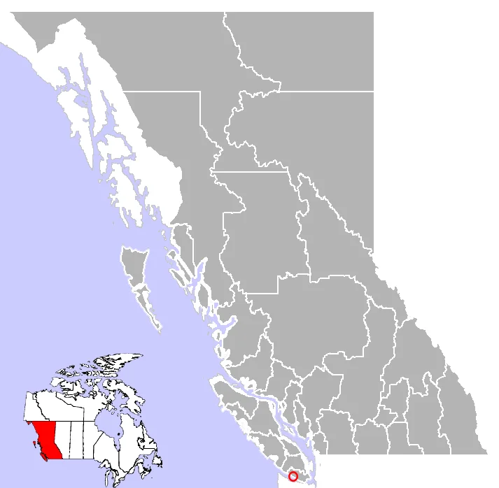

Jordan River, British Columbia
The chaplain got his way. In June of 1790, Sub-Lieutenant Manuel Quimper looked at this stretch of Vancouver Island's southwest shore and called the river Rio Hermoso - beautiful river - which was a fair reading of the place. The name did not last the year. When Gonzalo Lopez de Haro drew up the Carta Reducida a few months later, the water had become Rio Jordan, a change credited to Alejandro Jordan, the chaplain sailing with Francisco de Eliza's expedition. British surveyors anglicized it, and the settlement that grew at the river's mouth was gazetted as River Jordan, which is still its official name on the register. Everybody calls it Jordan River anyway. Seventy kilometres west of Victoria, the argument has simply never been resolved.
A Camp at the Edge of the Rain
Crews were cutting the Jordan River watershed by the 1880s, moving logs by whatever method the ground allowed. In 1907 the work turned industrial: six kilometres of railway track went down, and timber started leaving the valley at a different order of speed. Western Forest Products took over the tree farm licence in 1934 and holds it still - 32,490 hectares stretched between Sooke and Port Renfrew. The rails are long gone, and loaded trucks now grind down the same grades. At the centre of the settlement, between the bridge and the powerhouse, raw logs are sorted and lashed into rafts at the river's mouth, then towed by sea to Vancouver and to mills in Washington State. Most of this ground has been cut twice in a hundred years and is growing a second generation of replanted trees. Signs along Highway 14 announce the stages like chapter headings - logged, replanted, thinned. It is a working landscape that keeps its own scorecard in public.
Three Hundred Metres of Falling Water
The Vancouver Island Power Company finished the Jordan River system in 1911, giving the island its second hydroelectric generating station. The engineering is beautifully blunt. Water gathers behind Diversion Dam, runs 8.8 kilometres down what began as a wooden sluice to an equalizing basin, then drops through a steel penstock for a final 330 vertical metres - better than a thousand feet of nothing but gravity doing the work. Improvements and extra generators between 1912 and 1930 pushed capacity to 26 megawatts. Then came 1971: the flume was retired in favour of a tunnel, a new powerhouse went up across the river from the original, and a Japanese-built generator replaced the tired machinery. Output leapt from 26 megawatts to 170. During the original construction, a thousand workers lived here. The settlement has never come close to that number again, and the quiet of the place today is easier to understand once you know it.
The Ears Pointed at the Strait
Jordan River stares straight down the Strait of Juan de Fuca. The sightline runs unbroken from Cape Flattery, out where the strait opens to the Pacific, across to Port Angeles on the Washington shore - roughly a hundred kilometres of water with nothing standing in the way. That geometry is why the Royal Canadian Air Force came. Anticipating a Japanese attack on the west coast during the Second World War, the RCAF installed the X-1 Detachment's low-flying early warning radar here, a system carrying the unlovely name Microwave Early Warning / Ground Control Intercept. Young technicians sat in this rain shadow of nowhere watching a screen for aircraft skimming the wavetops. The same open horizon that recommended the site to radar operators now recommends it to people in thick hooded wetsuits: nothing between here and the open ocean to soften what the Pacific sends ashore.
Winter Is the Season
Until 1912 you arrived by boat or you did not arrive. That year the Old Otter Point Road was pushed through, tying Jordan River by land to Sooke and on to Victoria. In 1953 the route was folded into the newly created Highway 14, running west from Colwood; by 1975 the road reached all the way to Port Renfrew, although paving was not finished until the late 1980s. The community it serves is small and unglamorous, and its high season runs backwards from most of the coast. When North Pacific storms stack up offshore in the darkest months, surfers drive out from Victoria in the pre-dawn and pull on hoods and gloves for water that never warms. Three kilometres west, at China Beach, the Juan de Fuca Trail begins its rough run north along the coast. Between the log sort, the penstock, and the swell, almost nothing about this place is decorative.
From the Air
Jordan River lies at 48.4219 N, 124.0550 W on the exposed southwest coast of Vancouver Island. Best viewed from 2,500 to 4,000 feet AGL on a southeast-to-northwest track along the shoreline, which gives you the river mouth, the log-sorting grounds and booms, the powerhouse, and Highway 14 threading the shelf between forest and surf - all in one pass. The Strait of Juan de Fuca opens to the south, with the Olympic Mountains filling the horizon across the water on clear days. Nearest airports: Victoria International (CYYJ) about 30 nm east-northeast, Victoria Inner Harbour Water Airport (CYWH) roughly 27 nm due east, and William R. Fairchild International at Port Angeles, Washington (KCLM) about 29 nm southeast across the strait. Expect marine layer, low stratus, and fog banks pushing in off the Pacific; winter brings the strong onshore flow and heavy rain that make this coast what it is.
Nearby Stories
- Victoria Harbour 0.8 km away
- Portland Island (British Columbia) 4.3 km away
- Lyre River 7.2 km away
- Skutz Falls 10 km away
- Makah Museum 13 km away
- Ozette Lake 15 km away
- Cheewhat Giant 21 km away
- Hurricane Ridge 27 km away