The Islands That Vanished from Sight
From the peak of Mount Muria on Java's north coast, a father watched for his banished son. According to Javanese legend, the Muslim saint Sunan Muria had driven away his disobedient boy Amir Hasan, warning him never to set foot on Java again. The son obeyed. He sailed north into the Java Sea, through storms and enormous waves, until his boat washed ashore on a small uninhabited island. When Sunan Muria tried to find him clairvoyantly from the mountaintop, his vision was vague and unclear. In Old Javanese, the word for vague is kerimun. The islands became Karimunjawa -- the place that could not quite be seen from Java.
A Crossroads in the Java Sea
Long before the Indonesian government declared it a national park, Karimunjawa was a waypoint. The archipelago of 27 islands lies roughly 80 kilometers northwest of Jepara and 120 kilometers from Semarang, positioned squarely in the trade routes that connected Borneo, the Spice Islands, and the ports of Java's north coast. Navigators knew these islands under different names: Tortuga, Chirimao, Carimon Jawa. Chinese forces sent by Emperor Kublai Khan reportedly reached the archipelago in 1293 and called it Chi-li-men. Ottoman Turkish navigators followed in 1403, then Portuguese, Dutch, French, and English traders over the centuries that followed. Archaeological finds of Ming dynasty porcelain confirm the islands' place in the maritime networks of medieval Asia. For sailors crossing the Java Sea, Karimunjawa offered anchorage, fresh water, and a brief reprieve from open ocean.
The Guardian Tree of Gedangan
Amir Hasan, the banished son who became known as Sunan Nyamplungan, reportedly brought two seeds of the Nyamplung fruit with him during his exile. The tree that grew from those seeds -- called Dewadaru by the islanders -- became sacred. It is not used for furniture or building material. Only the bold employ its wood in spiritual practice. In 1992, biologists from the University of Gadjah Mada identified two species growing in the archipelago: Baccaurea sumatrana from the Euphorbiaceae family and Fagraea elliptica from the Loganiaceae family. Both are rare and difficult to propagate. The islanders consider the Dewadaru the totem guardian of Karimunjawa, and local belief holds that outsiders who attempt to steal the wood are thwarted by supernatural intervention -- Sunan Nyamplungan himself, some say, appearing as a gigantic bat to those who approach with ill intent.
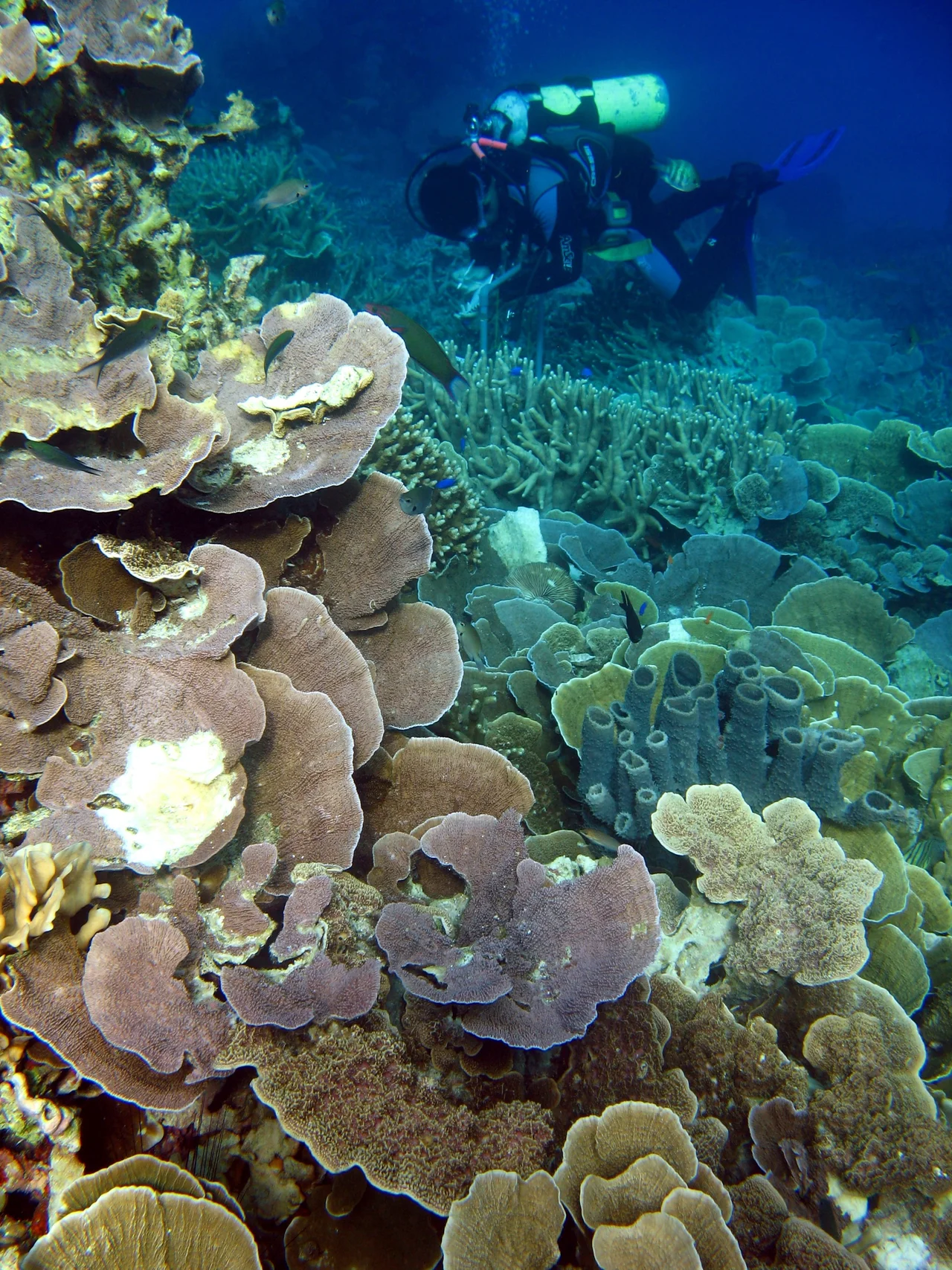
One Hundred Thousand Hectares of Sea
In 1999, the Ministry of Forestry designated the Karimunjawa archipelago as a Marine National Park covering 111,625 hectares. Two years later, 110,117 hectares were declared a Marine Protection Area. The park is divided into four management zones. The Sanctuary Zone -- 1,299 hectares encompassing Burung and Geleang Islands -- is a strict no-take area where only research and education are permitted. The Wilderness Zone of 7,801 hectares allows limited tourism and includes Krakal Besar, Krakal Kecil, and several smaller islands. The Utilization Zone covers 4,431 hectares around the more accessible islands of Menjangan Besar and Menjangan Kecil. The vast Buffer Zone, 98,093 hectares, includes the inhabited islands of Karimunjawa, Kemujan, Parang, and Nyamuk. Gajah Hill, the park's highest point at 506 meters, rises from Karimunjawa's largest island.
Five Peoples, One Archipelago
The communities of Karimunjawa are a mosaic of the Java Sea's maritime cultures. Javanese settlers are known for agriculture and household production. Bugis families, descended from the legendary seafarers of South Sulawesi, dominate the fishing industry. Madurese islanders specialize in salted fish. Mandar and Luwu communities add further strands to the cultural weave. These groups settled at different periods, drawn by the islands' position along trade routes and fishing grounds, and over time they have blended customs and habits into something distinct. The graves of Sunan Nyamplungan and his guards remain a pilgrimage site, with a mustaka -- the ornamental top of a mosque -- that Amir Hasan reportedly carried on his exile voyage still resting in the cemetery complex. Faith and fishing, legend and livelihood, coexist on these 27 islands as naturally as coral and sand.
Wreck Dives and White Sand
Today, ferries and fast boats run regularly from Jepara to Karimunjawa. Divers come for the coral reefs around Menjangan Kecil and Menjangan Besar. Off the coasts of Bengkoang and Kemujan, the wreck of the Panamanian ship Indono draws wreck-diving enthusiasts. Tanjung Gelam, Legon Lele, and Cemara Island offer white sand beaches. The hills of Bukit Bendera and Bukit Gajah provide trekking routes with views across the archipelago. Temperatures hover between 30 and 31 degrees Celsius year-round. Hotels, homestays, and guesthouses cluster on the main island, with one boutique resort near the village and a luxury resort on a private island. But the park's management acknowledges challenges: degradation of marine environments has made the existing zone system less effective, and a rezoning project begun in 2002 continues. Karimunjawa remains what it has always been -- visible from a distance, harder to manage up close.
From the Air
Located at 5.82S, 110.40E in the Java Sea, approximately 80 km northwest of Jepara and 120 km north of Semarang. Ahmad Yani International Airport (ICAO: WARS) in Semarang is the nearest major airport. The 27-island archipelago is clearly visible from altitude, with white sand beaches and coral reefs distinguishable in clear conditions. Gajah Hill on the main island rises to 506 meters. Recommended viewing at 3,000-8,000 feet for island detail, or 15,000+ feet for the full archipelago spread against the Java Sea. The islands appear as a green cluster on deep blue water, with no significant air traffic infrastructure on the islands themselves.
Nearby Stories
- U-168: The U-Boat Betrayed by Its Own Allies 21 km away
- Menara Kudus Mosque 78 km away
- Battle of the Java Sea 85 km away
- Dieng Temples: Java's Oldest Stone Shrines, Named for Heroes Nobody Built Them For 118 km away
- HNLMS Kortenaer: A Destroyer's Last Two Minutes 128 km away
- Dieng Plateau: Where the Gods Reside Above the Clouds 148 km away
- Eighteen Minutes Over Bawean 164 km away
- Way Kambas National Park 480 km away