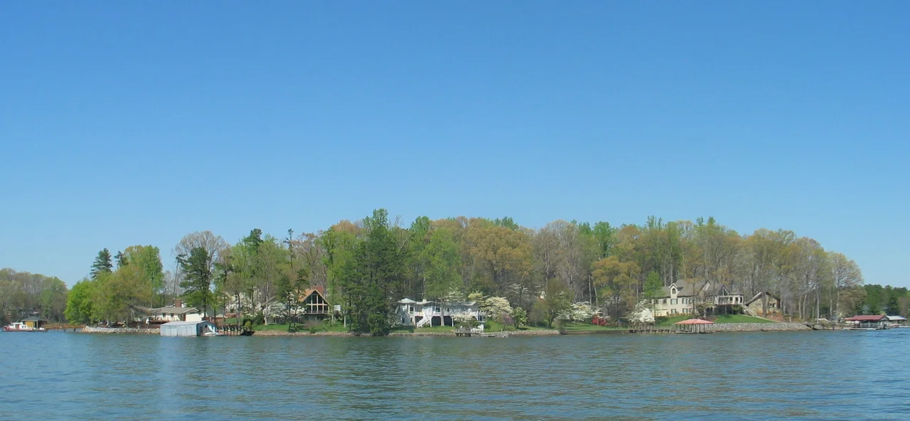

Lake Norman
On August 25, 1957, The Charlotte Observer announced Duke Power's plan to dam the Catawba River one more time and called the result a 'sportsman's playground for water-wacky Carolinians.' What it did not say was that the new lake would drown a Revolutionary War battlefield, two mill towns, several cemeteries, the homes of farmers whose families had lived on the river for generations, and an archaeological record of the Catawba people stretching back six thousand years. Six years later, the gates of Cowans Ford Dam closed and Lake Norman began to fill - 50 square miles of water rising slowly over the Piedmont. It is now the largest lake in North Carolina. Almost nothing on its surface remembers what is underneath.
Before the Water Came
The Catawba people lived along this river for 6,000 years before Duke Power flooded it. The Catawba River drew them, fed them, and gave them clay - traditionally dug from holes along its banks - for the pottery that remains their cultural signature. By the 1840s, after the Nations Ford Treaty, most of the Catawba had been pushed out of these lands and resettled around Rock Hill, South Carolina, where their reservation still stands. Pottery, tobacco pipes, glass beads, nose bangles, arrowheads - the material record of their long presence remained scattered across the river valley. Some of it is still there, beneath the lake. Archaeologists have not stopped looking. In 2012, a 500-year-old village turned up further up the Catawba near Morganton, above the dams. The lakebed itself almost certainly holds more.
The Drowned Villages
East Monbo and Long Island were mill towns on the Catawba's banks. East Monbo closed in 1959. Long Island followed in 1961. The mills had survived two historic floods - 'will man's ingenuity finally take down what two historic floods could not destroy?' asked Douglas Eisele in the Statesville Record and Landmark. The answer was yes. The Caldwell and Flemming family cemeteries went underwater too; Duke Energy tracked down descendants and moved many of the gravestones, cleaning and repairing them before reinstalling them on higher ground. The battlefield where General William Lee Davidson died fighting Cornwallis's forces in 1781 went under as well. Some farmers refused to sell, leasing only their water rights and waiting to see what happened. Others took the money and watched their family's land disappear beneath thirty feet of water.
Norman Cocke's Lake
The lake takes its name from Norman Atwater Cocke, who served as president of Duke Power from 1947 to 1959 and retired the year before the project broke ground. The dam was built where Davidson had fallen. The lake, when full, stretches 33.6 miles long and 9 miles wide, with 520 miles of shoreline - more shoreline than the entire coast of North Carolina. Its main outlet at Cowans Ford reaches 110 feet deep. Three power facilities run off it: the hydroelectric plant in the dam itself, the coal-fired Marshall Steam Station, and McGuire Nuclear Station, which uses Lake Norman's water to cool its reactors. The Catawba River - nicknamed by 1928 'the world's most electrified river' - became, with Norman's completion, even more so.
The Striped Bass and the Mussel
Every fish in Lake Norman was put there by humans. The Catawba River was free-flowing for six thousand years and then it was a lake; the fish that had lived in the river were not the fish a reservoir wanted. The North Carolina Wildlife Resources Commission introduced striped bass in 1969. Blue catfish came in to control shad. Flathead catfish arrived illegally, predator fish whose origins are still unclear. The Carolina heelsplitter - a federally endangered freshwater mussel with three remaining populations in North Carolina, only ten in the world - lives in waters near the lake but cannot survive in it. The lake has its species. The river it replaced had different ones. Beneath the surface, that erasure is still working itself out.
Lake Norman State Park
Duke Power donated 1,328 acres in September 1962 that became Lake Norman State Park. The park's centerpiece is the Itusi Trail, 30.5 miles of mountain biking and hiking through hardwood forest where pine plantations once stood before Southern Pine Beetles took them down. White-tailed deer browse along the park roads. Coyotes yip from the woods in the evenings. Almost a million people visited in 2017. Most of them came to see water, not to think about what is underneath it - which is, after all, a kind of mercy. The river that ran here before the lake is still flowing somewhere, in the geologic sense. It just does it now beneath 110 feet of Duke Energy's reservoir, very slowly, on its way south to Mountain Island Lake and eventually to the sea.
From the Air
Lake Norman centered roughly at 35.55 N, 80.95 W, about 15 miles north of Charlotte. 33.6 miles long north-to-south, surface area over 50 square miles, full pool 760 feet above sea level. From cruise altitude the lake is unmistakable - the largest body of water for hundreds of miles, with the McGuire Nuclear Station cooling tower steam plume visible on the southern shore in many weather conditions. Cowans Ford Dam at the southern outlet. Interstate 77 crosses the lake on a long causeway. Nearby airports: KCLT 25 miles south, Statesville Regional (KSVH) at the northern end.
Nearby Stories
- Catawba College 2.3 km away
- Nighthawk 10 km away
- 2025 North Carolina Cessna Citation II Crash 12 km away
- Cherokee County, South Carolina 13 km away
- Grace Evangelical and Reformed Church 14 km away
- Gardner-Webb University 22 km away
- Joara 22 km away
- Battle of Colson's Mill 38 km away