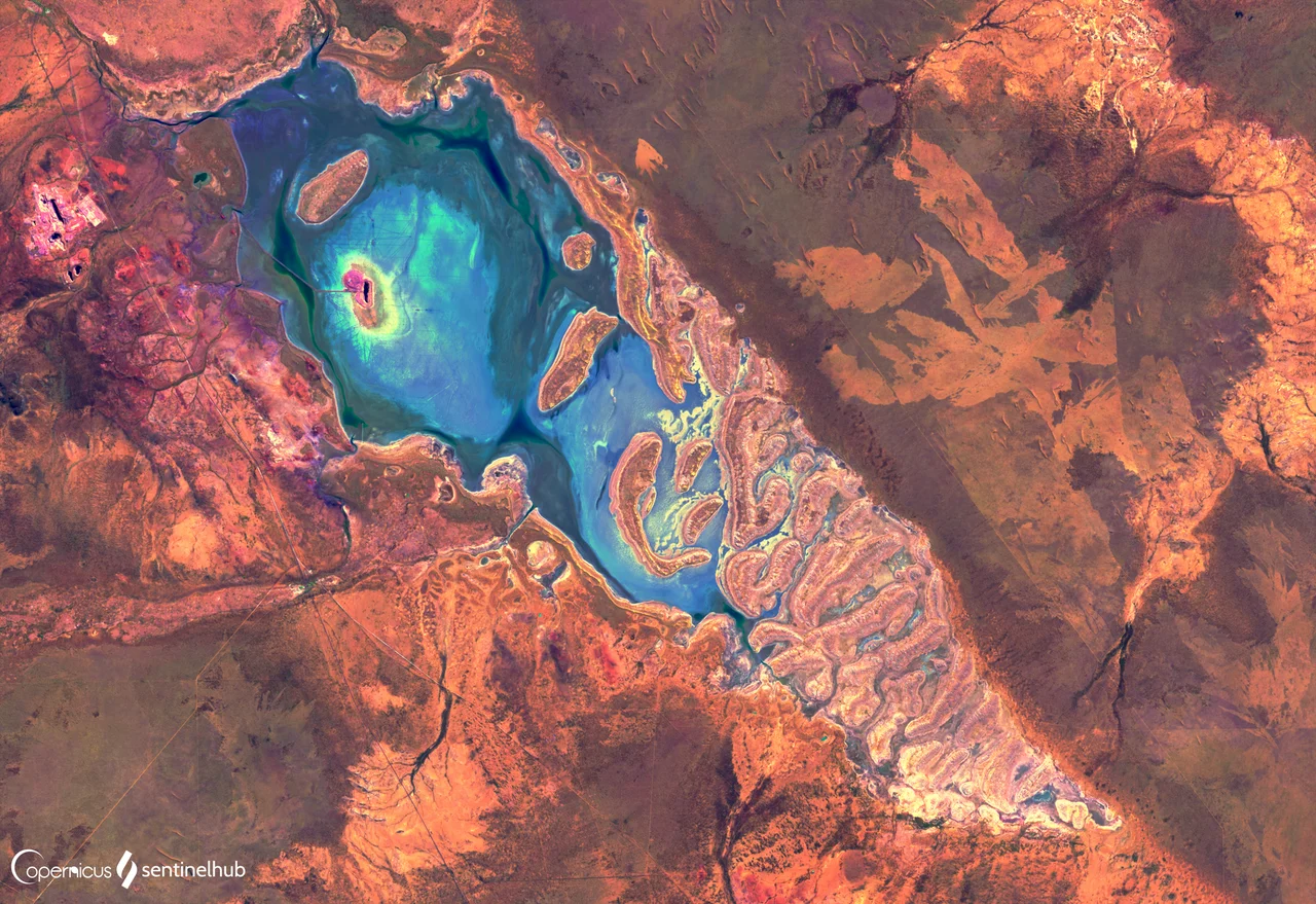

Lake Way
Most years, Lake Way is not a lake at all. It is a blinding white salt pan, flat to the horizon, its crust crunching underfoot in the heat south of Wiluna. Then, rarely, the rains come - in 1900, in 1942, in 1963, again and again through the wet years of the 1990s - and the pan fills, becoming a shallow silver sheet that doubles the sky. Birds arrive from nowhere. The transformation lasts weeks or months before the desert sun takes the water back. This rhythm of absence and brief abundance has shaped the lake for far longer than any map of it has existed, on country that the Martu and Tjupan peoples have known and named across generations.
A Lake on Borrowed Water
Lake Way is an ephemeral saline lake in the Mid West, running roughly parallel to the Goldfields Highway as it threads between Leinster and Wiluna. 'Ephemeral' is doing a great deal of work in that sentence. For most of recorded history the lakebed has been dry, holding water only after exceptional floods. The crust is salt and gypsum, the product of countless cycles of fill and evaporation that have concentrated minerals over enormous spans of time. It is a landscape that rewards patience and punishes assumptions - what looks like permanent emptiness is really a slow pulse, measured not in seasons but in decades.
Yellow Cake in the Calcrete
Beneath and around the lake's margins lies something the modern world has argued over for fifty years: uranium. The deposit is unusual - calcrete-hosted carnotite, a bright lemon-yellow mineral, lying in sheet-like layers only two to ten metres below the surface, near or below the water table. The mineralised zone averages about a metre and a half thick and ranges up to five metres, shallow enough to scrape rather than tunnel for. It is also low-grade and spread thin across the calcrete. Interest dates back to 1978, when the Wyoming Mineral Corporation and Delhi International Oil first proposed mining here, picturing small open pits scattered across some nine square kilometres. The Australian government granted Delhi permission in 1982, only for the project to be suspended the next year. The uranium, like the water, would prove a thing the land released slowly and reluctantly.
Toro's Long Wait
When Western Australia lifted its six-year ban on uranium mining in 2008, Lake Way returned to the spotlight. Toro Energy took up the Centipede-Lake Way project, planning to extract uranium oxide by heap leaching at around 700 tonnes a year over a decade. The company secured native title holders' approval for a resource-evaluation test pit, and in May 2010 ran an eight-week trial. Yet the project moved at the pace of the place it sat in - haltingly. A separate gold venture on the lake had already shown how expectations here could curdle: early reports of grades as high as 25 grams per tonne gave way to disappointing low-grade ore, and the open pit also saw a fatal accident in July 2005.
Unburied Questions
The uranium at Lake Way has never been only a technical matter. In 2010, state MP Robin Chapple asked why radioactive uranium oxide and ore were still lying unburied and unfenced at the site - a question he had first raised a decade earlier, in 2000. Laboratory testing confirmed the material as naturally occurring uranium-bearing rock, but the optics were unsettling: radioactive ore exposed to the open desert, year after year. Opposition gathered too. The Anti-Nuclear Alliance of Western Australia campaigned against the projects, and from 2011 the Walkatjurra Walkabout - a months-long walk from Wiluna toward Perth - gave voice to traditional owners and others who did not want a uranium mine on this land. The salt pan keeps its silence. The argument over what should happen on its shores does not.
From the Air
Lake Way sits at approximately 26.78 degrees south, 120.33 degrees east, about 15 km south of Wiluna in Western Australia's Mid West. From the air it is one of the region's most reliable navigation features: a large, elongated salt lake oriented roughly northwest-southeast, brilliant white when dry and a flat reflective sheet when flooded, paralleled along its eastern side by the Goldfields Highway toward Leinster. Best viewed at 5,000 to 9,000 feet; the white crust can be dazzling in midday sun, so polarised eyewear helps. Wiluna Airport (ICAO YWLU) lies just to the north; Leinster Airport (YLST) is to the south, and Meekatharra Airport (YMEK) is the larger field to the west. Visibility is typically excellent in the dry season; after rare rains, expect a shallow ephemeral water surface and unusual birdlife over the lake.
Nearby Stories
- Millbillillie Meteorite 11 km away
- Nickel mining in Western Australia 21 km away
- Western Australia 61 km away
- Wiluna Railway Line 62 km away
- Banjawarn Station 97 km away
- Yarrabubba 109 km away
- Murchison River 126 km away
- Matuwa Kurrara Kurrara National Park 130 km away