_(29079784067).jpg)
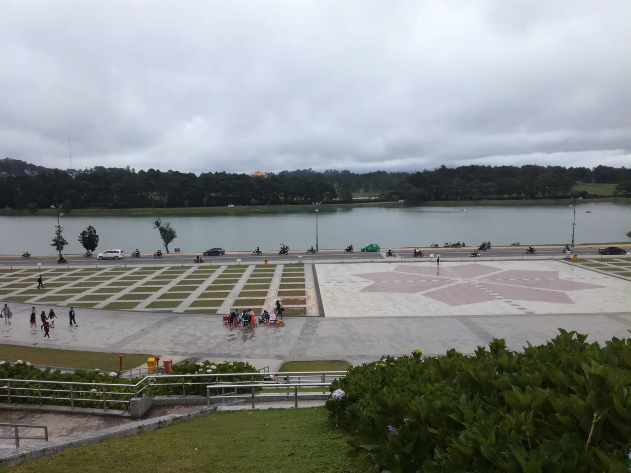
Lam Vien Square
The name was official for less than fifteen years before people stopped using it — not out of protest, but out of habit. Locals still call it Đà Lạt Central Square, the straightforward label it carried for decades before the city council formalized a new one in November 2011. The new name, Lâm Viên, is older than the square itself: it recalls the plateau on which Da Lat sits, and the province that once bore that name before administrative reshuffling swept it away. A square named for a plateau named for a place that no longer exists on the map — Da Lat, a city with many layers, wears them lightly.
The Plateau and the Place
Da Lat occupies the Lâm Viên Plateau in Vietnam's Central Highlands, roughly 1,500 meters above sea level — high enough that the air carries a genuine chill in the evenings, a rarity in Southeast Asia. The French chose this elevation deliberately when they developed the city as a hill station in the early twentieth century, seeking relief from the lowland heat. Lam Vien Square sits near the center of that city, close to Xuan Huong Lake, and the geography around it still bears the French imprint: wide avenues, a certain orderly spaciousness, flower beds tended with the diligence this town of florists brings to everything. The square gathers these strands — highland landscape, colonial planning, and Vietnamese civic life — into a single open expanse.
A Stage for Flowers
Da Lat calls itself the City of a Thousand Flowers, and the claim is not exaggeration. The cool climate makes the Lâm Đồng highlands one of Vietnam's primary flower-producing regions, and the Dalat Flower Festival — held biennially — turns Lam Vien Square into the event's ceremonial center. Hydrangeas, roses, chrysanthemums, and orchids fill temporary installations; performers take outdoor stages; the streets around the lake draw visitors from across Vietnam and abroad. The festival began in 2004 and has since become the city's most anticipated public event. Outside festival season, the square functions as a daily gathering spot: families walking in the evening cool, vendors selling roasted corn and hot soy milk, teenagers photographing the flower arrangements that seem to be tended year-round.
Naming as Memory
The decision to rename the square Lâm Viên was a deliberate act of geographic memory. The former Lâm Viên province — absorbed into Lâm Đồng in 1976 — no longer appears on maps, but the name survives in the plateau's designation and now in the square. Alexandre Yersin, the Swiss-French physician who first proposed Da Lat as a sanatorium site in the 1890s, gave the city its French foothold; the plateau name predates even that colonial chapter, drawn from older regional geography. By inscribing Lâm Viên on the square, the city council embedded a quiet historical argument in everyday public space: that the land has a name and a story that precede the architectures built upon it.
Evening at the Square
In the late afternoon, when the highland fog begins to settle over the lake and the air drops ten degrees in an hour, the square takes on a particular quality. Street lights reflect on damp paving stones. Vendors drape chrysanthemum bundles across motorbike handlebars. Children run the perimeter while their grandparents sit on benches and watch. The atmosphere is neither tourist performance nor purely local ritual — it is genuinely both, and Da Lat seems comfortable with that coexistence. The square has no grand monument at its center, no statue demanding attention. Its draw is the space itself: open sky, cool air, the sense of being at the center of a city that chose its location, and its name, with care.
From the Air
Lam Vien Square sits at approximately 11.939°N, 108.445°E, near the southern shore of Xuan Huong Lake in central Da Lat. Da Lat sits at roughly 1,500 meters elevation on the Lâm Viên Plateau in Vietnam's Central Highlands. Recommended viewing altitude from the air is 2,500–3,500 meters; the lake is the dominant navigation landmark. The nearest airport is Lien Khuong Airport (VVDL), approximately 30 km to the south-southwest. Cam Ranh International Airport (VVCR) lies about 100 km to the northeast on the coast. Mountain terrain surrounding the plateau rises sharply; approach from the south along the valley corridor provides the clearest view of the city and lake.
Nearby Stories
- Tà Đùng National Park 3.1 km away
- Phan Rang–Tháp Chàm 4.2 km away
- Cam Ranh 18 km away
- Bao Loc 18 km away
- Operation Byrd 23 km away
- Nha Trang Air Base 25 km away
- Bidoup Núi Bà National Park 34 km away
- Duc Lap Camp 43 km away