
Lamlash
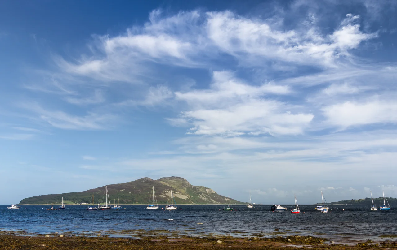
Stand on the seafront at Lamlash and look east, and there it is: a sleeping mountain in the water. Holy Isle rises out of the bay in front of you, a humped silhouette that has carried the same name, in one form or another, for nearly fifteen hundred years. The town behind you takes its name from the island, not the other way around. Around the year 590, a Celtic monk called Molaise spent time in a cave on Holy Isle, and the Gaelic Eilean MoLaise - Molaise's Island - softened over centuries through Elmolaise and Lemolash into Lamlash. By the nineteenth century the name had hopped across the water to the village on the shore.
A Long Memory
A ring of prehistoric stones outside the town hints that someone has been living here a very long time indeed. Lamlash brushed up against the Battle of Largs in the thirteenth century. In February 1548, during the rough chapter of Anglo-Scottish history known as the Rough Wooing, an English commander called Grey of Wilton proposed stationing warships at "Lammelashe" to intercept any French vessels trying to spirit the young Mary, Queen of Scots out of the country. They missed her. Her ship, blown back by adverse winds, anchored in the roadstead of Lamlash on 6 August - the same bay you are looking at now - before finally getting clear and reaching France. In the early years of the Second World War, the village became the training base for No. 11 (Scottish) Commando.
The Houses on the Shore
The basic character of Lamlash is a long, low ribbon of two- and three-storey houses lining the inland side of the shore road. Hamilton Terrace is the architectural set piece - two rows of single-storey-and-attic cottages designed by Sir John James Burnet in the late nineteenth century. Numbers 1 to 27 face the sea; another row sits behind, built so that families could rent out the front cottages to summer visitors and decamp to the back. The houses have changed remarkably little; some still have their original glazing. On the grass between the sea wall and the houses, three standing stones form a modern monument to people who once lived on Arran and were forced to leave.
Departure From the Pier
The Clearances on Arran were less brutal than in many parts of the Highlands, but they happened, and Lamlash remembers them. When crofters in Glen Sannox were displaced to make way for large-scale sheep farming, many saw no choice but to emigrate. On 25 April 1829, eighty-six souls climbed aboard the brig Caledonia at Lamlash. The Reverend A. Mackay preached his sermon from a mound formed of their own belongings, taking his text from 1 Peter: "Casting all your care upon him: for he careth for you." The Caledonia reached Quebec City two months later. The Arran emigrants became pioneer settlers in Megantic County, Quebec, and later, more than four hundred made for Dalhousie in New Brunswick. The monument was raised, generations later, by their descendants.
The Seabed They Saved
Lamlash Bay is a fine natural harbour, deep and sheltered, large enough to have once held the Royal Navy's Home Fleet and Atlantic Fleet at anchor. Today it shelters a more modest fleet: an Atlantic 75 inshore lifeboat that covers the waters around Arran, and a summer ferry that runs out to Holy Isle, now home to a Buddhist retreat. The more remarkable thing about the bay, though, lies underwater. After a long, patient campaign by the Community of Arran Seabed Trust, the northern portion of the bay became Scotland's first No Take Zone in September 2008 - statutory protection for the seabed, won not by government decree but by a community insisting that the maerl beds and the marine life depending on them were worth saving. The wider south Arran waters now sit within a Marine Protected Area.
From the Air
Lamlash lies on the east coast of the Isle of Arran at roughly 55.54 degrees north, 5.12 degrees west, in the Firth of Clyde. Holy Isle is the unmistakable landmark - a 314-metre humpback dominating the bay. From cruising altitude in clear weather, Arran's mountains in the north of the island make an obvious feature. Glasgow Prestwick (EGPK) lies about 30 nautical miles to the east-north-east; the Isle of Man's Ronaldsway (EGNS) is some 90 nautical miles to the south.
Nearby Stories
- RAF Machrihanish 4.6 km away
- 1948 KLM Constellation Air Disaster 6.9 km away
- Ballantrae Lifeboat Station 12 km away
- Great Cumbrae 12 km away
- Battle of Glen Trool 13 km away
- Paisley Abbey 17 km away
- Jura Distillery 24 km away
- Cushendall 30 km away