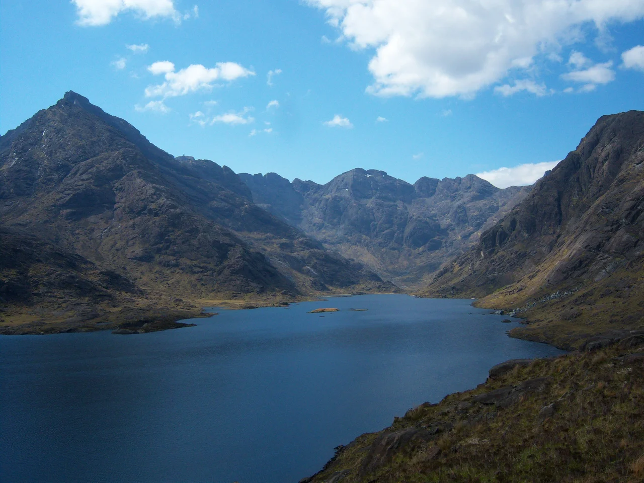

Loch Coruisk
Walter Scott reached Loch Coruisk in 1814 and wrote: 'Rarely human eye has known / A scene so stern as that dread lake, / With its dark ledge of barren stone.' Fifty years later Tennyson tried to repeat the trip and complained: 'After a fatiguing expedition over the roughest ground on a wet day we arrived at the banks of the loch, and made acquaintance with the extremest tiptoes of the hills, all else being thick wool-white fog.' The Cauldron of Waters lies at the foot of the Black Cuillin and shows itself only when the mountains decide. Tennyson was unlucky. Most visitors are.
The Cauldron
Coir' Uisge means cauldron of waters - a fitting Gaelic name for a loch nearly two miles long but only about four hundred yards wide, lying in a glacier-scooped trough at the foot of some of the most concentrated mountain wilderness in Britain. The northern end is ringed by the Black Cuillin, often wreathed in cloud that drops nearly to the water. The southern end discharges down the Scavaig River, which runs only a few hundred yards before reaching tidal water in the sea loch of Loch Scavaig. The water is freshwater, very deep, very cold. Local tradition holds it as the home of a kelpie, the shape-shifting water horse that could lure travellers to drown - a useful piece of folklore for a place this remote, where actual drowning would be very easy.
The Bad Step
There is no road to Loch Coruisk. To get there you either take a boat from the village of Elgol, half an hour across Loch Scavaig with seals usually basking on the skerries, or you walk - from Sligachan, the long way through Glen Sligachan, or from Elgol along the coastal path. The Elgol path includes a section called the Bad Step, where the trail breaks down into a sloping slab of gabbro above deep water. It is not technically difficult. It is not, in dry conditions, even a scramble in the strict sense. But it is exposed enough to stop nervous walkers in their tracks, and wet enough in rain to become a genuine fall risk. Climbers traverse it without much thought. Walkers occasionally turn back.
Painters and Writers
Scott's verse in The Lord of the Isles (1815) drew the first wave of Romantic tourists. By the mid-19th century the loch had become a fashionable destination for landscape painters travelling north - William Daniell, J. M. W. Turner, Sidney Richard Percy, Alexander Francis Lydon, and many others. Turner sketched the loch in 1831 during a Highland tour; his watercolour studies catch the disorienting scale of mountain wall and dark water. Modern writers have been drawn back: Robert Macfarlane devoted a chapter to Coruisk in his 2007 travelogue The Wild Places. Mark Haddon, before The Curious Incident of the Dog in the Night-Time, used the loch as a portal in his 1992 children's novel Gridzbi Spudvetch! - reissued in 2009 as Boom! - including the Bad Step in his narrative.
What You See When You Get There
On a clear evening Coruisk does something to scale that defies photographs. The Cuillin behind it, particularly Sgurr Alasdair and Sgurr nan Gillean, rise nearly vertically from the loch's far shore, and the water below holds them inverted in the kind of mirror that requires no wind for half a mile in any direction. There is no other building or fence in view. The only structure is the small Memorial Hut on the shore, maintained by the Scottish Mountaineering Club. The walk back to Sligachan along Glen Sligachan is one of the great Scottish ridge corridor walks - roughly seven miles between the Red Cuillin to the east and the Black Cuillin to the west, with no road and almost no other people. Tennyson was right that the place is hard to reach. He was wrong that the fog always wins.
From the Air
Loch Coruisk sits at 57.21 N, 6.17 W, hemmed by the Black Cuillin ridge to the north, west and east. Recommended viewing altitude 3,500-5,000 ft AGL to clear the ridge (Sgurr Alasdair 992 m). The loch is best identified as the dark elongated water just north of Loch Scavaig (the sea loch that opens to the Sound of Sleat). Nearest ICAO airports: Inverness (EGPE) ~95 nm east, Oban (EGEO) ~50 nm south, Glasgow (EGPF) ~140 nm south. The Cuillin generate severe orographic cloud and rotor; Coruisk is one of the cloudiest spots in Britain. VFR access to the basin itself is rarely viable; the surrounding ridges should be given a wide vertical margin.
Nearby Stories
- Bernera Barracks 0.3 km away
- Storr Lochs Hydro-Electric Scheme 1.9 km away
- Eigg 6 km away
- Torridon 10 km away
- Glenfinnan Railway Station 14 km away
- German submarine U-722 16 km away
- Lochmaddy 32 km away
- SS Seniority 46 km away