.jpg)
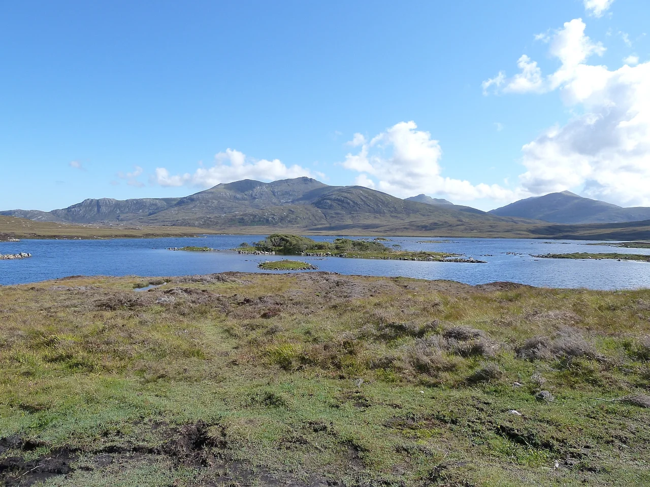
Loch Druidibeg
In autumn the geese arrive in lines. Greylag geese - Anser anser, the ancestor of every domestic farmyard goose in Europe - have used Loch Druidibeg as a breeding ground for so long that the colony here became the most important in Britain. They land in the shallows and on the islets, raise their goslings on the machair, and in good years the population fledges in the thousands. The corncrake, too, holds out here - a small brown rail whose harsh nocturnal kerrx-kerrx call once echoed across every European hayfield but which has retreated, in Britain, almost entirely to the Outer Hebrides.
A Cross-Section of Habitats
Loch Druidibeg is unusual because it offers, within a small area, a complete cross-section of Hebridean ecological zones. From the west comes alkaline machair grassland - a thin, calcareous soil fertilised by wind-blown shell sand and grazed for centuries by crofting cattle, producing some of the richest wildflower meadows in Europe. The loch itself is oligotrophic, meaning nutrient-poor and clear, with sparse aquatic vegetation and characteristic species like the slender naiad, which is rare almost everywhere else in Britain. Beyond the loch the ground rises into acidic moorland, peat and heather, the standard cover for the wetter Hebridean uplands. The transitions between these zones happen within a kilometre. Few sites in Britain offer such a compressed transect of habitats, which is why Loch Druidibeg sits inside both a Special Area of Conservation and a Special Protection Area under Natura 2000.
The Strange Forest
Before the loch became a National Nature Reserve in 1958, someone planted an experimental woodland on the north shore. It was intended as the policies - the ornamental grounds - of an estate lodge that was never built. Whoever made the planting list seems to have ordered from a catalogue with their eyes closed: lodgepole pine, Scots pine of unknown origin, Chile pine (monkey-puzzle), Norway maple, and Rhododendron ponticum. The mixture had no native antecedent and no obvious plan. Native species - birch, alder, hazel, rowan, aspen - eventually moved in or were planted, and the small woodland became an island of trees in an otherwise treeless landscape, important to woodland birds that have nowhere else in the Hebrides to nest. Then in the 1990s the rhododendron, true to form, ate most of it. Scottish Natural Heritage initiated a long restoration plan; volunteers have been pulling rhododendron out for thirty years.
Crofters and Conservation
The management approach at Loch Druidibeg deliberately encourages traditional crofting practice - low-intensity cattle grazing, the cutting of machair hay - as integral to maintaining the biodiversity, not as an obstacle to it. The wildflower meadows of the machair exist precisely because they have been grazed and lightly tilled for centuries; left fallow, the same ground reverts to coarser grass and the rare flora disappears. Numerous cooperative projects link conservation agencies with the local Uist community. Schools use the reserve for environmental education. The arrangement worked well enough that in 2018 Scottish Natural Heritage transferred ownership of its 1,100 hectares to Storas Uibhist, the community-owned company that holds most of South Uist. The reserve is now managed by the people who live around it - and have lived around it, in some cases, for forty generations.
What Was Lost and What Endures
Some of the designations have come and gone. Loch Druidibeg was declared a National Nature Reserve in 1958 but de-declared in 2012, partly because the formal NNR designation no longer fit the new community-management model. It was a UNESCO biosphere reserve from 1976 until 2013, when that status too was withdrawn. The land is still designated, still protected as an SSSI, Ramsar site, SAC, and SPA - the alphabet soup of European nature law - but the practical work happens on the ground, between conservation officers and crofters with cattle. The geese still come. The corncrake still calls in the long Hebridean evenings. The strange small wood on the north shore is slowly recovering. The thing protected here is not just an ecosystem but a relationship between a community and its loch, which is older than any of the designations and likely to outlast them.
From the Air
Loch Druidibeg sits at 57.43 degrees north, 7.42 degrees west, on the north-central part of South Uist, just east of the A865. The nearest airport is Benbecula (ICAO: EGPL), about 6 nautical miles north along the same causeway-linked island chain. From 4,000 feet the loch is easy to identify - a complex, irregular freshwater body with dark islets, set against the pale machair to the west and the rising eastern hills toward Hecla. The protected area extends roughly 1,677 hectares around the loch. Spring and autumn offer the best chances to observe migrating waterfowl from the air. Westerlies and low ceilings are the meteorological norm.
Nearby Stories
- St Clement's Church, Rodel 10 km away
- Whisky Galore! (1949 film) 14 km away
- Neist Point 15 km away
- Canna 30 km away
- Leverburgh 34 km away
- St Kilda, Scotland 35 km away
- German submarine U-516 127 km away
- German submarine U-764 154 km away