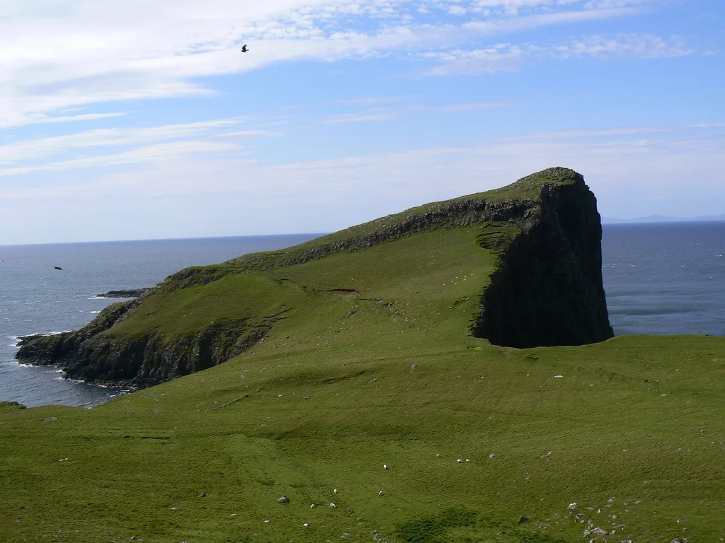

Neist Point
The road to Neist Point ends abruptly above a cliff, and from the small car park you walk down a steep concrete path, then up over a ridge, then down again on the seaward side until the lighthouse appears below you. It is white, square, and small against the size of the rock it sits on. Beyond it the Atlantic spreads west toward the long blue line of the Outer Hebrides, twenty miles away across the channel called The Minch. There is no further land between Neist Point and Canada that anyone would notice from this height. Skye stops here.
Most Westerly
Neist Point is the western tip of the Duirinish peninsula, the broad northwestern arm of Skye that ends in two long fingers reaching into the sea. The point pushes further west than any other spot on the island, which makes it a magnet for sunsets. In summer the sun goes down somewhere between the Outer Hebrides and the open ocean, and the basalt columns of the cliff face turn orange for ten minutes and then black. Photographers know this, and so the small car park can be busy in the hours before dusk in July; the rest of the year, and most of the time, you have the headland to yourself.
Columnar Basalt
The cliffs at Neist Point are formed of basalt arranged in vertical columns, identical in geological origin to the more famous columns at the Giant's Causeway in Northern Ireland. The same long Tertiary volcanism that produced the Cuillin, Rum and Mull threw out lava across what is now western Scotland. As that lava cooled it contracted and cracked into hexagonal prisms, packed against each other like a stand of stone fenceposts. At Neist Point the columns rise sheer from the surf, weathered now into vertical ribs of dark grey rock. Below the lighthouse, where the path drops to sea level, you can step onto the tops of broken columns and look down into rock pools cleared by every tide.
The 1909 Lighthouse
The lighthouse was completed in 1909 by the Stevenson family, the Edinburgh dynasty of lighthouse engineers whose work studded the Scottish coast for more than a century. (The writer Robert Louis Stevenson came from the same family; he was the disappointing one, in the family view, having declined to follow his father into lighthouse engineering.) Neist Point's light marks the western edge of Skye for ships passing through The Minch between the Inner and Outer Hebrides. It was manned by keepers until automation in 1990. The keepers' cottages still stand. The light still flashes every five seconds.
Whales and Birds
Standing at the railing above the lighthouse, on a calm day, you can watch the open ocean for hours. Minke whales pass through these waters in summer; basking sharks, the second-largest fish in the world, drift slowly along the surface with their mouths open feeding on plankton. Dolphins and porpoises hunt the tide rips just off the point. The cliffs themselves are loud with seabirds in nesting season: gannets diving at the water with folded wings, black guillemots in their black-and-white plumage, razorbills, and European shags strung along the ledges. Rare saxifrages cling to the wet rock above the splash zone. None of this is curated. It just happens, and you happen to be there when it does.
After Dark
On a still night Neist Point is one of the darkest places in Britain. The light from the lighthouse swings once every five seconds, throwing a brief white blade across the cliffs and then leaving them to the stars. There is no settlement within ten miles to leak its glow into the sky. The Milky Way rises like a smear of bright dust over the Atlantic, the Outer Hebrides go black against a deeper black, and the surf you cannot quite see breaks against the columns of the cliff below. It is a small headland. It feels like the edge of the world.
From the Air
Located at 57.421°N, 6.787°W at the western tip of the Duirinish peninsula on the Isle of Skye. The lighthouse sits at sea level on a small rocky promontory below the main cliff line; from above the white tower is a useful marker on a green and grey landscape. Useful landmarks include MacLeod's Tables (Healabhal Mhòr 488m, Healabhal Bheag 489m) about 8nm east on the same peninsula. The Outer Hebrides (Harris and the Uists) lie 25-30nm west across The Minch. Nearest airports are Stornoway (EGPO) about 50nm northwest on Lewis, Plockton (EGPP) 30nm east, Benbecula (EGPL) 35nm west on the Uists, and Inverness (EGPE) 80nm east-northeast. Recommended viewing altitude 1500-2500 ft AGL; expect significant turbulence on the windward cliffs in west and northwest winds.
Nearby Stories
- Skye Trail 3.1 km away
- Loch Druidibeg 5 km away
- Skye 7.6 km away
- St Clement's Church, Rodel 11 km away
- Traigh Mhor 12 km away
- Kinloch Castle 13 km away
- Canna 20 km away
- Flannan Isles Lighthouse 71 km away