
Skye Trail
There is no signpost at the start. Rubha Hunish, the northernmost knuckle of Skye, drops off into the Minch in basalt steps and stacks, and the Skye Trail begins by simply not telling you where to go. Over the next 128 kilometres, the route will climb the Trotternish escarpment, traverse the spine of the Cuillin foothills, drop to abandoned crofting villages cleared in 1853, and end on the village green at Broadford with no fanfare and no certificate. It is not officially a trail at all. It is a route that experienced walkers stitched together from existing paths, trods, and open moorland, and it asks more of you than almost any other long-distance hike in Britain.
An Unofficial Spine
The Skye Trail typically takes five to seven days, depending on pace and weather, and it strings together the island's most dramatic landscapes by linking footpaths and crossing open ground where no path exists at all. It has no waymarks. It requires a map, a compass or GPS, and the kind of navigation skill that does not panic when the cloud comes down at 600 metres. The terrain is often boggy, often steep, often exposed. Two bothies along the route provide rough shelter; otherwise, wild camping is the rule. The trail is unsuitable for beginners. For those prepared for it, it is one of the great walks of the British Isles, both for what it crosses and for the solitude in which it crosses it.
Trotternish
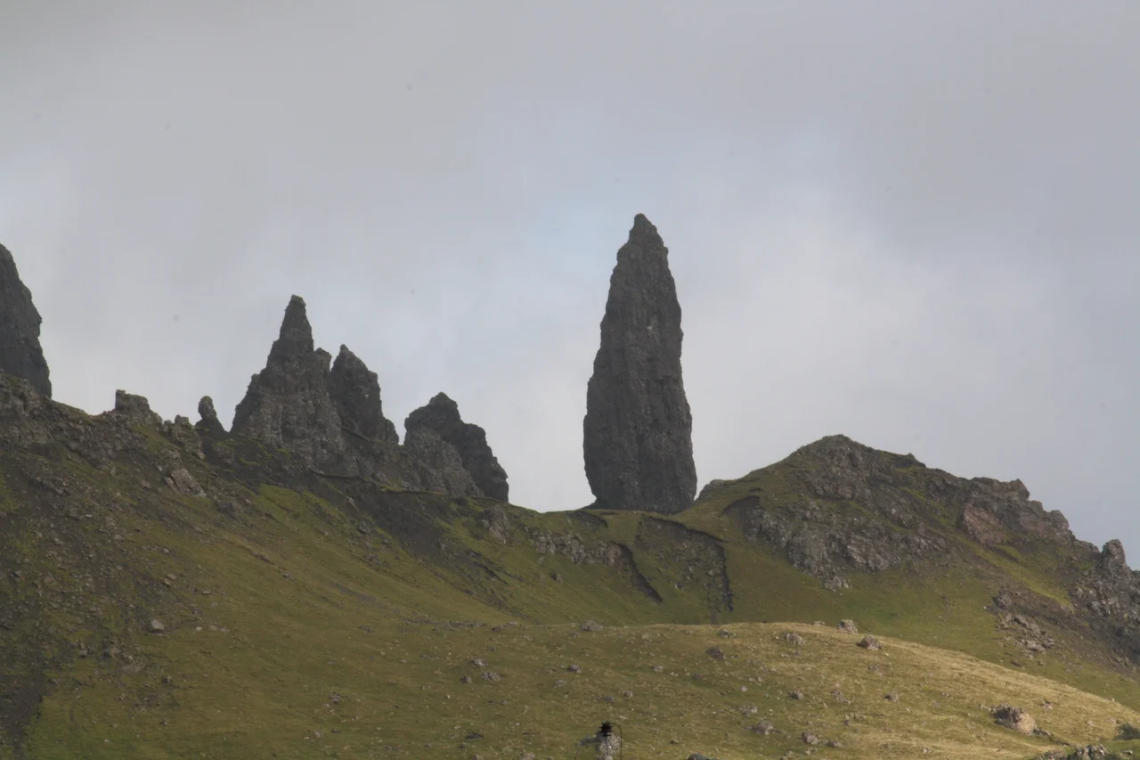
The hardest day comes early. From Flodigarry, the trail climbs onto the Trotternish Ridge, a 30-kilometre escarpment running the length of the peninsula, formed by the largest landslip complex in Britain. The path crosses the Quiraing, a maze of pinnacles, slipped blocks, and grassy terraces with formations called the Needle and the Prison. It then continues south over a succession of summits to The Storr, the great fissured monolith whose pinnacle, the Old Man of Storr, has become one of the most photographed rocks in Scotland. There are no facilities anywhere along this stage. The wind on the ridge can be ferocious. In poor visibility, navigation becomes the only thing that matters, because in places the path simply disappears under heather and bog.
Sligachan and the Cuillin
South of Portree the trail eases for a day, following minor road through The Braes, the quiet crofting area where in April 1882 the Battle of the Braes took place, an uprising of crofters resisting eviction. The clash with police sent from Glasgow led directly to the Crofters' Holdings Act of 1886, which gave Highland tenants security of tenure for the first time. No markers remain. The walk continues along Loch Sligachan to the famous stone bridge at Sligachan itself, where the Black Cuillin rise behind the campsite like a wall of broken teeth. From here Glen Sligachan opens south between the Red and Black Cuillin, a long wild valley where the path winds toward Camasunary Bay and the sea. The coastal stretch from Camasunary to Elgol is exposed, steep, and demanding, with the Cuillin themselves rising behind.
Boreraig and Suisnish
The final stage from Torrin to Broadford passes through some of the saddest ground on Skye. Near Boreraig and Suisnish, the path crosses the remains of two settlements abandoned in 1853 when Lord MacDonald ordered the evictions that emptied the Strath. Stone foundations and the grassy outlines of former blackhouses are all that survive. A small interpretation sign explains what happened. The trail then turns toward Broadford Bay along a quiet coast looking across to Scalpay and the mainland mountains, and finishes on the village green by the bay, with the Red Cuillin behind. There is no end-of-trail marker. The Skye Trail simply stops, the way it began, in a place where you have to know what you are looking at.
When to Go and What to Bring
The walk is best attempted from late spring to early autumn, when daylight is long and snow has cleared from the Trotternish ridge. The midges are at their worst in July and August, and any walker who plans to wild camp should expect them; insect repellent is essential. Mobile signal is unreliable throughout. There is no waymarked route, no organised support, no permit, no fee, no shuttle service. Resupply is possible in Portree, the Flodigarry Hostel, and at the end of stages near Sligachan and Torrin, but otherwise you carry what you eat. The weather changes within minutes. Layered waterproof and windproof clothing, navigation tools, and a four-season sleeping bag for shoulder seasons are not optional. Tell someone your plan, and check in when you can.
From the Air
The Skye Trail runs along the spine of the Isle of Skye from Rubha Hunish (57.71 N, 6.36 W) in the north to Broadford (57.24 N, 5.91 W) in the south, a 128 km route. The Trotternish Ridge, Quiraing, and Old Man of Storr are unmistakable from the air on clear days, with the Cuillin range further south. The midpoint coordinates 57.68 N, 6.33 W lie near the Trotternish ridge. Nearest airfields: Plockton (private grass strip) on the mainland opposite, Inverness (EGPE) 60 nm east-southeast, and Stornoway (EGPO) 60 nm northwest. Skye weather is among the most changeable in Britain; expect orographic cloud on the ridges even when valleys are clear.
Nearby Stories
- Portree 7.9 km away
- Neist Point 9.2 km away
- Isle of Ewe 10 km away
- Summer Isles 10 km away
- The Minch 12 km away
- Strome Castle 14 km away
- St Clement's Church, Rodel 17 km away
- Callanish IV 19 km away