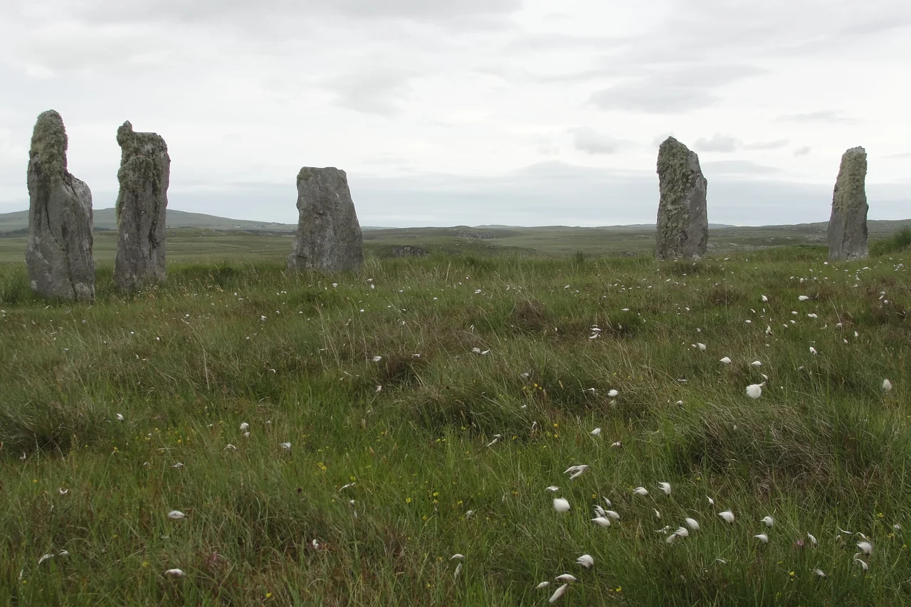

Callanish IV
Five stones still stand. There may once have been thirteen. Two miles southeast of the great cross-shaped megalithic site of Callanish, this smaller circle sits 180 metres off the unfenced B8011 road, half-hidden in the peat and the grasses around it. No archaeologist has ever excavated here. The Royal Commission surveyed the site in 1914, an independent team came in the 1970s, the Commission returned in 2009 - and that is the sum of what has been done to a monument that has stood here, by every reasonable estimate, for around four thousand years. Sometimes leaving a place alone is the most respectful thing scholarship can do.
A Circle Among Circles
Callanish IV - the Romans never came here, but the antiquarian numbering scheme catalogues this monument as the fourth of the Callanish group - lies near the small settlement of Garynahine on the west coast of Lewis. At its centre is a dilapidated cairn; to the southwest, the stone footprint of a shieling, the seasonal summer hut a Hebridean shepherd would have built to live in while watching cattle on the hill. Of the original stones, five remain upright. The others may have fallen and been buried in the deepening peat, or they may have been cleared away over centuries. What is visible aboveground is only part of what is here. Nobody yet knows how much more.
Why It Was Scheduled
Callanish IV became a scheduled monument in 1992, under Scottish law that gives the highest legal protection to sites of national importance. The protected area is irregular - the longest aspect runs 410 metres north-south - and it covers far more than the visible cairn. Historic Environment Scotland's statement of importance reads, in part: 'The undisturbed deep peat around it gives it the potential for recovery of information regarding contemporary landuse and economy, and possibly other structural evidence... Together, this complex is one of the most remarkable Neolithic/Bronze Age site assemblages in NW Europe.' The peat, in other words, is the archive. Disturb it and you lose what you came to find. Protecting Callanish IV is partly an act of refusal: do not dig until you can read.
The Group Across the Moor
Callanish IV is one of more than a dozen stone circles, alignments, single stones and cairns scattered across this corner of west Lewis - a sacred landscape laid out across several square kilometres around the village of Calanais. The main site, Callanish I, is one of the most spectacular Neolithic monuments in Europe, a cross-shaped arrangement of standing stones whose construction began around 2900 BC. Callanish II and III lie to its south, smaller and less famous. Callanish IV sits further south still, then V, VI, VII, VIII... There is no full agreement on what the group did or meant, but the sightlines across the moor are clearly intentional. Standing at Callanish IV at twilight, you can sometimes see the silhouettes of the other circles on neighbouring ridges. They were not built in isolation. They were built in conversation.
From the Air
58.176°N, 6.714°W on the west coast of Lewis, about two miles southeast of the main Callanish Stones. The B8011 road runs east of the site. Approach altitude 1,500-3,000 ft to see the circle, the surrounding peat moor and the larger Callanish group strung along the ridges to the north. Stornoway (EGPO) lies about 12 nm east-northeast. The east lochs of Lewis and the open Atlantic west toward the Flannan Isles are visible from height. Expect Atlantic weather and rapidly changing visibility.
Nearby Stories
- St Clement's Church, Rodel 12 km away
- Bayble Island 13 km away
- Ness, Lewis 13 km away
- Skye Trail 17 km away
- Spaceport 1 21 km away
- Clach an Trushal 22 km away
- Flannan Isles Lighthouse 25 km away
- The Laki Eruption: The Volcano That Changed World History 858 km away