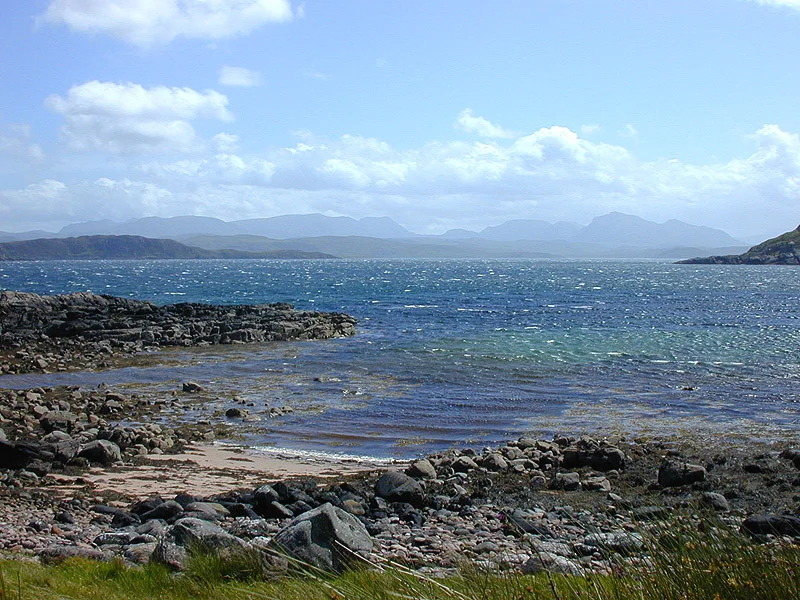

Isle of Ewe
Until the late twentieth century, the children of the Isle of Ewe travelled twenty-six miles to school every day. The journey involved a boat across Loch Ewe to Aultbea, then a bus up the long coast road, then a bus back, then a boat home before the weather turned. They were the children of a single extended family, the Grants, who have lived on this small Scottish island - one square mile of farmland and rough grazing in Loch Ewe, on the west coast of Wester Ross - since the nineteenth century. There used to be more families. There used to be other children. The Second World War took the rest of them away, and they did not come back.
Name as a Joke
The Isle of Ewe has, by accident of phonetics, become one of the great romantic puns of the English-speaking world. The Glasgow singer-songwriter Aidan Moffat wrote a love song called A Scenic Route To The Isle Of Ewe. The Goon Show used the joke in 1954 when Neddie Seagoon, told that the dreaded lurgi had reached the Isle of Ewe, replied, "I love you too. Shall we dance?" The actual etymology is older and less flirtatious. The name probably comes from one of two Gaelic roots: eo, meaning yew tree, or eubh, meaning echo - a reference to a place name on the adjoining mainland. The yew theory fits the early sixteenth-century descriptions of the island as wooded, although it is treeless today.
What the Travellers Wrote
Two early Scottish writers left useful glimpses of what this island was like before the modern era. In 1549, the priest and traveller Donald Munro wrote in his Description of the Western Isles: "Ellan Ew, haffe myle in length, full of woods, guid for thieves to wait upon uther mens gaire." Thirty years later, in 1579, George Buchanan repeated the description in his Rerum Scoticarum Historia - the island was "almost all covered with woods, and good for nothing but to harbour thieves, who rob passengers." Both writers, comically, located the island in Loch Broom rather than Loch Ewe. By 1889, when Black's Picturesque Tourist of Scotland was published, the woods were gone and the picture had reversed: the island was "in a state of high cultivation; the fields large and well fenced, having been all reclaimed from moorland. There is an extensive dairy on the island." Three and a half centuries of change, captured in two sentences.
What the War Did
In 1939 the Royal Navy turned Loch Ewe into one of the great strategic anchorages of the war. From 1942 onwards, the Arctic convoys to the Soviet Union assembled here before steaming north for Murmansk and Archangel - voyages so dangerous that the convoy routes are still remembered for their casualty rates. The Isle of Ewe sat in the middle of the requisitioned anchorage. The other families on the island left during the war; some never returned. Only the Grants stayed. The island's children, in those years and for decades afterward, made the daily 26-mile round trip to school - a routine that combined with the isolation to gradually thin out further what life had remained. The Loch Ewe naval base wound down after the war. The crofting on the island continued. The Grants are still there.
Off-Grid Living
Today the island is privately owned by GBB Estates Ltd and crofted by the Grants. The southern half is low-lying farmland of fertile Permian or Triassic sandstone soils. The northern half is uncultivated, on harder Torridonian sandstone with acidic peaty cover. The shoreline alternates between flat pebble beach and small cliff. The whole island is part of the Wester Ross National Scenic Area. There is no electricity grid connection: power comes from renewables and backup generators. There is no piped water; supply is sourced locally. There is one phone cable to the mainland, the island's single physical link to the rest of the world. Residents and visitors use the pier at Aultbea on a daily basis to come and go for work and supplies. A jetty built after the Second World War provides the actual landing point.
What You See
From the air, the Isle of Ewe is a clear, small, oval island in the middle of Loch Ewe, west of the village of Aultbea. The southern half is striking - cultivated fields with hedgerows, a working dairy and croft, the small cluster of dwellings on the leeward north-east side. The northern half is moorland and rough grass. Two small bays - Camas Angus and Camas Beithe - notch into the south coast, sheltered by the hummock of Cnoc na Gaoithe, the windy knoll. Across the loch sit the villages of Poolewe and Aultbea. North-west is the open coast and Greenstone Point; to the north sits Gruinard Bay and Gruinard Island. In good weather the Summer Isles are visible further north-east. On most days, on most of the surrounding sea, you will not see another boat.
From the Air
The Isle of Ewe sits in Loch Ewe at 57.83 N, 5.61 W, west of the village of Aultbea in Wester Ross. Inverness Airport (ICAO EGPE) is about 110 km east; Stornoway (EGPO) about 80 km west across the Minch. Recommended viewing altitude 2,000-3,500 ft AGL - low enough to see the cultivated south half against the moorland north half, and the small dwelling cluster on the north-east side. Aultbea pier on the mainland and the wartime naval anchorage of Loch Ewe are useful navigation references. Gruinard Bay and Island lie just to the north-west.
Nearby Stories
- Stoer Head Lighthouse 6.8 km away
- Beinn Eighe 8.7 km away
- Tiumpan Head Lighthouse 13 km away
- South Rona 14 km away
- Battle of Tuiteam Tarbhach 17 km away
- Conon Hydro Scheme 22 km away
- Shiant Islands 23 km away
- Loch Naver 33 km away