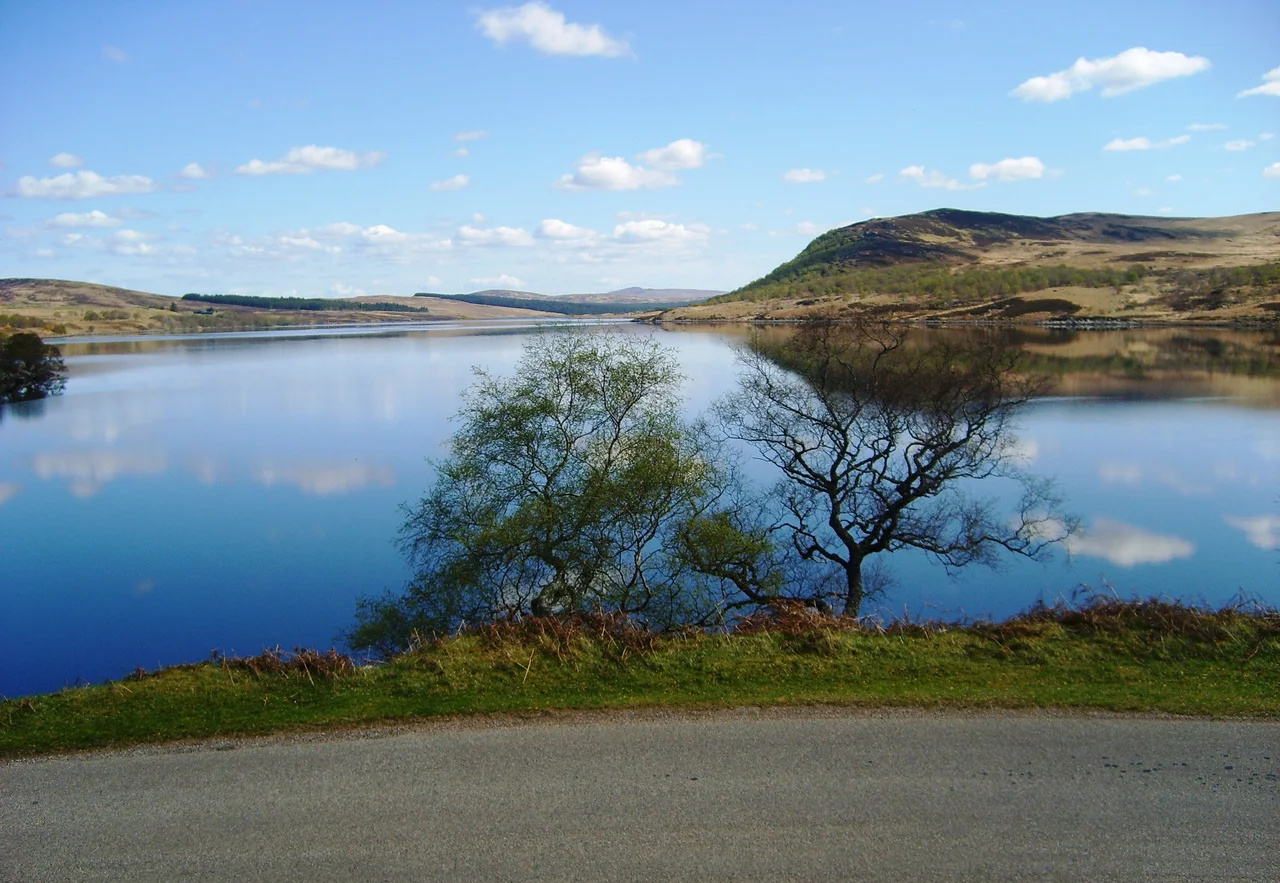

Loch Naver
The loch is ten kilometres long and rarely more than half a kilometre wide, a long thin slot of water in the heart of Sutherland. To the east, the River Naver flows out and runs down Strathnaver to the north coast. To the west, the River Mudale brings water in from Loch Loyal. Today the strath is quiet. Sheep graze where townships once stood. That quietness is not natural, and the loch knows it.
A Beautiful, Long Body of Water
Loch Naver stretches east to west, narrow and clean, with hills closing in on either side. It is fed primarily by the River Mudale at its western end and the River Vagastie from the south, with smaller burns - Grummore Burn, Allt Gruama Beag, Allt a' Choire Bhuidhe, Kilbreck Burn - falling off the surrounding moor. The single outflow at the eastern end becomes the River Naver, which winds north through the strath for some twenty miles before reaching the sea at Bettyhill. The road that hugs the south shore is the B873, a single-track lane with passing places, much of it built on what used to be the only path through the glen.
The Townships That Are Not There
Walk the shore of Loch Naver and you will see, on the hillsides above, the outlines of old turf walls and stone footings - the foundations of houses that have not been lived in for two hundred years. Strathnaver was the most densely populated glen in inland Sutherland in the early nineteenth century. Hundreds of families lived in townships strung along the river. In 1814 and again in 1819, those families were cleared. The Sutherland estate's factor, Patrick Sellar, oversaw the removals. People were given short notice or none at all. Houses were unroofed and the roof timbers burned to prevent return. One elderly woman, Margaret MacKay, was carried from her burning home in Badbea and died days later from the exposure. Sellar was tried for culpable homicide in Inverness in 1816 and acquitted by a jury drawn from the landowning class. The verdict has been argued over ever since. The strath was emptied and replaced with Cheviot sheep.
Strathnaver Museum and the Long Memory
At Bettyhill, where the River Naver reaches the sea, the Strathnaver Museum tells this history in plain language. The collection includes the Farr Stone, a Pictish cross-slab from the eighth century, alongside artefacts from the cleared townships - hand tools, fragments of crockery, a few personal items. Genealogical records from across the diaspora arrive regularly: families in Canada, Australia, New Zealand, and North Carolina trace their ancestors back to one of the townships at the loch. For many of them the strath is the source of a family story that begins with displacement. The museum is small and quiet, and it does not soften what happened. Tour the inland strath in summer with their leaflets in hand and you can find the named sites where people once lived.
Fishing and Quiet
Today Loch Naver is best known to outsiders as one of the finest brown trout lochs in northern Scotland. Anglers come for the spring and autumn fishing, staying at the Altnaharra Hotel at the western end of the loch or at lodges in Syre further down the strath. The River Naver itself, which flows out of the loch, is one of the most productive salmon rivers in the north of Scotland. The fishing economy is what supports the small handful of people who still live around the water. Caravan parks along the shore handle the summer visitors. The Crask Inn, just south of the watershed, is one of the most remote pubs on the British mainland and a much-loved stop for cyclists on the long road between Lairg and Tongue. The strath rewards patience. The wind comes off the hills and the surface of the loch turns from silver to slate in an hour.
The Hills Around
Ben Klibreck rises just south of the loch's eastern end, its long whaleback dominating the skyline. To the north, the Naver's straighter ground gives way to the rougher country around Loch Loyal and Ben Loyal. The road from Altnaharra over to Tongue is one of the great driving routes in Scotland, slow and empty and visually dense, climbing through moorland with hardly a building in sight. From Loch Naver itself there is no view of the sea - the strath bends just enough to hide it - but the air carries the same sharp clarity that you get on the north coast forty miles away. Sit on the shore for an hour and you will hear only water, wind, and occasionally a sheep on the hillside above. The silence has a history.
From the Air
Coordinates 58.28 N, 4.38 W in the heart of inland Sutherland, at the head of Strathnaver. Inverness Airport (EGPE) is about 60 nm south. From the air, Loch Naver appears as a long, narrow east-west slot of water, distinctively straighter and thinner than nearby Loch Loyal. Ben Klibreck dominates the south side of the eastern end. The River Naver runs from the loch's east end north toward Bettyhill on the coast. Best viewing 4,000 to 6,000 ft AGL. The strath funnels weather; expect rapid changes in visibility and cloud base between the open moor and the coast. The B873 single-track road follows the south shore.
Nearby Stories
- Falls of Shin 5.3 km away
- Kylesku Bridge 6.2 km away
- Sandwood Bay 8.2 km away
- Dounreay 8.7 km away
- Coigach 16 km away
- Flow Country 17 km away
- Tarbat Ness Lighthouse 17 km away
- Smoo Cave 19 km away