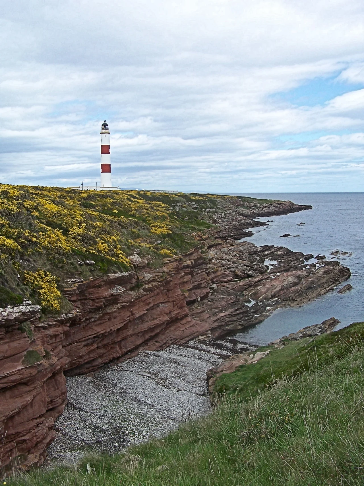

Tarbat Ness Lighthouse
Two broad red bands wrap the white tower, a navigational signature visible from miles out in the Moray Firth. Robert Stevenson designed Tarbat Ness Lighthouse after a single storm in November 1826 sent sixteen vessels to the bottom of the firth. Coastal communities petitioned. The Northern Lighthouse Board agreed. By 26 January 1830, the light was burning at the northeastern tip of the Tarbat peninsula, where it has burned ever since.
A Storm's Argument
The Moray Firth in November 1826 was deadly. Sixteen ships were lost in a single storm, and the aftermath produced a wave of applications to the Northern Lighthouse Board for new lights at Tarbat Ness and at Covesea Skerries near Lossiemouth. Robert Stevenson, the patriarch of the great Scottish lighthouse-building dynasty - grandfather of the novelist Robert Louis Stevenson - was the engineer assigned. James Smith of Inverness was the contractor responsible for the actual construction. The total cost came to £9,361, a substantial sum for the period. The light was first exhibited on 26 January 1830. With 203 steps to the top of a 53-metre tower, it is the third tallest lighthouse in Scotland after North Ronaldsay and Skerryvore.
The Red Bands
The distinguishing feature is daymarking - two broad red bands around an otherwise white tower. Each lighthouse in the Northern Lighthouse Board system carries its own paint scheme, so that mariners in daylight can identify which light they are passing without needing the lamp to be lit. Tarbat Ness's bands are bold and unambiguous, designed to read at sea-level distance. The architecture is otherwise classic Stevenson - tapering masonry, projecting gallery, lantern room with crisscross glazing bars. Bella Bathurst's 1999 book The Lighthouse Stevensons recounts a rescue by principal keeper William Davidson, who saved four of the five crew members of a wrecked Norwegian schooner. Robert Stevenson's standing instructions told keepers to remain with the light and not risk themselves saving shipwrecked sailors. Even with the lighthouse burning, ships could still be driven ashore.
Older Layers Beneath
The lighthouse stands on ground much older than 1830. The site sits near Port a' Chaistell - earlier called Port a' Chait - on the northeast tip of the peninsula, where the foundations of an old structure were identified in the Middle Ages as a "Roman landmark." Whether the masonry was genuinely Roman or simply old enough for medieval observers to assign it the deepest available pedigree is unclear, but the local tradition was persistent enough to make it onto Ordnance Survey maps. Tarbat Ness has a long history of being noticed by ships - Thorfinn the Mighty defeated Karl Hundason (a name some scholars believe might be a Viking term for Macbeth) in an eleventh-century battle near here. The peninsula has been a navigational marker since the Norse expansion into the North.
Living With The Light
Earthquake shocks were occasionally reported. Bathurst records one episode when Tarbat Ness shook hard enough that the shades and lamp glasses rattled - a rare reminder that even the seemingly stable bedrock of the North Sea coast is part of a larger seismic story. The lighthouse was automated like most others in the late twentieth century. Today it remains a Category A listed building, the keepers' cottages converted for other use, the light itself still burning. The walk out from Portmahomack along the peninsula tip is a Sutherland classic - low coastal heath, oystercatchers in spring, the red and white tower growing larger as you approach until you stand directly beneath its 53 metres of white masonry.
From the Air
Coordinates 57.87 N, 3.78 W at the northeastern tip of the Tarbat peninsula. Inverness Airport (EGPE) lies about 30 nm south. From cruising altitude the lighthouse is one of the more easily identifiable navigational marks on the east coast - its two red bands stand out against the dark heath of the peninsula tip. The light marks the entrance to the Dornoch Firth from the Moray Firth and is a useful waypoint when transiting north or south along this coast. Light character per the Northern Lighthouse Board.
Nearby Stories
- Culbin Sands, Forest and Findhorn Bay 3.4 km away
- Gordon Castle 5.9 km away
- Black Isle 7.4 km away
- Bonar Bridge 7.7 km away
- Dunbeath Air Crash 12 km away
- Loch Naver 15 km away
- Battle of Tannach 25 km away
- Cullen Viaduct 32 km away