.jpg)
Cullen Viaduct
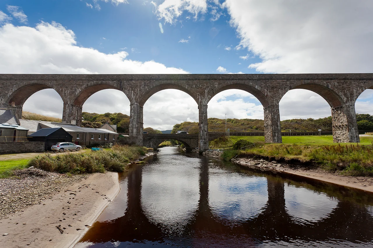
The most striking thing about Cullen is what isn't there. The Great North of Scotland Railway wanted to run a line through low ground to the south of the town, the way any rational engineer would lay it. The Seafield Estate said no. So the railway went up. Eight tall stone arches now stride across the seaside burgh, leaping the Burn of Cullen and the main road and the rooftops, a piece of late-Victorian infrastructure built not for speed but for trespass - the trespass it was forbidden to commit on the ground.
The Refusal
In the 1880s the Great North of Scotland Railway was extending its line along the Moray coast between Portsoy in Aberdeenshire and Elgin. The natural route ran through the policies of Seafield Estate, immediately south of Cullen. The estate, then one of the most powerful landed interests in the north-east, refused to allow the rails on its property. The railway company could either give up the line or find another way through, and giving up was not in the company's vocabulary. So the engineer P. M. Barnett designed a viaduct that would carry the single track on a curving stone trestle high enough to clear the town entirely. Work was finished in 1886. The result is the sort of engineering decision that no purely rational planner would make, and that no town would ever have asked for, and that no one now would dream of losing.
Eight Arches Over a Burgh
The main viaduct contains eight arches and crosses both the Burn of Cullen and the A98 trunk road. A separate four-arch bridge handles the line where it descends to Seafield Street at the foot of the town, with vehicles and pedestrians passing beneath. The masonry is the buff-grey local sandstone, dressed and squared, weathering now to a soft honeyed tone in evening light. From the higher streets above Castle Terrace the structure looks almost domestic in scale, a row of arches you could imagine washing flapping under. From sea level on the beach below, with the salt breeze coming in off the Moray Firth, the arches feel enormous - a stone aqueduct dropped into a fishing town. The structure is listed at Category B by Historic Environment Scotland, the second-highest tier of statutory protection in Scotland.
After the Trains
The line itself is long gone. British Railways closed the coastal route through Cullen as part of the Beeching cuts in 1968, and the rails were lifted soon after. What survived was the viaduct, sturdier than the operation it had served. The arches found a second life as part of the Moray Coast Trail, a long-distance footpath now running along the old trackbed, with walkers and cyclists crossing the burgh on the line that trains once threaded. Below, Cullen Golf Links spreads across the dunes, and the smell of frying fish drifts up from the harbour - Cullen Skink, the smoked-haddock soup that takes the town's name, is still made here in the way it has been for generations. The viaduct outlasted both the railway and the reason it was built; the Seafield Estate's veto turned an act of obstruction into the most photographed structure on this stretch of coast.
From the Air
Cullen Viaduct stands at 57.692°N, 2.830°W on the Moray Firth coast about 12 nm east of Lossiemouth. Best viewed at 800 to 1,500 feet AGL on a north or east approach: the eight-arch curve is unmistakable against the buff-grey sandstone of Cullen Bay. RAF Lossiemouth (EGQS) lies 12 nm west; Aberdeen Dyce (EGPD) about 40 nm southeast. Coastal flying in this area is usually clear but watch for sea fog drifting in off the firth on calm summer mornings, and for low cloud capping Bin Hill just inland.
Nearby Stories
- Fyvie Castle 5.7 km away
- Speyside Way 6.8 km away
- Moray Firth Fishing Disaster 7.6 km away
- Balvenie Castle 8.7 km away
- Gardenstown 11 km away
- Helmsdale 15 km away
- Hill o' Many Stanes 38 km away
- German submarine U-58 (1938) 56 km away