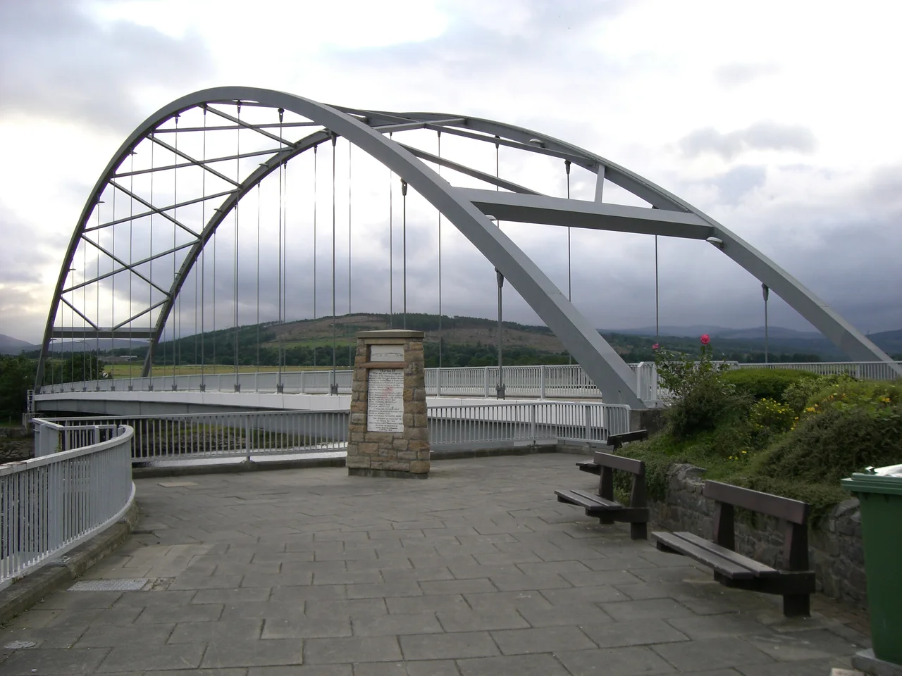

Bonar Bridge
On the calm night of 16 August 1809, an overloaded ferry left the Dornoch shore for the market at Tain. About a hundred people climbed aboard with their goods and livestock. Halfway across the firth the boat turned broadside to the tide, took on water, and sank within minutes. Ninety-nine people drowned, including the sheriff of Dornoch. The disaster shocked Britain, and the donations that came in from overseas helped fund the bridge that would replace the ferry forever. The village that grew around the new crossing is still called Bonar Bridge.
The Fair Ford
Long before Telford's iron arch went up, this stretch of the Kyle of Sutherland had a Gaelic name: Am Ban Ath, the fair ford. Drovers brought cattle south from Caithness and Sutherland to the markets of Falkirk and beyond, and this was the best place to cross without a long inland detour. Over the eighteenth century the name slipped across maps as Bana, Bona, and finally Bonar. The Norse had been here before, leaving Sudrland - the southern land of their Orkney earldom - as the name for a county that now sits at the top of the British mainland. Earlier still, prehistoric peoples left cairns and hut circles in the hills above the Kyle, and in 1900 workmen blasting a granite outcrop at Tulloch Hill exposed the Migdale Hoard - bronze axe head, bangles, anklets, jet buttons, and the fragments of an elaborate bronze headdress, all dating from around 2000 BC.
Telford's Iron Arch
Construction of the first bridge began in September 1811 and was completed in just over a year, in November 1812. Thomas Telford was the engineer; Simpson and Cargill the builders. The cast-iron components were made in Denbighshire, assembled there to check the fit, then taken apart and shipped north. The single arch spanned 150 feet, the prototype for several later Telford bridges including Craigellachie. The historian Roland Paxton wrote that it 'combined elegance with economy and strength to an unparalleled degree'. A plaque on the Ross-shire side asked travellers to 'stop and read with gratitude the names of the Parliamentary Commissioners' who had built more than five hundred miles of Highland road since 1803. The bridge cost £9,736 and stood for eighty years. On 29 January 1892, in a winter of catastrophic floods, the great flood took it away. The replacement, in steel and granite, opened in July 1893. The current bridge, a 1970s structure designed by Crouch and Hogg, took over in December 1973.
Where the Rivers Meet the Sea
The Kyle of Sutherland is the estuary of four rivers - Oykel, Cassley, Shin, and Carron - that all gather their waters above the bridge. East of it, the estuary opens into the Dornoch Firth and the sea. Salmon push upstream in summer; ospreys, buzzards, and grey seals work the same water from above and below. The old Battles of Invercarron and Carbisdale were fought just upstream in 1650, between the Covenanter government and royalists loyal to the king under James Graham, Marquess of Montrose. The royalists lost. A century later, in 1746, Clan Sutherland intercepted the retreating Earl of Cromartie and his men near here, capturing most of the Jacobite officers and preventing Clan MacKenzie from reaching Culloden in time. The Kyle has a way of being the hinge on which armies turn.
Quiet Now, Mostly
Since the Dornoch Firth Bridge opened further east, traffic through Bonar has thinned. The A9 to Wick now skips inland of the Kyle entirely, and what was once a hub for drovers and railway passengers has become a quiet village where locals simply call it 'Bonar', dropping the 'Bridge'. The Ardgay station across the water is still a calling point on the Far North Line. There are walking routes around Loch Migdale, a nine-hole golf course overlooking the water, and a Gala Week most years in August that revolves around a Salmon Queen. The village's twentieth century included a school of pilot whales running aground in the bay in 1927, an event still recorded in the local museum. Most days now, it is simply a beautiful and quiet place to stand on a bridge and watch the tide change.
From the Air
Coordinates 57.89 N, 4.34 W on the north bank of the Kyle of Sutherland where four rivers meet. Inverness Airport (EGPE) is about 35 nm south-southwest. From the air, the bridge is immediately recognizable as the road crossing at the head of the Dornoch Firth's western inlet, where the estuary narrows. The Far North Line railway parallels the south shore. Best viewing 3,000 to 5,000 ft AGL. The Kyle of Sutherland and the Dornoch Firth east of the bridge form one of the clearest navigational features in Easter Sutherland; the surrounding hills funnel weather, so expect rapid changes in visibility on showery days.
Nearby Stories
- Tulloch Castle 5.7 km away
- Tarbat Ness Lighthouse 8.1 km away
- Nairn 8.1 km away
- Assynt 8.3 km away
- Loch Naver 11 km away
- Battle of Leckmelm 12 km away
- Dunbeath Air Crash 21 km away
- Cape Wrath Trail 23 km away