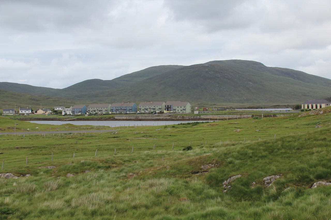

Leverburgh
Until 1920 this place was called Obbe - Gaelic An t-Òb, from a Norse word meaning bay. Then a soap baron arrived with a chequebook and a plan, and the village was rechristened in his honour. The plan failed. The name stuck. Today, road signs use An t-Òb, but the ferry timetables and the post office still call it Leverburgh, and the harbour William Lever built for his herring empire now handles the modest hourly traffic of the Calmac ferry from Berneray. Behind the village rise the gneiss hills of South Harris, and ahead lie some of the most extraordinary beaches in the world.
From Obbe to Leverburgh
William Hesketh Lever, 1st Viscount Leverhulme, made his fortune from soap. By the late nineteenth century his Sunlight brand had become a household name across the British Empire, and by the early twentieth he was looking for new worlds to industrialise. In May 1918, aged 66, he bought the Isle of Lewis for £167,000. He believed he could resurrect the fishing industry, distribute the catch through his Mac Fisheries chain of more than 400 fishmonger shops, and make the Hebrides modern. The Lewis crofters did not share his vision - many of them, returned servicemen from the First World War, had been promised land of their own and started taking it. Leverhulme called them squatters. The Scottish Office sided with the ex-servicemen. By 1919 his Lewis plan was in tatters, so he turned to South Harris, bought from the Earl of Dunmore for £36,000, and chose Obbe as his new headquarters. In 1920, with local consent, Obbe became Leverburgh.
The Herring Plan
Three hundred men began work on a new pier and the shore infrastructure for processing the catch from a planned fleet of fifty trawlers. Curing sheds went up. So did smoke houses, a refrigeration building, store sheds, managers' houses and a twenty-car garage. A second phase was drawn up that would have converted the inner sea loch into a harbour for 200-plus trawlers, fitted with a sea lock to maintain a constant 25-foot depth. Leverhulme paid for road upgrades to handle the freight. By 1924 production began. Twelve Great Yarmouth drifters landed so much herring in their first season that extra female workers had to be brought in from the mainland to handle the catch. The site was wrong, as several of Leverhulme's advisers had quietly suggested - Tarbert further north had deeper sheltered water, and a canal across the narrow isthmus there would have given his boats access to both sides of the Hebrides. But Leverhulme had already renamed the village after himself. There was no going back.
What Happens When the Tycoon Dies
Lever made his last visit to Leverburgh in September 1924. He took a trip to Africa shortly afterwards, caught pneumonia there, and died in May 1925. His executors and the Lever Brothers board had no interest in continuing the Hebrides project. They sold off the village and production facilities for £5,000 and the surrounding estate for £300 to the Campbell brothers, a local family. The whole experiment is estimated to have cost Leverhulme £500,000 - roughly £30 million in today's money. Mac Fisheries continued in business until 1979 as a brand on London high streets, never quite as the Hebridean fish empire Leverhulme had imagined. Leverburgh shrank back to what it had been: a small ferry village on the south coast of Harris, with a population now of about 200 and a name nobody wanted to change again.
The Golden Road and the Crossing
The main A859 follows the west coast of Harris from Tarbert through Seilebost, Borve, Scarista and Northton down to Leverburgh, then on to Rodel. But the road most people remember is the Golden Road - the narrow, twisting east-coast lane between Tarbert and Rodel, so named for the expense of its construction across boulder-strewn moorland. Drive it slowly. You will pass single-track stretches above hidden coves where seals haul out, between abandoned crofts and lochans no bigger than ponds. From Leverburgh, the Calmac ferry crosses the Sound of Harris to Berneray four times a day, taking about an hour and threading carefully between countless islets and skerries - the captains know the route by heart, because it changes with every reading of the chart. Berneray connects by causeway to the long chain of North Uist, Benbecula, South Uist and Eriskay.
The Beaches and St Kilda
Luskentyre, just north of Leverburgh on the west coast, regularly makes lists of the best beaches in the world - a long arc of pale sand against turquoise water, with the mountains of Harris rising behind. The water is, of course, freezing. Scarista beach further south is similar. MacLeod's Stone at Nisabost is a tall prominent megalith from the Neolithic period - already ancient when the thirteenth-century figure called Leod founded the kindred (Mac meaning son of) that bears his name. Leverburgh is also the closest port for day trips to St Kilda, the lonely archipelago 40 miles out into the Atlantic where the last residents left in 1930. Sea Harris and Kilda Cruises run boats from May to September, weather permitting, with three-hour crossings each way and four or five hours ashore on Hirta. Booking is essential. You make yourself available for a two-day slot and they sail on the first suitable day - sometimes neither day works, and you wait for the next slot.
From the Air
Leverburgh sits at 57.76 degrees north, 7.02 degrees west, on the south coast of Harris in the Outer Hebrides. Visual landmarks: the harbour and ferry pier, the village strung along the A859, and to the north the white arc of Luskentyre beach. No airfield at Leverburgh - nearest is Benbecula (EGPL) about 30 nm south via the Sound of Harris causeway chain, or Stornoway (EGPO) about 50 nm north across Harris. Recommended viewing altitude 2,000-4,000 ft AGL for the village and surrounding beaches. The St Kilda archipelago lies 40 nm further west into the Atlantic - on clear days visible from high altitude. Weather notoriously fast-changing; Atlantic squalls common year-round, headwinds steady from the west.
Nearby Stories
- Loch Druidibeg 5.6 km away
- Skye Trail 6.7 km away
- Neist Point 7.8 km away
- Portree 11 km away
- Spaceport 1 12 km away
- Uig, Lewis 16 km away
- Bayble Island 22 km away
- Flannan Isles Lighthouse 33 km away