
Uig, Lewis
In 1831, the sand at Camas Uig shifted, and ninety-three small figures emerged from a thousand-year sleep. The Lewis Chessmen, carved from walrus ivory, had probably been buried by a Norse trader sometime in the 12th century and forgotten. A local crofter found them. They are now scattered across two of Britain's greatest museums, but the sand they came from is still here, fringing one of Scotland's loneliest bays at the western edge of the Isle of Lewis.
Bay of the Norsemen
The name says everything. Uig comes from the Old Norse Vik, meaning bay, and the Vikings who named it left fingerprints across the parish. Place names in Gaelic and Norse layer the map like sediment. The civil parish of Uig sprawls across roughly 250 square miles, reaching from the Harris border in the south to Dalmore in the north, containing 36 settlements scattered through some of the most sparsely populated land in Scotland. West Uig holds the highest point on Lewis, Mealasbhal at 574 metres, and Loch Langavat stretches over 11 kilometres inland. The Atlantic coast from Gallan Head to Loch Resort is a wall of cliffs broken by narrow chasms the locals call geodhs. Inland the rock is Lewisian gneiss, some of the oldest stone on Earth, scraped bare by glaciers and softened only by thin acidic soil and bog.
The Shell-Sand Beaches
Camas Uig is one of those rare places where the geology cooperates with the eye. A vast strand of ground shell forms the beach, and where the shell sand meets the grass it produces machair, a fertile coastal meadow that bursts into wildflowers in summer. Similar shell beaches edge Traigh na Beirigh, Bhaltos, Cliff, Capadale, Mangurstadh and Mealastadh. The wind here is relentless and the sand reliably flat, which is why Uig Beach has become one of Scotland's premier kite-buggy locations. Even the geology offers surprises: in 1995, the largest sapphire ever found in the British Isles was discovered here, a 242-carat stone now displayed at the National Museum of Scotland. There is a long-running pattern of finding things in Uig that no one expected to find.
The Clearances
In 1841, the parish held nearly 2,000 people. The villages around Uig Bay - Capadale, Pennydonald, Baileneacail, Baileghreusaich, Earastadh and Mealastadh - were thriving crofting townships. Then the evictions began. Landowners wanted sheep and sporting estates, and over the next decade entire villages were emptied. The most notable evictions sent hundreds of Uig families onto the emigrant ships Marquis of Stafford and Barlow in 1851, bound for Canada and the Antipodes. Many of them had sons who had served in the 78th Seaforth Highlanders during the Napoleonic Wars - recruited in waves in 1778, 1793, 1794 and 1804, winning battle honours at Maida and Java. Military service had not bought their families security. Today around 400 people live in the district, the lowest population ever recorded. The 2011 census found 873 Gaelic speakers in Uig parish, still a majority at 56 percent.
The Chessmen and the Seer
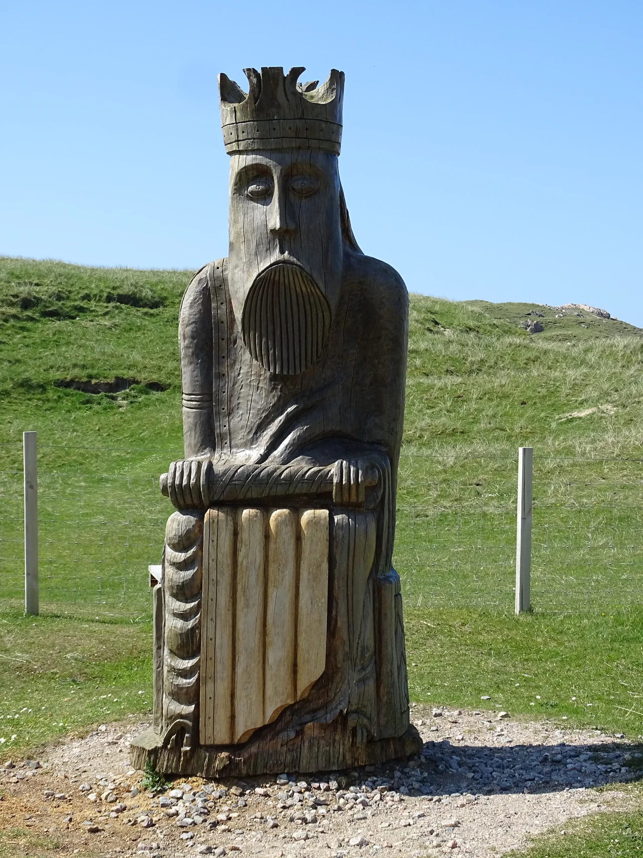
Pennydonald was the place. A crofter found the hoard buried in the sand at Camas Uig sometime before 1831 - the exact circumstances were lost almost immediately to legend. Most of the pieces are now at the British Museum and the National Museum of Scotland, with replicas at the Uig Heritage Centre in Tuimisgearraidh. The figures are stout, grim, and unmistakable: kings with grave faces, queens with hands pressed to cheeks, berserker rooks biting their shields. They probably came from Trondheim. How they ended up in Uig remains a mystery. According to local tradition, this same parish was the birthplace of Coinneach Odhar, the Brahan Seer - a 17th-century prophet sometimes called the Scottish Nostradamus, credited with predicting the discovery of North Sea oil among other things. Uig also gave the world the MacAulays. Donald Cam MacAulay was clan chief in the early 1600s; his descendants included Zachary Macaulay the anti-slavery campaigner, and Thomas Babington Macaulay, the historian who wrote A History of England.
What Remains
The archaeology of Uig is dense. The Callanish Stones, a Neolithic site of international importance, sit within the parish - older than Stonehenge and ringed by seven smaller satellite circles. Dun Carloway is the second-best preserved Iron Age broch in Scotland, after Mousa in Shetland. At Cnip, a Viking woman was buried with her treasures in 1979 - rediscovered by archaeologists who later found nine more burials dating between 1770 and 1620 BC. At Bostadh on Bernera, interconnected circular Iron Age houses sit by the beach with a reconstruction nearby. Norse water mills, beehive dwellings on Morsgail Moor, ruined pre-reformation chapels at Aird Uig and Mealastadh, fish curing houses at Little Bernera - the parish is a long catalogue of survivals. The Abhainn Dearg distillery at Carnish, opened in 2008, claims to be the first legal distillery in the Outer Hebrides since 1829. Even the whisky here has a backstory.
From the Air
Coordinates 58.15 N, 6.86 W. Uig occupies the wild western quarter of the Isle of Lewis, with Camas Uig (the bay) visible as a long crescent of pale sand against the Atlantic. Nearest airport is Stornoway (EGPO), roughly 35 nm east. Recommended viewing altitude 3,000-5,000 ft to take in the cliff coast from Gallan Head south to Loch Resort. Expect strong westerlies and frequent low cloud; clear days reveal Mealasbhal (574 m) inland and the long thin shape of Loch Langavat. The Callanish Stones lie about 13 nm east of the bay.
Nearby Stories
- St Clement's Church, Rodel 12 km away
- Bayble Island 13 km away
- Ness, Lewis 13 km away
- Skye Trail 17 km away
- Spaceport 1 21 km away
- Clach an Trushal 22 km away
- Flannan Isles Lighthouse 25 km away
- The Laki Eruption: The Volcano That Changed World History 858 km away