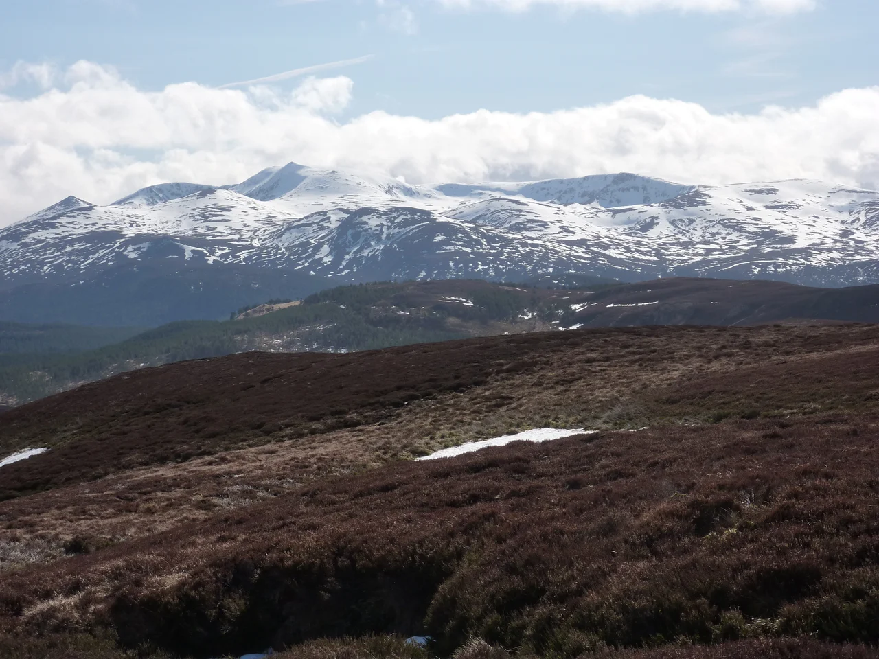

Lochnagar
Lord Byron was nine years old and lame from birth when his mother took him to the Cairngorms for the summer. The mountain he watched from his rented Aberdeenshire room would shadow the rest of his short, brilliant life. 'England, thy beauties are tame and domestic,' he wrote years later, 'To one who has roved on the mountains afar. Oh for the crags that are wild and majestic, The steep frowning glories of dark Lochnagar.' Beethoven, sometime after, began setting the verses to music. The composition was left unfinished. The mountain, characteristically, did not care.
A Mountain with Three Names
The English name comes from a lochan - a small mountain loch - sitting in the northeast corrie: Lochan na Gaire, the 'little loch of the noisy sound.' The probable original Gaelic name for the mountain itself was Beinn Chiochan or Beinn nan Ciochan, 'the breast-shaped mountain' - a name applied to many Scottish summits whose twin tops earned the comparison. The actual summit is named Cac Carn Beag. Translated politely, it means 'small cairn of faeces.' Translated honestly, it means 'little pile of shit.' Generations of hillwalkers have stood on the summit cairn at 1,155 metres, photographed the view across Royal Deeside, and signed the visitor book without ever knowing they had just summited a mountain whose true Gaelic name no estate agent would dare to print on a postcard.
The Corrie and the Cliffs
Lochnagar's defining feature is the great north-facing corrie - a cirque carved by Pleistocene ice, ringed by some of the most famous summer and winter climbing routes in the Cairngorms. Around this corrie sit the subsidiary tops and the main peak, all on a granite plateau that runs strangely flat once you reach it. That flatness is the danger. In poor visibility, the summit plateau has few obvious features, and the corrie's edge - a sudden drop of several hundred metres - has caught hillwalkers who thought they were still safely on the tops. The standard ascent comes from Glen Muick above Ballater, via the Meikle Pap; a longer route runs from Crathie church via Glen Gelder. Either way, the corrie waits on the far side of any wrong turn.
Royal Climbs and Wild Birds
Queen Victoria climbed Lochnagar in 1848, the same year Prince Albert bought Balmoral for her. The mountain has been part of the Balmoral estate ever since, which has woven it tightly into the imagery of the modern monarchy - though the granite was old long before there were any kings or queens of Scotland. Lochnagar lies within two Special Protection Areas because of the breeding populations of dotterel, those small high-altitude plovers that arrive each spring on the summit plateau, and of golden eagles soaring the corrie edges. The wider Deeside and Lochnagar National Scenic Area covers 40,000 hectares of mountain, moorland and pine forest - a substantial chunk of the eastern Cairngorms protected for both its biodiversity and its view.
Alpine Weather at 56 Degrees North
The summit experiences what climatologists classify as an alpine tundra climate. Winters are freezing and snowy; summers are cool. The weather station at Braemar, just to the northwest, holds records as the third-coldest low-lying place in the United Kingdom - and the summit is more than 800 metres higher. January averages 26.9 frost days, slightly more than February despite February having colder nights. Frost can strike here in any month: even July and August average one air frost every ten years. The yearly temperature range routinely covers more than 40 degrees from low winter to high summer. Standing on the summit cairn in a July squall, with sleet driving sideways and the lochan below half-hidden in mist, you understand why Byron called these glories 'frowning.'
From the Air
Coordinates 56.9599N, 3.2448W. Summit elevation 1,155 m (3,789 ft) at Cac Carn Beag. Recommended cruising altitude in IFR conditions 7,500 ft and above; the plateau and surrounding tops form a substantial terrain hazard. The mountain lies about 5 miles south of the River Dee near Balmoral, 9 miles east of Braemar and 7 miles southwest of Ballater. The great north-facing corrie holds Lochan na Gaire - look for the dark circular shape with cliffs on three sides. Nearest ICAO: Aberdeen (EGPD) 55 nm east; Inverness (EGPE) 65 nm northwest; Dundee (EGPN) 45 nm southeast. Mountain weather is severe and volatile - orographic cloud forms rapidly, summit experiences alpine tundra conditions, and frost can occur in any month. In winter, full Scottish winter conditions apply with rime ice and zero visibility common. Avoid VFR routing close to the summit plateau.
Nearby Stories
- Falls of Bruar 4.1 km away
- The Glenlivet Distillery 4.8 km away
- Tomatin distillery 9.3 km away
- Aberlemno Sculptured Stones 10 km away
- River Feshie 11 km away
- Battle of Lumphanan 11 km away
- Battle of Slioch 15 km away
- Airlie Castle 18 km away