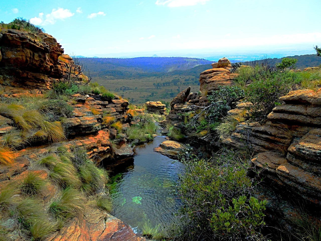

Magaliesberg
Stand on the Magaliesberg and you are standing on rock that is half as old as the Earth. This is not a range that overwhelms - its highest point reaches only about 1,852 metres, a gentle quartzite spine running across northern South Africa from near the Pilanesberg through the suburbs of Pretoria. But altitude is the wrong measure here. The naturalist Vincent Carruthers, who wrote the definitive study of these mountains, put it best: the Magaliesberg is almost a hundred times older than Mount Everest, a place that has, in his words, witnessed the whole span of life, from its very origins. What it lacks in height it makes up in time.
Ripples From a Vanished Sea
The story of the Magaliesberg begins underwater. More than two billion years ago, sand and silt settled in layers on the floor of a shallow inland sea, hardening over roughly 300 million years into quartzite, shale, and dolomite atop the ancient Kaapvaal craton. Then the planet heaved. About two billion years ago a vast upwelling of molten rock - the Bushveld Igneous Complex, one of the largest such intrusions on Earth - shouldered into the crust and tilted those flat layers on edge, so the broken rims now face outward and the gentler slopes lean inward. Look closely at the stone today and you can still find the fossilized ripple marks of that long-gone sea, frozen into rock that has outlasted entire oceans.
Where Humanity Began
The land around these mountains may be the oldest home our species has. Just south of the range lie the Sterkfontein Caves, part of the Cradle of Humankind World Heritage Site, where the fossil skull known as Mrs Ples and other ancient hominins were found in deposits reaching back millions of years. Long before any written record, people lived in the shelter of this ridge. The mountains carried many names across the ages - the seTswana speakers knew them simply as Dithaba, the mountains - before the range took the name Magaliesberg in the mid-1800s, after the Tswana leader Kgosi Mogale, whose name carries the sense of sharp and brave. The Magaliesberg has been a human landscape for as long as humans have existed.
A Barrier Worth Fighting For
The ridge divides the land like a wall. To the north lies the warm, low Bushveld; to the south, the cooler Highveld where winter frost settles in the valleys. That natural barrier made the mountains a prize in war. In 1823 the Zulu commander Mzilikazi broke from Shaka and settled his Matabele nation here, until Voortrekkers and allied Sotho-Tswana chiefdoms drove them north across the Limpopo in 1838. Decades later, during the Second Anglo-Boer War, Boer fighters who knew every hidden kloof used the mountains for guerrilla raids, and the British answered by building stone blockhouses along the ridgeline to choke off their movement. The crumbling ruins of those blockhouses still stand on the heights, weathering slowly into the far older rock beneath them.
An Ancient Range Made New
For all its antiquity, the Magaliesberg lives very much in the present. In 1923 the Hartbeespoort Dam filled one of its valleys, and the towns of Hartbeespoort and Kosmos grew up around a weekend getaway for the people of Johannesburg and Pretoria; an aerial cableway now lifts visitors to a ridgetop view that spreads the whole landscape below them. The deep ravines carved by ancient erosion have become a climber's paradise, threaded with hundreds of routes up the quartzite cliffs. In June 2015, after years of campaigning, UNESCO declared the range a World Biosphere Reserve - international recognition for a mountain that, as one of its champions said, is a unique treasure: half the age of the Earth, and still teaching us how to live alongside it.
From the Air
The Magaliesberg runs roughly east-west across northern South Africa, with the coordinates 25.86 degrees south, 27.53 degrees east falling near its central reaches. From the air it reads as a long, narrow ridge - modest in height but sharply defined - separating the lower Bushveld to the north from the higher Highveld plateau to the south. The Hartbeespoort Dam, set in a valley near the eastern end, is a bright and reliable landmark. Lanseria International (ICAO: FALA) lies just southeast of the range, with O. R. Tambo International (FAOR) farther southeast near Johannesburg, and Pilanesberg International (FAPN) to the northwest. Recommended viewing altitude is 5,000 to 8,000 feet AGL. Be alert for terrain-driven turbulence and rapidly building summer thunderstorms along the ridge; winter mornings offer the clearest air.
Nearby Stories
- Rand Refinery 4.3 km away
- Voortrekker Monument 18 km away
- Roodeplaat Research Laboratories 25 km away
- Soweto 29 km away
- Royal Bafokeng Nation 39 km away
- Vaal Reefs Mining Disaster 88 km away
- 2014 Orkney Earthquake 122 km away
- Matsieng Footprints 151 km away