.JPG)
Mamelon of Sikasso
Thirty meters does not sound like much. But in the heart of Sikasso, that modest rise of earth has carried more weight than most mountains. The Mamelon, a hill some 461 meters around, was the place where Kénédougou's kings sat to rule, where spirits were believed to dwell, and where leaders climbed to read the whole of their territory in a single glance. Whoever held the Mamelon held Sikasso. And for the people of southern Mali, that made this small hill the truest measure of power in the land.
Seat of Kings
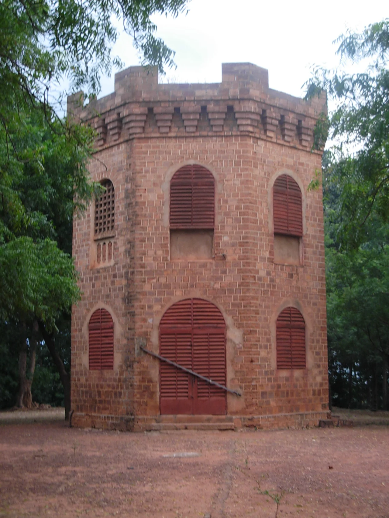
In the 1880s, Tiéba Traoré, king of the Kénédougou Kingdom, built up the Mamelon as the seat of his rule. The hill was already sacred long before him. Local tradition held it home to spirits, and for generations it had served as a gathering place where court was held, where guests were received, and where leaders observed the surrounding country from its height. Tiéba understood the hill's logic instinctively: command the high ground at the center of the city, and you command everything around it. Atop the Mamelon he raised a fortified, multistory structure that functioned as both a place of work and a traditional court — the administrative and ceremonial heart of his kingdom.
The Citadel of the Tata
The Mamelon did not stand alone. It was the keystone of a far larger defensive system, the great tata of Sikasso, a massive earthen wall that made the city the most heavily fortified place in West Africa. From this elevated core, Kénédougou's kings directed a defense that held off the Malinke conqueror Samori Touré through a punishing fifteen-month siege between 1887 and 1888. Walls of rammed earth absorbed the assaults; the high ground gave the defenders eyes on every approach. For a decade, the Mamelon and its tata stood as a symbol that this kingdom would not be swallowed — not by Touré's empire, and not, the people hoped, by the European armies pressing in from the coast.
The Flag on the Summit
On May 1, 1898, that hope ended. After weeks of French artillery battering the tata, Sikasso fell. It was on the summit of the Mamelon — the very seat of Kénédougou's kings — that the French flag was flown over the city for the first time. The fortified structure that had crowned the hill was destroyed. The symbolism was deliberate and devastating: to raise the colonial banner where kings had ruled was to announce, in the most visible way possible, that one era had ended and another begun. Scholars have noted how the hill passed from hand to hand as a symbol of authority — first the Traoré dynasty, then the French colonists, and in time the independent Malian state. Power changed; the Mamelon remained the place where power was displayed.
A Monument Restored
Today the Mamelon sits at the civic center of Sikasso, ringed by the institutions of a modern city: the Town Hall to the west, the regional central bank building (BCEAO) to the east, the courthouse to the south, and the Boulevard de l'Indépendance to the north. A replica of the old fortified structure stands again at its summit, recalling what was lost in 1898. The hill has not been left to fade. Under Culture Minister N'diaye Ramatoulaye Diallo, the city secured World Bank funding through a program known as PACUM to restore the monument — the esplanade, the staircase climbing to the top, and the public spaces at the foot of the hill. Once a fortress against empires, the Mamelon is being reclaimed as a place of memory, where Sikasso keeps faith with the kings who once watched the horizon from its crown.
From the Air
The Mamelon rises near the geographic center of Sikasso at roughly 11.315°N, 5.666°W, in the southern Malian highlands. From the air it reads as a low rounded hill crowned by a structure (a replica fort and, historically, a water tower), set within the dense urban grid of the city. The nearest airfield is Sikasso (Dignangan) Airport, ICAO GASK; Bamako-Sénou International (GABS) lies about 300 km northwest. Best photographed in low morning or late-afternoon light during the dry season (November–April), when shadows define the hill against the surrounding rooftops and harmattan haze is at its thinnest.
Nearby Stories
- Morila Gold Mine 58 km away
- Sudanese Style Mosques in Northern Cote d'Ivoire 66 km away
- Kenedougou Kingdom 89 km away
- Koutiala 94 km away
- Grand Mosque of Bobo-Dioulasso 108 km away
- Battle of the Sama Forest 124 km away
- Mare aux Hippopotames 124 km away
- Ruins of Loropéni 205 km away