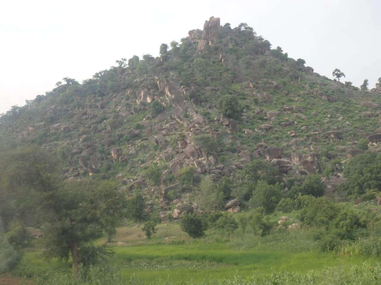

Mandara Mountains
Photographers have a favorite spot in these mountains, and it is easy to see why. Near the Cameroonian village of Rhumsiki, a single shaft of rock leaps straight out of the plain like a stone finger pointing at the sky. This is Kapsiki Peak, and it is the most photographed point in the Mandara Mountains, a 190-kilometer volcanic range that runs along the northern border between Cameroon and Nigeria, from the Benue River in the south to the lowlands beyond Maroua in the north.
The Bones of Old Volcanoes
The spires that make this range so striking are the cores of dead volcanoes. Long ago, magma rising through the crust cooled and hardened inside the throats of erupting cones. Over millions of years the softer outer slopes wore away, leaving only those resistant plugs standing alone, sharp and improbable, above the surrounding tableland. Kapsiki Peak near Rhumsiki is the largest and most famous of them, reaching 1,224 meters above sea level. The highest point in the whole range, Mount Oupay, reaches 1,494 meters. The range was born when a slab of ancient basement rock was pushed upward, then carved by rivers in a wetter age into the rugged country seen today.
Terraces Built by Hand
What truly defines the Mandara is not the rock but the work of the people who farm it. For generations, communities such as the Kapsiki, the Mafa, the Mofu, and their neighbors have wrapped these hillsides in stone terraces that climb from the valley floors to the high slopes. It is a careful, patient system. Crops rotate between sorghum, millet, and legumes to keep the soil alive. Sheep, goats, and cattle are penned through the growing season and turned loose afterward to graze the stubble, their manure feeding next year's fields. Trees such as the African mahogany and the apple-ring acacia are kept for shade and green manure. Nearly nothing is wasted. The result is a landscape engineered by hand, terrace upon terrace, sustaining dense populations on slopes that would otherwise wash bare with the first hard rain.
Life Among the Spires
The Kapsiki number perhaps 120,000, living on both sides of a border that means little to them; in Nigeria the same people are known as the Kamwe or Higi. Around villages like Rhumsiki they build low houses of local stone roofed with thatch, scattered across the valley beneath the great plug. Here, too, survives a famous tradition: the crab sorcerer of Rhumsiki. The diviner, traditionally a blacksmith, arranges sticks and pieces of calabash that stand for people and places inside a clay pot, drops in a crab, covers the pot, and after fifteen minutes reads the future in how the creature has rearranged the pieces. Villagers come at dawn to ask whether the harvest will be good or a marriage will hold. For travelers in better times, Rhumsiki was the gateway to all of this, a place to climb among the spires and watch the light move across a landscape that has shaped, and been shaped by, its people for centuries.
Mysteries in Stone
Scattered through the Cameroonian heights are some of the most remarkable ruins in sub-Saharan Africa: the Diy-Gid-Biy sites, a name from the Mafa language meaning, roughly, place of chiefly residence. There are sixteen of them, dry-stone complexes of terraces, passages, staircases, and underground chambers built around the fifteenth century. Outside Great Zimbabwe and the ancient sites of the Horn, no indigenous stone architecture in the region rivals them. Yet archaeologists only began serious study in 2001, and much remains unknown, including who built them and exactly why. The Mandara holds its history close, in walls of fitted stone that have outlasted the memory of their makers.
From the Air
The Mandara Mountains run roughly northeast to southwest along the Cameroon-Nigeria border, centered near 10.47 degrees north, 13.60 degrees east, with summits up to 1,494 meters at Mount Oupay. The signature landmark from the air is Kapsiki Peak near Rhumsiki, a sheer volcanic plug standing alone on the plain. The nearest airports are Maroua Salak (ICAO FKKL) to the north in Cameroon and Maiduguri (ICAO DNMA) across the border in Nigeria. Give the spires and ridgelines wide terrain clearance, and watch for harmattan dust during the dry season, which can sharply cut visibility from November into February. The wet season brings towering convective cloud over the high ground.
Nearby Stories
- Sukur 4.5 km away
- Murder of Hauwa Liman 26 km away
- Chibok Schoolgirls Kidnapping 54 km away
- Yola 125 km away
- Lagdo Reservoir 150 km away
- Palace of Rey Bouba 170 km away
- Bouba Njida National Park 214 km away
- Zakouma National Park 610 km away