Mantaro River
In 2014, the Amazon River got longer. Not by any physical change - the same water still flowed the same way - but by the decision of researchers who, armed with satellite imagery and topographic data, pointed at a river that drops out of Peru's central Andes and said this one, actually. The Mantaro. For forty years, National Geographic had officially credited the Apurímac as the Amazon's most distant source. The 2014 study argued the Mantaro extended the Amazon's length by another 75 to 92 kilometers. The debate is unresolved. But for anyone flying over central Peru, the Mantaro cuts a canyon so dramatic you can see why it might deserve the title.
Hatun Mayu, the Great River
Mantaro is a Quechua name, or possibly an Asháninka one. In Quechua it means great river. The Asháninka, who live downstream along the Ene River into which the Mantaro eventually pours, may have used a similar word first. Whatever the etymology, the Mantaro earns the superlative. It nominally begins at Lake Junín at 4,082 meters elevation, though tributaries push the headwaters another 70 kilometers farther upstream. By the time it joins the Apurímac to form the Ene River, it has traveled 809 kilometers and descended to 440 meters - a drop of nearly five meters per kilometer, which in river terms is violent.
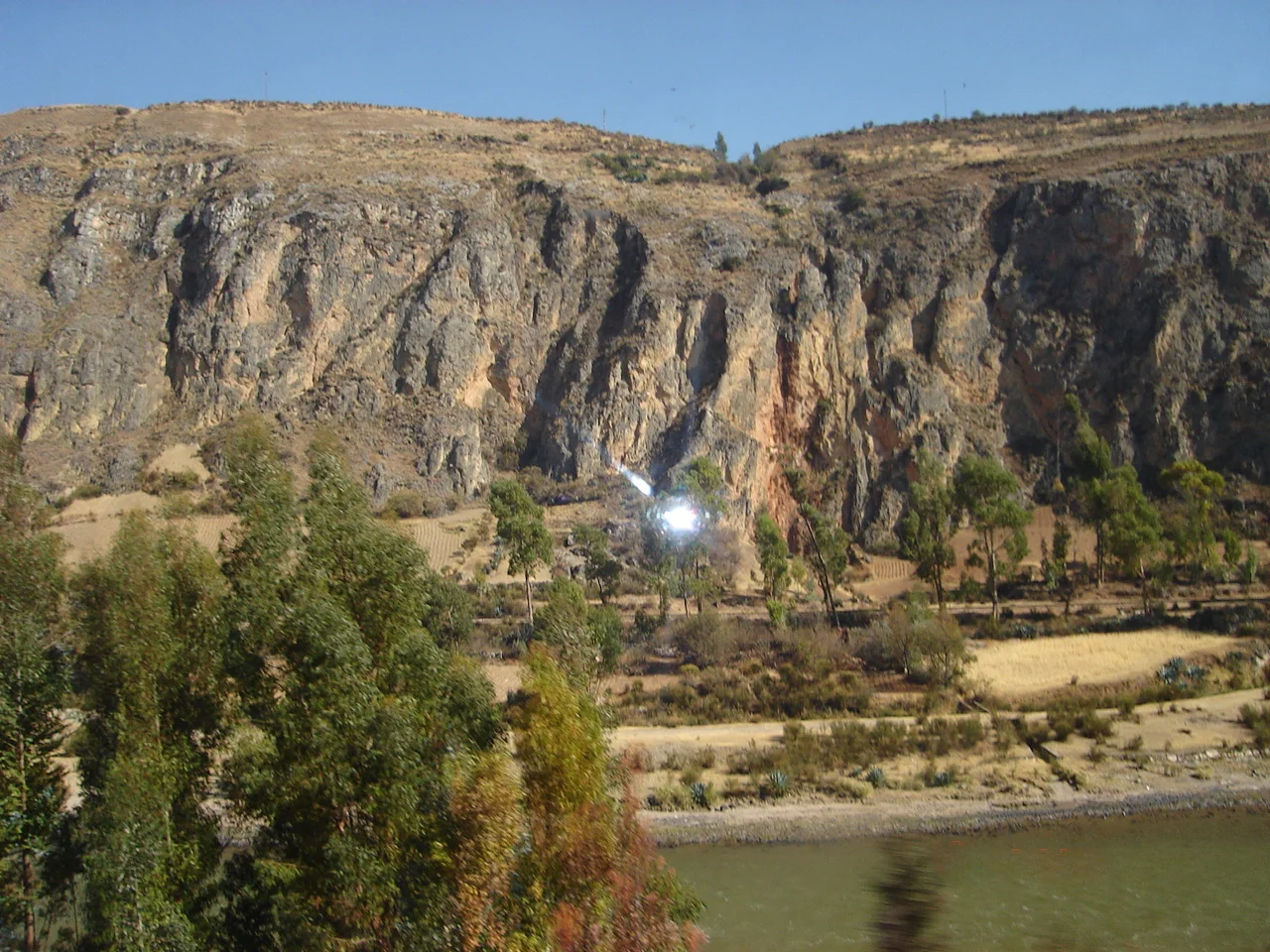
The Gradient That Carved a Valley
That steep gradient built one of Peru's most productive agricultural landscapes. The Mantaro Valley runs southeast from Lake Junín through the provinces of Junín, Yauli, Jauja, Concepción, and Huancayo, its broad floor laid down by millennia of river work. This is Lima's breadbasket. The capital, three hundred kilometers west across the coastal desert, depends on Mantaro Valley potatoes, artichokes, corn, and dairy. Huancayo, the regional capital where the Cunas River joins the Mantaro, is the commercial heart of the central highlands and one of the largest Andean cities in Peru.
Power from the Drop
The same gradient that fed the valley also generates electricity. The Mantaro Hydroelectric Complex, in Tayacaja Province of the Huancavelica Region, produces 31 percent of all electrical energy generated in Peru. The Tablachaca Dam, completed in 1974, diverts water through tunnels to drop it through turbines hundreds of meters below. The cost is real: five months a year, a stretch of river downstream of the diversion runs nearly dry. The trade-off has been fought over since the dams were built, and the broader Marañón basin is now facing a similar debate as new hydroelectric projects are proposed upstream.
The Question of the Amazon
Deciding where a river begins sounds like geography, but it is really a fight over definitions. In 1971, a National Geographic expedition placed the Amazon's origin at the headwaters of the Apurímac, and a 2000 follow-up confirmed Lake Ticllacocha as the furthest continuous source. Their rule was simple: measure total length, but only count water that flows year-round. That rule excluded the Mantaro because the Tablachaca Dam interrupted continuous flow. The 2014 team, led by American geographer James Contos and others, challenged both the length measurement and the continuity rule. Using high-resolution imaging, they argued the Mantaro drainage reached farther upstream and should count. Which river earns the title depends on which rule you adopt. Both rivers, meanwhile, keep flowing.
A Descent First Made in 2012
Despite the Mantaro's importance, the river was not fully paddled from source to confluence until May 2012, when American kayaker Rocky Contos and James Duesenberry completed the first full descent. Earlier, in 2002, Richard Pethigal had kayaked and rafted the lower 140 kilometers. The upper Mantaro can be run as whitewater when the flow is right, but the lower river carries a different risk: this section passes through territory where Sendero Luminoso - the Shining Path insurgency born in the 1980s - retained camps in the early 2000s. The descent combined genuine whitewater challenge with real security planning. Many Peruvian river miles remain more wilderness than recreation.
The River as Route
From the air the Mantaro is a silver thread pulled through high valleys, bending around mountain shoulders, cutting deeper into canyon as it heads toward the Amazon lowlands. From Huancayo downstream it becomes harder to follow. The valleys narrow. Road access thins. The river swings east through Ayacucho Region, then re-enters Junín Region in Satipo Province, where it meets the Apurímac and, with the new combined flow, loses its name. From there it is the Ene, then the Tambo, then the Ucayali, then - when it joins the Marañón - finally the Amazon. Whether the Mantaro is the true ultimate source or not, every drop it carries eventually reaches the Atlantic, 6,000 kilometers east.
From the Air
The Mantaro runs generally southeast through central Peru. Waypoint at 10.92°S, 76.28°W sits in the upper valley near Huancayo. The headwaters at Lake Junín lie at 4,082 meters; mouth at 440 meters. Nearest airports include Huancayo (JAU/SPJJ) and Jauja (SPJJ) in the upper valley, with Ayacucho (AYP/SPHO) serving the middle reaches. Recommended viewing altitude 13,000-17,000 feet AGL for canyon sections. Dramatic canyon walls and hydroelectric infrastructure are visible landmarks.
Nearby Stories
- Oxapampa 26 km away
- La Merced 29 km away
- Raura Mountain Range 35 km away
- La Cantuta massacre 78 km away
- Klaus Barbie 103 km away
- Ancon (archaeological site) 104 km away
- Putis massacre 209 km away