Raura Mountain Range
Twenty kilometers. That is the full length of the Cordillera Raura - a tight, sharp ridge of the Andes just southeast of the more famous Huayhuash range, straddling the borders of Peru's Huanuco, Lima, and Pasco regions. In that short span you'll find 245 lakes, eighteen glaciers, a mountain at 5,685 meters, and one of the highest mines in the world, all of it draining in two directions at once. Water leaving the southern slope runs to the Pacific. Water leaving the northern slope flows to the Amazon and, eventually, the Atlantic. Few places make continental divides so visible.
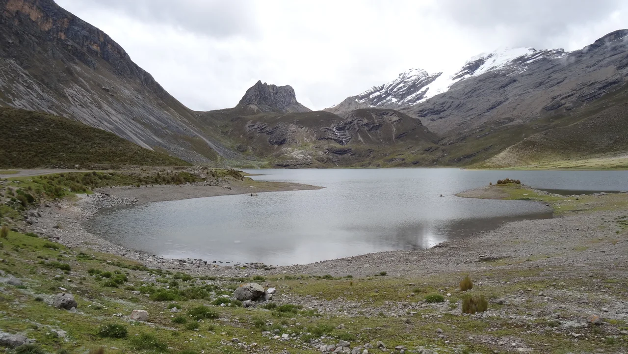
Chains of Deep Blue Lakes
The mountaineer John Ricker, who knew the range as well as any outsider, described the Raura as 'chains of deep blue lakes, open swampy green valleys, rock and glacier-mantled peaks.' The lakes are the most striking feature from the air. Patarcocha, Tinquicocha, and Huascacocha are the largest, but they are only three of 245 lakes and tarns scattered through moraines and cirques left by retreating ice. Some sit in stacked chains where one drains into the next. Others lie alone in their own glacial bowls. Yarupac, at 5,685 meters, is the highest peak; Santa Rosa rises to 5,655. Below the summits, the valleys open into damp meadows where huge black polylepis shrubs and cushion plants hold what little soil the ice hasn't scraped away.
Two Oceans, One Ridge
The range functions as a continental divide in miniature. The Huaura River, born on the south side, runs west through dry Andean valleys toward the Pacific coast near Huacho. Water from the north side drains into the Lauricocha River, which eventually joins the Maranon, which in turn becomes the Amazon, which three thousand miles later reaches the Atlantic near Belem. A raindrop landing on one side of a Raura ridge can end its journey at a beach where the sun sets into the ocean. A raindrop landing fifty meters away, on the other side, can end its journey at a beach where the sun rises out of one. Few places in the world make that geography so compact.
The Mine at the Top
On the eastern slope, Peruvian Highway 110 - still unpaved in 2024 - climbs to about 4,800 meters and enters the Raura mining district, one of the highest polymetallic operations in the world. The mine produces copper, lead, zinc, and silver. Open pits scar parts of the range; permanent worker housing clusters around the entrance. Mining here began on a small scale in 1890, when crews first hauled equipment up on mules. The modern operation is a different scale of disturbance: it interrupts the flow of the Lauricocha River, draws down glacial lakes, and has created legacy pollution that downstream communities still live with. The altitude is what keeps the mine notable. Most miners in the world work below 2,000 meters. The Raura workforce lives and labors at more than twice that elevation, in air thin enough that walking a flight of stairs can leave a newcomer gasping.
Ice in Retreat
Peru holds most of the world's tropical glaciers, and tropical glaciers are disappearing fast. Between 2000 and 2016, Peruvian glaciers lost an estimated thirty percent of their water - a measurable, catastrophic shrinkage in less than two decades. The Raura is not spared. The average snow line rose between 1986 and 2005, a change the neighboring Huayhuash did not see. Eighteen glaciers still cover the highest peaks, with the longest tongues flowing down the wetter eastern side, but they are thinner and shorter than they used to be. The consequences run downstream. Lima and Peru's coastal agriculture depend on glacial melt. As the ice retreats, summer flows dwindle, and the moraine-dammed lakes that hold much of that meltwater grow larger, less stable, more prone to sudden catastrophic breaches that can wipe out valleys below. The Raura is beautiful and dangerous in the same sentence.
Small Range, Serious Mountains
The Raura has never been a destination for most travelers. It sits in the shadow - literally, in some cases, at sunset - of the Huayhuash, which has the famous ice faces and the trekking circuit that made its reputation. But for climbers looking for less-traveled walls, and for hydrologists trying to understand what happens when tropical ice goes away, the Raura is a laboratory. Twenty kilometers of ridge, 245 lakes, a mine that broke ground when mules still hauled the ore, and glaciers that feed rivers heading in opposite directions toward opposite oceans. The whole system fits inside a distance you could walk in a day, if the altitude didn't insist otherwise.
From the Air
Located at 10.46 degrees south, 76.81 degrees west, in the central Peruvian Andes. The range forms a tight 20-km ridge reaching 5,685 meters (18,645 feet) at Yarupac, about 100 km southeast of the Cordillera Huayhuash. Major valleys on the eastern side hold visible glacier-fed lakes. Nearest airport is Alferez FAP David Figueroa Fernandini Airport at Huanuco (SPHU / HUU) to the east, or Lima (SPJC / LIM) to the southwest across the mountains. High terrain and rapid weather changes demand turbine performance and careful planning; oxygen required above 3,000 m.
Nearby Stories
- Mantaro River 22 km away
- Huánuco 30 km away
- Huánuco Pampa 41 km away
- Huaricanga 45 km away
- Barranca 46 km away
- Huaraz 77 km away
- Huacho 96 km away