Maré Island
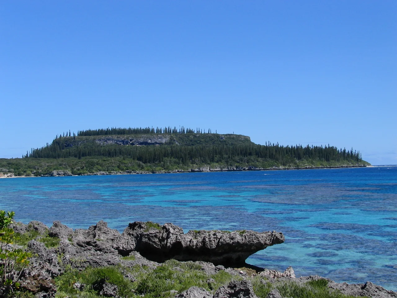
Walk across Maré Island and the ground fights you. The fossil coral rock is honeycombed with caves, pools, and pits of every size, their edges sharp enough to shred boot leather. This is what happens when an atoll rises 120 meters out of the Pacific - the reef that once lay beneath warm, shallow water becomes a landscape of jagged limestone, and the lagoon that once filled its center becomes the island's interior plateau. Maré is the second-largest of the Loyalty Islands, part of France's overseas territory of New Caledonia, and it is a place where geology and politics share the same stubborn quality: nothing here yields easily. The island stretches 42 kilometers long and up to 16 kilometers wide, lying northeast of Grande Terre, New Caledonia's mainland. Its narrow beaches are backed by cliffs rather than gentle slopes, and the fringing reef along the current shoreline is short and recent - a new edge still forming on ancient bone.
An Atoll Turned Inside Out
Understanding Maré requires imagining it upside down. Like its northern neighbor Lifou, the island is a raised coral atoll - once a ring of reef islets encircling a shallow lagoon, now lifted high above sea level by tectonic forces. The former ring of islets became a rim of elevated land surrounding the island's perimeter, and the former lagoon became the flat, lower interior. The result is an island that looks, in cross-section, like a shallow bowl with raised edges. Because the lifting is geologically recent, the shoreline that formed after the island rose has not had time to develop the extensive barrier reef that protects Grande Terre. Instead, Maré presents cliffs and narrow beaches to the ocean, and Araucaria trees - the distinctive columnar pines of the Pacific - cover the flat land near the sea. Villages dot the coastline from Roh in the north to Eni in the south, most of them associated with one of 29 chieftaincies that divide the island into territories as precisely drawn as any European map.
Twenty-Nine Chieftaincies, Closed to Outsiders
Maré's population of roughly 6,900 is predominantly Melanesian, with less than two percent of European ancestry. Most Maréans do not live in the island's two small towns - Tadine on the west coast and La Roche inland - but in tribal communities associated with chieftaincies that remain closed to outsiders. The indigenous language is Nengone, one of the Austronesian languages whose family stretches from Madagascar to Indonesia to the Pacific Islands. Christianity arrived in the late 19th century through competing Protestant and Catholic missions - the London Missionary Society and the Marist order, respectively - and the sectarian divisions they introduced mapped onto existing tribal boundaries. The result has been episodic intertribal violence over the decades, a pattern where imported faith became entangled with indigenous politics. Maréans are often described as fervent Christians, but the devotion carries an edge. Religion on Maré did not replace the old structures of loyalty and territory; it added another layer to them.
The Front and Its Martyrs
Maré has produced leaders whose influence reached far beyond the island. Nidoish Naisseline, a former grand chief of Maré, founded the Front de Liberation Nationale Kanak Socialiste around 1970 - the FLNKS, the militant movement seeking New Caledonian independence from France. The violence of the early 1980s, when the independence movement and French loyalists clashed in a series of confrontations that brought New Caledonia to the edge of civil war, shaped a generation of Kanak leaders. Among them was Yeiwene Yeiwene, a Maréan who served as deputy to the FLNKS leader Jean-Marie Tjibaou. Together they navigated the negotiations that produced the Matignon Accords on June 26, 1988, a peace agreement that was supposed to end the bloodshed. Militant elements of the FLNKS saw the accords as betrayal. On May 4, 1989, both Tjibaou and Yeiwene were assassinated on the island of Ouvea. Near Tadine, on Maré's west coast, Yeiwene's gravesite faces the sea. The flower garlands that adorn it are renewed often.
The Britannia's Passing
The first European known to have sighted Maré was William Raven, master of the ship Britannia, who sailed past around August 1793 on a voyage from Sydney to Batavia to procure provisions for the struggling penal colony. For Raven, the island was a navigational waypoint, barely worth a logbook entry. For the Maréans, the sighting changed nothing - the chieftaincies continued to govern, Nengone continued to be spoken, and the coral rock continued to resist easy passage. It would be decades before missionaries arrived to complicate the island's internal world. The interval between first sighting and sustained contact gave Maré a longer period of uninterrupted self-governance than many Pacific islands received. By the time the London Missionary Society and the Marists began their competing campaigns in the mid-19th century, the chieftaincies were well established enough to absorb the newcomers on their own terms, converting to Christianity without surrendering the political structures that had held the island together for centuries.
Monsoon Season and the Coral Below
Maré's tropical monsoon climate brings its heaviest rain in March and warmest temperatures in February. The record high was set on February 13, 2016; the record low on August 27, 1979. But the climate statistics matter less than the coral. Everything on Maré is built on, carved from, or shaped by the ancient reef that the ocean floor pushed skyward. The caves are former coral chambers. The pools are former tidal hollows. The sharp-edged pits that make hiking treacherous are the fossil remains of organisms that lived and died in shallow water millions of years ago. The commune of Maré includes the much smaller Dudune Island nearby, but Maré itself is the center of gravity - Tadine serves as the administrative center, the port, and the connection point to the wider world of New Caledonia. For an island defined by its elevation from the sea, Maré remains deeply tied to the water that built it. The reef may be above the waves now, but it has not forgotten what it was.
From the Air
Located at 21.55°S, 167.88°E in the Loyalty Islands chain, northeast of New Caledonia's Grande Terre mainland. The island's raised atoll shape is clearly visible from altitude - look for the elevated rim surrounding a flatter interior plateau. The island is 42 km long, making it a substantial landmass easily spotted from cruising altitude. Nearest airport: Maré La Roche Airport (MEE/NWWR) on the island itself. Tadine port is visible on the west coast. The narrow fringing reef along the shoreline contrasts sharply with the extensive barrier reef visible around Grande Terre to the southwest. Best viewed at 5,000-10,000 ft AGL to appreciate the raised atoll morphology.
Nearby Stories
- Païta 108 km away
- Fiji 1069 km away
- HMS Porpoise (1799) 1239 km away
- Wreck Reefs 1293 km away
- Manawatawhi / Three Kings Islands: New Zealand's Evolutionary Outpost 1421 km away
- SS Elingamite: Gold, Fog, and a Captain Wrongly Blamed 1451 km away
- Stirling Castle (1829 brig) 1497 km away
- Coral Sea Islands 1787 km away