Païta
On a rock along a small river in the southeast of Païta, someone pecked lines into the stone that look like suns. Or like flowers. Nobody is quite sure what they were meant to represent. The dating is uncertain too - possibly as old as the 13th or 14th century B.C., placing them among the earliest human artifacts in New Caledonia. You reach them by climbing cement stairs behind a wooden pavilion, follow a short path to the river, and there they are: quiet, weathered, unsigned. Today Païta is the commune that holds La Tontouta International Airport - the gateway through which almost every visitor to New Caledonia arrives. The tourists who come to the island mostly pass through Païta without knowing it. The petroglyphs have been watching them pass for three millennia.
The Commune and the Airport
Païta is one of the suburban communes ringing Nouméa, New Caledonia's capital, in the South Province of this French overseas territory in the southwest Pacific. The airport, La Tontouta International, sits within Païta's boundaries and handles flights from Paris, Sydney, Auckland, Tokyo, and a handful of regional Pacific destinations. Before Tontouta existed, Magenta Airport near Nouméa handled international traffic - but New Caledonia's growth outstripped Magenta's short runway, and in 1947 the Americans-built Tontouta strip (originally a World War II bomber base) was converted for civilian use. Most Païta residents live a long way from the noise of the jets. The commune stretches across a wide valley, from the rugged mountain spine of the Grande Terre in the north to the lagoon coast in the south, and its roughly 25,000 people are spread thinly across that terrain.
The Climate of the Leeward Coast
Païta sits in the rain shadow of New Caledonia's central mountain range, which means it receives noticeably less rainfall than the eastern windward coast. Its climate is tropical savanna - Koppen classification Aw - with March as the wettest month and the hottest averages in February, when the mercury hovers around the upper 20s Celsius. Winter mornings in July can drop to 19.5 degrees Celsius, chilly by tropical standards. The highest temperature ever recorded in Païta was set on 4 March 1997, and the coldest on 8 August 1957. Outside of cyclone season - roughly December to April - the weather is reliably pleasant. The surrounding landscape reflects the drier climate: savanna grasslands, stands of niaouli (Melaleuca quinquenervia, a hardy paperbark tree native to the region), scrubby hillsides, and cultivated paddocks where cattle graze the valley floor.
The Little Train That Ran
About a mile north of the town center sits the former railway station of the Noumea-Paita railway. A small locomotive - used until 1940 - is preserved there as a memorial to a railway that once connected the commune to the capital. The line was narrow-gauge, built in the late 19th century to serve nickel mines and move agricultural produce, and it was decommissioned after World War II when roads proved cheaper to maintain than track. Today the locomotive sits in open air, patinated by decades of tropical weather, a monument to an industrial past most visitors would not know to look for. The Catholic church in the center of town is older still, built in 1875 during the earliest years of the French colonial settlement. A modern Cultural Centre on the High Street hosts exhibitions and performances. The Mairie - Town Hall - sits close by, in the kind of easy walking distance that makes sense in a commune where most public life happens on a single main street.
Before the French, Before the British
The petroglyphs are older than any of it. Archaeologists studying Pacific rock art have associated similar designs with the Lapita cultural complex - the seafaring Austronesian peoples who, beginning around 1500 B.C., colonized most of the islands of Remote Oceania, including New Caledonia, Vanuatu, Fiji, Tonga, and Samoa. The Lapita left behind distinctive dentate-stamped pottery and rock art across an enormous geographic range, and the petroglyphs at Paita fit broadly within that horizon. The Kanak people - the Melanesian population that inhabited New Caledonia when Europeans arrived in the 1770s - are the direct descendants of those earlier settlers and many later arrivals. Their presence on the Grande Terre predates the petroglyphs at Paita by a thousand years or more. For Kanak families today, these rock carvings are not merely archaeology. They are ancestral traces, reminders that the land now called New Caledonia has always been inhabited land, with its own long and layered history.
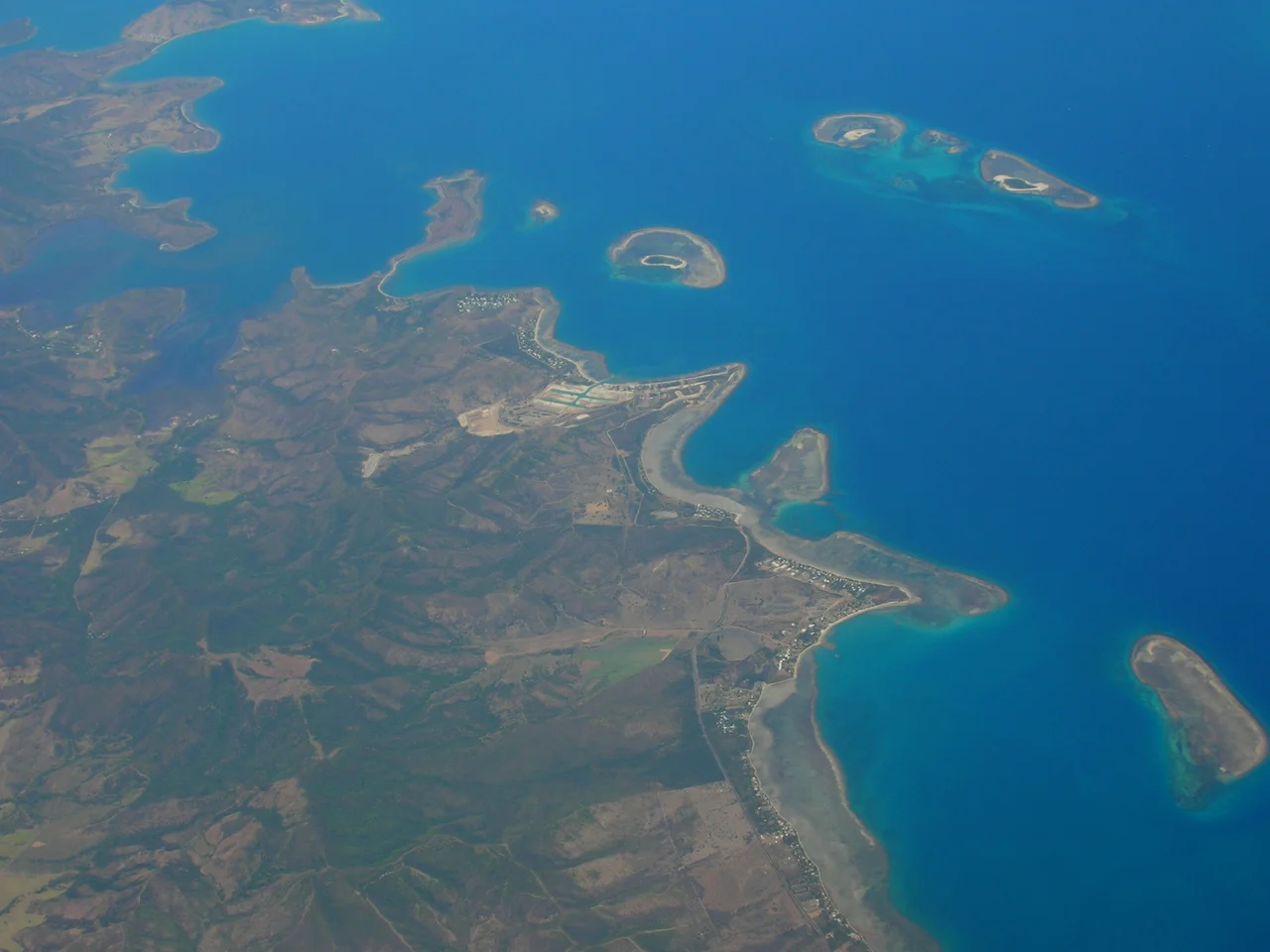
From the Air
Located at 22.13 degrees south, 166.37 degrees east on the west coast of Grande Terre, New Caledonia. La Tontouta International Airport (NWWW / NOU for passenger services) is the dominant landmark within the commune. From altitude, look for the airport runway on the valley floor with the mountain spine rising to the north and the coral-fringed lagoon to the south.
Nearby Stories
- Maré Island 96 km away
- HMS Porpoise (1799) 1090 km away
- Fiji 1235 km away
- K'gari 1340 km away
- Stirling Castle (1829 brig) 1351 km away
- Double Island Point Light 1405 km away
- Manawatawhi / Three Kings Islands: New Zealand's Evolutionary Outpost 1407 km away
- Coral Sea Islands 1648 km away