
Coral Sea Islands
It is a territory of Australia that is almost entirely sea. The Coral Sea Islands Territory sprawls across 780,000 square kilometres east of the Great Barrier Reef, an area larger than many nations, and yet if you gathered every scrap of dry land within it into one place, it would amount to roughly seven square kilometres of sand. Most of those specks have no name a sailor would recognise and no human ever sets foot on them. On exactly one island do people live at all. The rest belong to the birds and the turtles.
An Ocean With Footnotes of Land
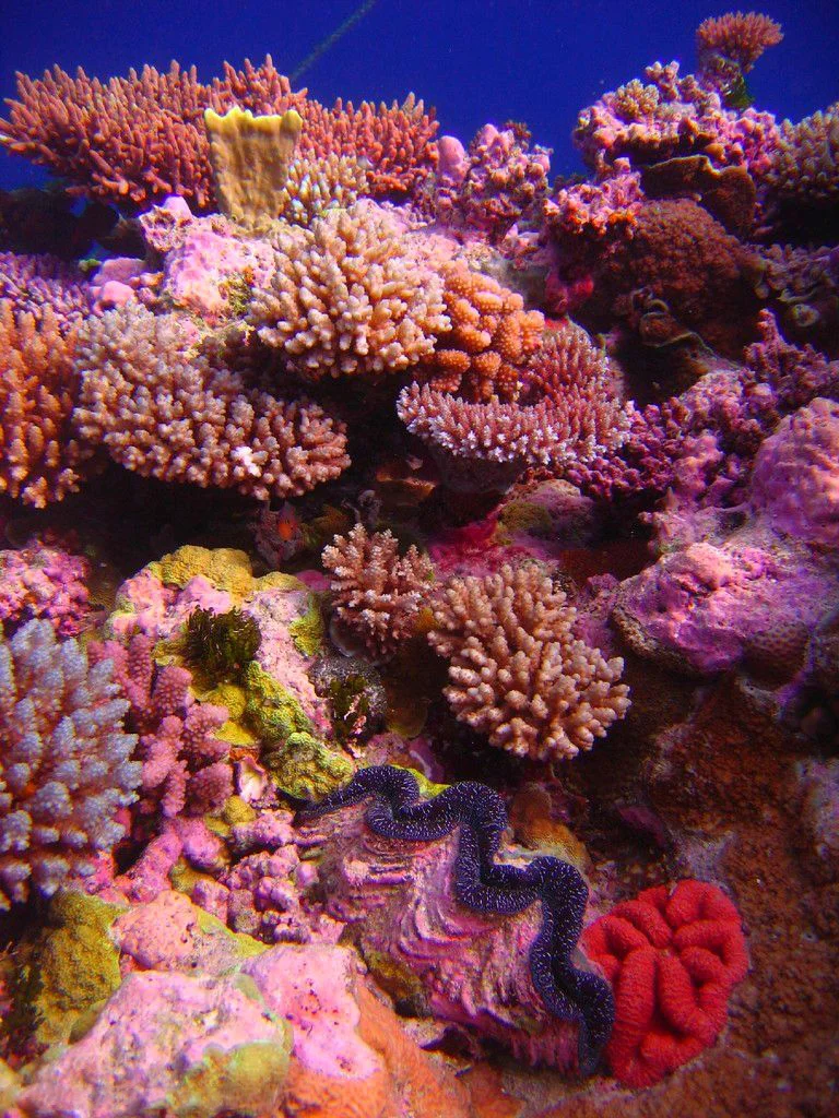
Scattered across this vast blue expanse are about 30 reefs and atolls, most of them wholly submerged or breaking the surface only at low tide. Where land does rise above the waves, it does so barely. The cays are low, flat and small; the territory's high point, on Cato Island, stands a mere six metres above the sea. The atolls range from a few kilometres across to the immense Lihou Reef, one of the largest atolls in the world by total area, whose lagoon spans a hundred kilometres while its actual dry land, eighteen tiny islets all told, adds up to less than a single square kilometre. To cross this territory is to sail for days between markers that are mostly underwater.
The One Inhabited Island
The single exception sits about 450 kilometres east of Cairns: Willis Island, a sliver of sand roughly 500 metres long. Since 1921 it has carried a weather station, established for one urgent reason, to give the Queensland coast advance warning of the cyclones that spin in from the Coral Sea. A staff of three or four observers lives there, the only permanent human presence in a territory the size of New South Wales. They were there in 2011 when Cyclone Yasi bore down, battening the buildings before a helicopter lifted them clear, and the instruments recorded the storm's fury until they failed. Across the rest of the territory, automatic stations and the occasional lighthouse stand watch on the empty reefs, machines keeping vigil where no one lives.
A Nursery for Birds and Turtles
What the islands lack in people they make up for in wings and flippers. The forested cays of the Coringa-Herald and Lihou groups are among the most important seabird rookeries in the Coral Sea, home to breeding colonies of more than a dozen species, terns and boobies and tropicbirds wheeling in their thousands above the sand. The waters around them shelter six species of marine turtle. The threatened green turtle hauls out to nest on the cays of the Coringa-Herald cluster and on eleven small islands of Lihou Reef, dragging itself up the beach in the dark to dig and lay, as its kind has done here for longer than there have been ships to wreck nearby. Much of the territory is now protected reserve, knitted together into a wetland of international significance.
The Reefs That Keep Their Dead
These same beautiful, low-lying reefs have always been deadly to ships. The territory was first charted in 1803, the very year HMS Porpoise drove onto its coral and gave Wreck Reefs its name, stranding Matthew Flinders and ninety-odd others on a sandbank within these waters. In the 1870s and 1880s prospectors briefly mined the cays for guano, but with no reliable fresh water no one could stay. The Royal Australian Navy patrols the territory now, and divers come for some of the clearest water and most dramatic walls in the world, the sheer drop-offs of Osprey Reef among them. It remains one of the least-visited corners of Australia, a near-empty ocean dotted with sand, where the loudest sound is the colony of seabirds and the surf breaking on reefs that have swallowed more than one ship whole.
From the Air
The Coral Sea Islands Territory spreads across the Coral Sea east and southeast of the Great Barrier Reef; this entry centres near 19.09 degrees south, 150.90 degrees east, in the heart of the scattered reefs. From altitude the territory reads as deep open ocean stitched with bright turquoise rings and crescents, the cays themselves often no more than pinpricks of white. Willis Island, the only inhabited point, lies to the northwest near 16.3 degrees south, 150.0 degrees east. There are no airports within the territory and no mainland diversion within easy reach; the nearest coastal fields are Mackay (ICAO YBMK) and Rockhampton (YBRK) far to the west. This is true oceanic airspace, so plan fuel and navigation conservatively. Calm, clear conditions reveal the reef structure best, when the shallows glow against the abyssal blue.
Nearby Stories
- Whitehaven Beach 183 km away
- Hayman Island 199 km away
- Hook Island 234 km away
- Stirling Castle (1829 brig) 237 km away
- The Great Barrier Reef: The Living Structure Visible from Space - Now Dying 377 km away
- Cyclone Yasi 441 km away
- Heron Island 488 km away
- Louisiade Archipelago 861 km away