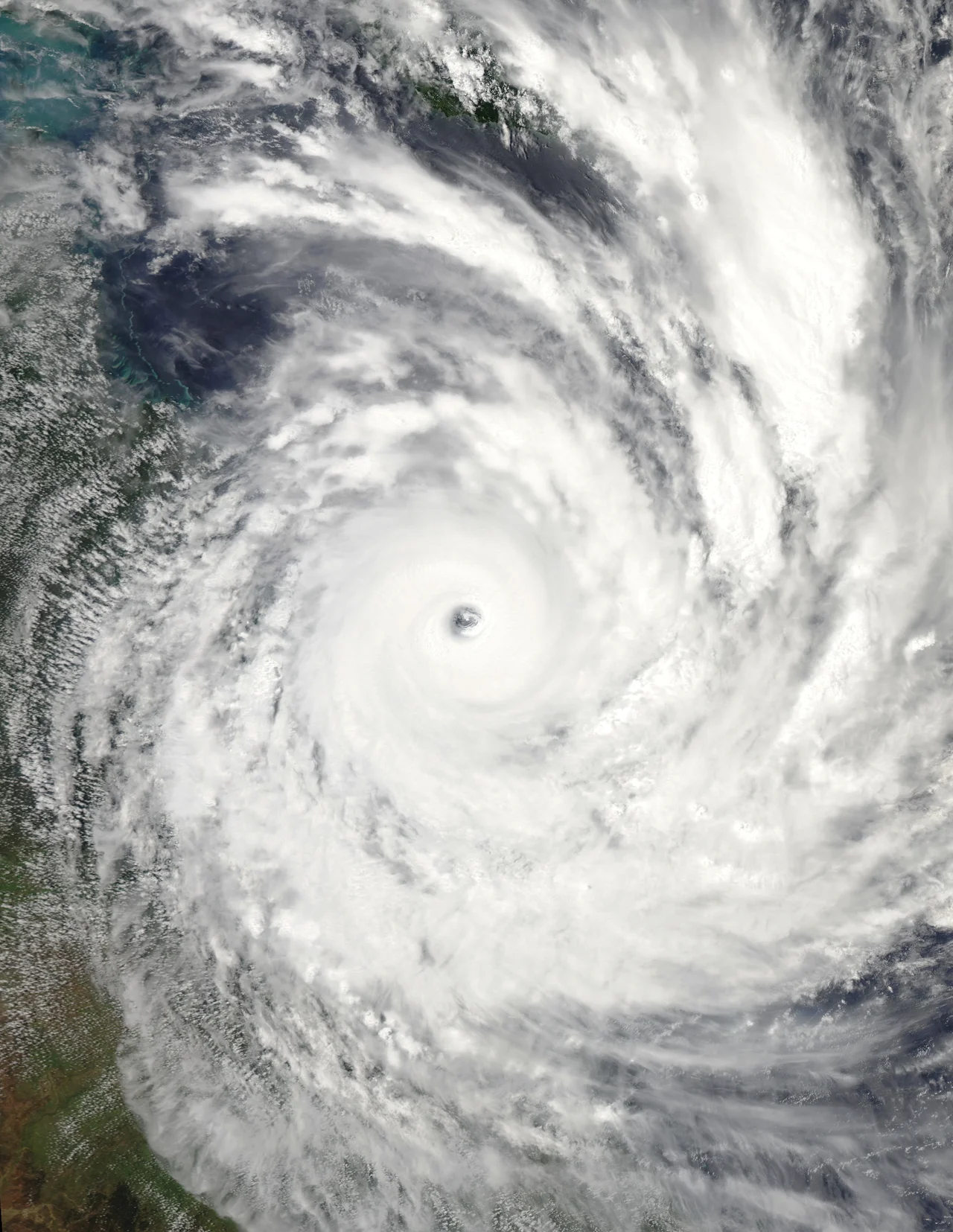

Cyclone Yasi
It was 500 kilometres wide, with an eye 30 kilometres across, and it came ashore in the dark. Just after midnight on 3 February 2011, Severe Tropical Cyclone Yasi crossed the north Queensland coast near Mission Beach as a Category 5 system, the most violent rating the scale allows. The record low pressure measured as the eye passed over Tully marked it as one of the most powerful cyclones in the state's recorded history. By dawn, towns that had stood for a century were unrecognisable. And yet, in the towns it tore apart, almost no one had died.
A Storm Born Near Fiji
Yasi began far out in the Pacific, a tropical low that the Fiji Meteorological Service first noted southwest of Tuvalu in late January. It crossed the islands of Vanuatu, brushed the edges of the Solomons and Papua New Guinea, then entered the Australian region and began to intensify with frightening speed over warm ocean. In barely two days it climbed from a named cyclone to a Category 5 monster. Out on tiny Willis Island, a lonely weather station 450 kilometres off the coast, the staff battened down and were lifted off by helicopter just ahead of the eye. The instruments they left behind recorded gusts of 185 kilometres an hour before the equipment and the communications failed entirely.
The Coast Empties
Queensland had weeks of catastrophic flooding already behind it that summer, and the forecasters did not understate what was coming. Media called it possibly the worst cyclone in the state's history. Premier Anna Bligh urged the coast to flee, and it did. Thirty thousand people left Cairns alone. Every patient in the city's two hospitals was airlifted south to Brisbane by the air force and the Royal Flying Doctor Service. More than 10,000 people in all were moved from their homes. The state emergency coordinator delivered a blunt warning that anyone who stayed would be on their own for up to 24 hours, because once the winds rose no rescuer could reach them. Then the coast went dark and waited.
The Night Itself
At Mission Beach, near the point of landfall, gusts were estimated around 290 kilometres an hour. By morning the beach had lost its sand and not a single structure was undamaged. Tully, where the eye's record pressure was logged, was described by its own residents as a scene of mass devastation; some 30 percent of the town's houses were destroyed and roughly nine in ten buildings along the main street were badly damaged. The high school was wrecked beyond saving. In Innisfail an evacuation centre began to flood as people hammered boards across the doors and watched the windows flex in the wind. At Cardwell a storm surge over three metres high pushed in from the sea. Through the worst of it, families trapped in their homes called for help that could not come, and waited out the eye and the screaming wall of wind behind it.
The Reckoning, and the Mercy
Daylight revealed the scale of it. Around 170,000 homes lost power, some for more than a month. Townsville's water supply nearly ran dry. At least three quarters of the region's banana crop was gone, and the damage to the sugar cane was counted in the hundreds of millions; total losses reached about A$3.5 billion, the costliest cyclone in Australian history to that point. The storm did not stop at the coast, either, spinning inland for days and dumping record rain as far away as South Australia. And here is the part that still astonishes: for all that ruin, the storm caused only one death, a man who died of fumes from a generator running in a confined space. A Category 5 cyclone had erased towns and spared almost every life in them, because this time the warnings were early and the coast believed them.
From the Air
Cyclone Yasi made landfall on the north Queensland coast near Mission Beach, between Cairns and Townsville, at roughly 17.4 degrees south, 147.1 degrees east (the track position offshore; the coast crossing lay just west). The landfall zone takes in Tully, Cardwell, Mission Beach and Dunk Island, a stretch of coastal plain, cane fields and rainforest-clad ranges running down to the reef. The nearest major airports are Cairns (ICAO YBCS) to the north and Townsville (YBTL) to the south. In settled weather this is calm tropical flying with the Great Barrier Reef visible offshore, but the region remains one of Australia's most cyclone-prone coasts during the November-to-April wet season, when convective build-ups can rise fast in the afternoon heat.
Nearby Stories
- HMS Mermaid (1817) 36 km away
- The Great Barrier Reef: The Living Structure Visible from Space - Now Dying 49 km away
- Hull River Aboriginal Settlement 62 km away
- Green Island (Queensland) 74 km away
- Andrew Leon 149 km away
- SS Gothenburg 204 km away
- Great Barrier Reef 238 km away
- Samarai 786 km away