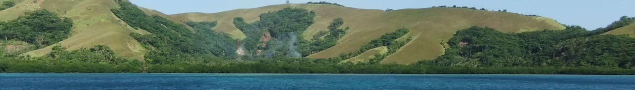
Louisiade Archipelago
For most people living in the Louisiade Archipelago, the nearest shop is a one-to-two-day journey each way - by sailing canoe. The villages trail off into the Coral Sea at the southeastern tip of Papua New Guinea like a line of stepping stones abandoned midway, each one a reef-rimmed speck with its own gardens, its own fishermen, and its own arrangements for getting by. Outboard motors exist here. Cash exists here. But the sailing canoe - a dugout hull with an outrigger and a triangular lateen sail the locals cut from whatever cloth they can find - is still the workhorse of inter-island life, and the most common way a stranger arrives at your beach is under sail.
The Coral Sea Crossing
From Cairns in Queensland it is about 510 nautical miles of open ocean to the Louisiades - roughly four days under favorable conditions for a cruising yacht. Every year dozens of Australian boats make the crossing, some independently, some as part of the annual Louisiades Rally that has given the archipelago a kind of second identity among Pacific sailors. The islands themselves form a long, loose chain: Misima at the northern end, then the Deboyne Islands, the Calvados Chain, the Duchateau Island Group, and the larger masses of Sudest and Rossel further east. A small airfield serves Misima's main town of Bwagaoia with a handful of scheduled flights a week, but for most of the archipelago there is no airstrip, no road, and no cell tower. The charm and the inconvenience are the same thing.
Gardens and the Lagoon
Life in the outer islands runs on subsistence. Most families keep a garden - a cleared patch of jungle planted with yams, taro, bananas, and sweet potato, with a few chickens or pigs in the yard. The lagoon is not a commons; the fish in it are already owned. Firewood is owned. The coconuts on a particular tree are owned. When you arrive at an island and want something, the correct move is to ask, and if what you want is plentiful the islanders will usually give it freely. If it is not plentiful, you offer to trade or buy. The one exception is pelagic fish - tuna, mackerel, and wahoo moving through the channels - which the small canoes cannot catch. Trolling yachts are encouraged to bring extra fish ashore; the villages will find use for every pound of it.
The Trade Economy
Visiting yachts are usually met by canoes paddling out from shore, each carrying a small inventory of mangoes, pawpaws, crabs, shell necklaces, or whatever the family has to spare. What the islanders want in return is practical: fish hooks and fishing line, hand tools, t-shirts, laundry powder, soap, sunglasses, raw sugar, batteries for torches. Used goods are welcome if they still work. The website louisiades.net maintains running notes on what particular villages need - school fees and fuel for the open fibreglass boats that run to distant medical facilities have made cash increasingly useful, but most routine exchange is still barter. Misima is the only island with anything resembling a developed economy; elsewhere a crumpled twenty-kina note can sit in a drawer for months before someone has occasion to spend it.
Language and Distance
The indigenous language of the archipelago is Misiman, part of the Kilivila-Louisiades branch of the Austronesian family. Children pick up English in elementary school, and older boys who have crewed on yachts often speak it well. The distances here shape everything. A journey between islands is not a ferry crossing - it is an open-ocean passage in a twenty-foot boat with no radio, no flares, and no plausible mechanism for signaling distress. Locals do it all the time. Canoes slip out at dawn and reappear at the far beach by evening, their crews watching the wind and the current and the sky as sailors have done in these waters for three thousand years. Austronesian voyagers reached the Louisiades before they reached most of the Pacific.
The Divers' Secret
The archipelago is renowned among those few who know it for the quality of its coral. Fringing reefs wrap most of the islands, and large sections of the Calvados Chain and the Deboynes are effectively untouched - no dive resorts, no liveaboards apart from cruising yachts, no commercial fishing pressure. What you see underwater is what the Coral Sea looks like when nothing has been subtracted from it: reef sharks cruising the drop-offs, schools of barracuda parked in the current, soft corals in improbable colors, giant clams the size of bathtubs. The islands do not advertise themselves, and the locals do not particularly want them to. The people who come here are already people who have made a four-day ocean passage to get here. That filter works, and the Louisiades stay the way they are.
From the Air
Located at approximately 11.20 degrees South, 153 degrees East, the Louisiade Archipelago stretches roughly 250 nautical miles southeast from Milne Bay, the tail end of Papua New Guinea. Bwagaoia Airport (AYMS) on Misima is the only commercial airfield in the group; Gurney at Alotau (AYGN) on the mainland is the regional hub. From above 15,000 feet the chain resolves into a long scatter of white-fringed green against the deep blue of the Coral Sea, with extensive barrier reefs visible on either side of Sudest and Rossel. Watch for fast-building convective buildups in the wet season, November through May.
Nearby Stories
- Misima Island 47 km away
- Normanby Island (Papua New Guinea) 193 km away
- Samarai 217 km away
- Battle of the Treasury Islands 444 km away
- Japanese cruiser Kinugasa 471 km away
- Cod Hole 831 km away
- Coral Sea Islands 884 km away
- Wreck Reefs 1210 km away