.jpg)
Heron Island
Somewhere past the edge of the Solar System, bolted to a spacecraft launched in 1977, there is a picture of Heron Island. The Voyager Golden Record was meant to show any future finder the diversity of life on Earth, and among its handful of images is this one cay, 800 metres of sand and forest on the southern Great Barrier Reef, chosen to represent the living planet. It is a fitting ambassador. Around this scrap of land, a reef of extraordinary richness supports some 900 of the 1,500 fish species and roughly seventy percent of the coral species in the entire Great Barrier Reef. If aliens ever come looking, Heron Island is one of the addresses we gave them.
Named for the Wrong Bird
On 12 January 1843, a Royal Navy survey expedition under Captain Francis Blackwood, working the eastern margin of the reef in the corvette Fly and the cutter Bramble, came upon a low green cay alive with wading birds. They named it Heron Island. The birds, as it turned out, were mostly reef egrets, not herons, and the only true heron ever seen here is a rare vagrant blown in from the mainland. The misnomer stuck anyway, the way sailors' names do. There is no evidence that Aboriginal people ever lived on or used Heron Island; it lies too far from the coast, a green dot in open water that the surveyors charted not as anyone's home but as a hazard to be mapped, one more reef to be made safe for ships.
A Cay Built by Birds
Heron Island is, in a real sense, made of birds. During the summer breeding season, more than 200,000 of them descend on this tiny island, and tens of thousands of wedge-tailed shearwaters, the moaning, burrowing seabirds Australians call mutton birds, dig their nesting tunnels through the forest floor. That constant churning is why the cay has such rich soil for a coral island: the birds turn the earth, mixing the humus and stopping the formation of the hard, barren phosphate pan that would otherwise seal the ground. Black noddies crowd the Pisonia trees overhead. The whole island, by the height of the season, is a single vast rookery, the air thick with wings and the night loud with the eerie wailing of shearwaters calling from underground.
The Turtles' Beach
If the birds own the forest, the turtles own the sand. Heron Island is one of the great green turtle rookeries of the reef, where in summer the females haul their bodies up the beach in the dark, dig, lay, and return to the sea, and weeks later the hatchlings boil out of the sand and scramble for the waterline. The reef around the island has become a kind of natural laboratory for this and a thousand other questions. Researchers have even shown how warming sand skews the sex of hatching turtles, a finding with sober implications for a heating world. The waters draw divers and snorkellers to a resort on the island's northwest corner, but the turtles were here long before the resort, and the whole eastern half of the cay is protected national park, left to them.
Science on the Sand
In the island's southwest quarter stands one of the world's principal coral reef research stations. The Great Barrier Reef Committee established it in the 1950s, and the University of Queensland has run it as a partner since 1970, building laboratories, aquaria, and, in 2010, a facility devoted to studying how reefs will fare under climate change. A fire tore through the station in 2007, injuring no one, and the rebuilt labs reopened by 2009. David Attenborough filmed here in 2014 for his series on the Great Barrier Reef, drawn, as the researchers are, by the sheer concentration of life within wading distance. Few places let scientists step off a veranda and into a reef this diverse. Fewer still send their portrait into interstellar space as a calling card for the planet.
From the Air
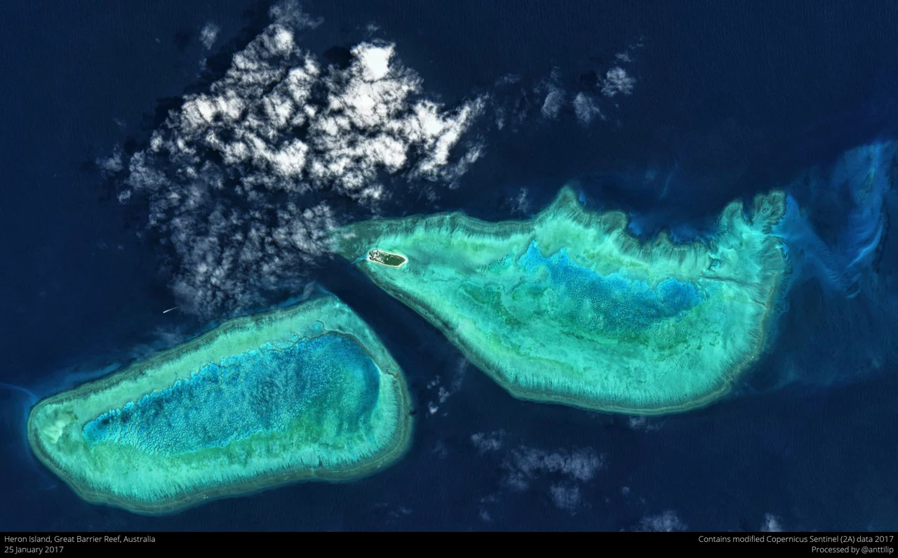
Heron Island lies at 23.44 degrees south, 151.91 degrees east, just south of the Tropic of Capricorn on the southern Great Barrier Reef, about 87 km northeast of Gladstone. From the air it is a classic coral cay: a small forested island of about 16 hectares perched on the leeward western edge of a much larger oval reef platform, with the pale Heron Reef flat and turquoise lagoon dwarfing the land itself, and the rusted wreck of HMCS Protector forming a breakwater at the harbour channel. There is no airstrip on the island; access is by catamaran launch from Gladstone or by helicopter. Gladstone Airport (ICAO YGLA) is the mainland gateway. Recommended viewing altitude is 2,000 to 4,000 feet to take in the full reef platform and the contrast between deep ocean blue and the cay's bright shallows. The highest point is barely 3.6 metres above the sea, so the island all but vanishes against the water in poor light.
Nearby Stories
- Cape Capricorn Light 29 km away
- Lady Elliot Island 45 km away
- Great Keppel Island 58 km away
- Bundaberg Rum 129 km away
- Canal Creek Air Crash 162 km away
- K'gari 206 km away
- Stirling Castle (1829 brig) 244 km away
- Hornet Bank Massacre 311 km away