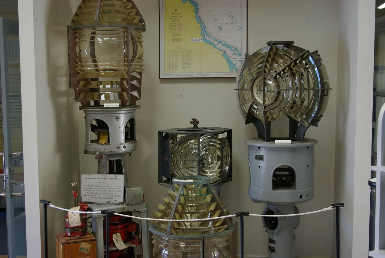

Cape Capricorn Light
Captain Cook sailed past here on 25 May 1770 and reached for his charts. The headland sat almost exactly on the Tropic of Capricorn, that invisible line where the sun stands directly overhead at the southern summer solstice, so he gave it the only name it could have: Cape Capricorn. A century later, the colonists who came after him needed more than a name. They needed a light. Ships bound for the Fitzroy River and the wool port of Rockhampton had to thread a coast of reefs and shoals, and too many of them did not make it. The answer was a lighthouse on the northeast tip of Curtis Island, a place so isolated that simply keeping the lamp burning became a feat of endurance in itself.
A Light for a New Colony
Queensland had only just become a colony in its own right, separated from New South Wales by Queen Victoria's signature in 1859, when the need for navigation aids here became urgent. A pilot station went up on Cape Capricorn as early as 1861, though it was shifted to Grassy Hill three years later; the case for a proper light on the cape never went away. The first real lighthouse followed in 1875, a classic Queensland design: timber-framed, clad in iron, prefabricated in Brisbane and shipped north. The plans came from the office of the Colonial Architect, F. D. G. Stanley. The build was almost comic in its mishaps. A last-minute change to the lantern order from England meant no lamp room had been provided at all, forcing an urgent improvised one of timber and iron plate. When it finally lit, the lamp was an oil wick burner, a small flame doing an enormous job, with two auxiliary lights set to the north and southeast to fix the safe line through the channel.
The Hardest Part Was Getting There
Everything the station needed came the hard way. Supplies sailed up from Rockhampton by steamboat to the foot of the hill, then had to be hauled more than ninety metres up a steep tramway, hand-winched crate by crate. An inspector in 1912 recommended steam winches, stronger light, repaired dwellings, then watched his advice get followed slowly and only in part. Not until 1923 did the light source improve to an incandescent kerosene mantle. Life here was measured in deliveries and weather. The keepers and their families lived at the edge of the continent with the sea as their only road, and a single missed supply run could mean weeks of going without.
Three Towers, One Headland
The lighthouse you would see today is the third on the spot. A concrete-block tower replaced the timber one from plans drawn in 1937, and the current squat concrete structure, just 6.4 metres high with chamfered corners and a small porch, dates from 1964. Around it stands a whole vanished way of life rendered in corrugated iron and white-painted cottages: a powerhouse, a winch house, a store, even a still-working rail line of steel tracks running down to the beach with its timber trolley. In 1988 the light went solar and the keepers went home for good. Its original lens, the glass heart that once threw the warning out to sea, now sits on display at the Townsville Maritime Museum.
Island Time
Cape Capricorn now keeps a quieter watch. Its light still flashes white and red every five seconds, powered by solar panels and managed remotely by the Australian Maritime Safety Authority, while the surrounding land falls within Curtis Island National Park. The tower itself is closed, and the only ways to reach it are by boat or helicopter. Yet the old keepers' cottages have found a second life as holiday accommodation, so it is still possible to sleep on this headland, wake to the same horizon the lightkeepers scanned, and stand with one foot on each side of the tropic line that gave the cape its name.
From the Air
Cape Capricorn sits at the northeast point of Curtis Island near 23.49 degrees south, 151.24 degrees east, on the Tropic of Capricorn just north of Gladstone. Gladstone Airport (ICAO YGLA) lies about 40 km southwest; Rockhampton (YBRK) is roughly 90 km northwest. Look for the white tower and green-roofed cottages on a bald headland where Curtis Island meets the Coral Sea, with The Narrows separating the island from the mainland. Best light is early morning at 1,500 to 3,000 feet; afternoon sea breezes and tropical haze can soften visibility along this coast.
Nearby Stories
- Heron Island 4.8 km away
- Great Keppel Island 40 km away
- Canal Creek Air Crash 43 km away
- Lady Elliot Island 96 km away
- Bundaberg Rum 162 km away
- Pine Islet Light 211 km away
- Stirling Castle (1829 brig) 264 km away
- Hornet Bank Massacre 267 km away